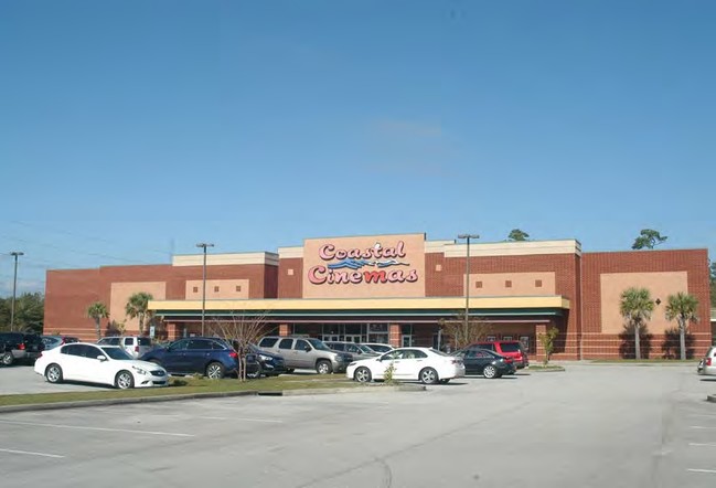
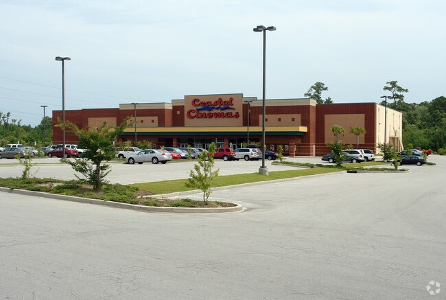
Property Record
5200 Bridgers Rd, Shallotte, NC 28470


Save to a Folder
{{folder.Name}}
{{folder.ListingIds.length}} Properties
{{folder.ListingIds.length}} Property
Create a New Folder
Property Detail
5200 Bridgers Rd
1970005012
6.02 ACRES PL 27/15 US 17 & SR 1349
Religious
BRUNSWICK
HB
North Carolina
AE The base floodplain where base flood elevations are provided. AE Zones are now used on new format FIRMs instead of A1-A30 Zones.
6.03 AC
2024
West Brunswick
2025
Wilmington
020601
Wilmington, NC
39,452 SF
NEARBY LISTINGS FOR SALE OR LEASE
DEMOGRAPHICS near 5200 Bridgers Rd
1 mile
3 mile
5 mile
2025 Total Population
386
7,249
16,083
2030 Population
441
8,304
18,733
Pop Growth 2025-2030
+ 14.25%
+ 14.55%
+ 16.48%
Average Age
42
45
46
2025 Total Households
153
2,984
6,776
HH Growth 2025-2030
+ 13.73%
+ 14.38%
+ 16.43%
Median Household Inc
$55,000
$67,588
$68,850
Avg Household Size
2.40
2.30
2.30
2025 Avg HH Vehicles
2.00
2.00
2.00
Median Home Value
$230,882
$293,477
$299,557
Median Year Built
2002
2000
2000
Nearby Places
Map Layers
Map Styles
 Street
 Aerial
Layers
 Traffic
 Biking
Places
Listings with unknown addresses are not visible on the map
- Restaurants
- Banks
- Shops
- Fitness
- Groceries
PUBLIC TRANSPORTATION
AIRPORT
Wilmington International
Drive
Walk
Distance
Wilmington International
65 min
41.6 mi
Myrtle Beach International
Drive
Walk
Distance
Myrtle Beach International
62 min
43.3 mi
Freight Ports
Port of Wilmington
Drive
Walk
Distance
Port of Wilmington
55 min
37.3 mi
SALE & LEASE HISTORY
LISTING DATE
SALE/LEASE

Apr 20, 2017
For Sale
Nearby Properties
Address
Land Use
TOTAL SIZE
Lot Size
Zoning
Address
Land Use
TOTAL SIZE
Lot Size
Zoning
188,832 SF
54.14 AC
HB
Address
Land Use
TOTAL SIZE
Lot Size
Zoning
36,883 SF
56.92 AC
MF10
Address
Land Use
TOTAL SIZE
Lot Size
Zoning
117,289 SF
60.11 AC
HB
Address
Land Use
TOTAL SIZE
Lot Size
Zoning
152,873 SF
22.53 AC
HB
Address
Land Use
TOTAL SIZE
Lot Size
Zoning
63,093 SF
19.15 AC
HB
Address
Land Use
TOTAL SIZE
Lot Size
Zoning
2,090 SF
11.18 AC
HB
Address
Land Use
TOTAL SIZE
Lot Size
Zoning
14,118 SF
5.20 AC
MF14
Address
Land Use
TOTAL SIZE
Lot Size
Zoning
6,596 SF
9 AC
MF14
Address
Land Use
TOTAL SIZE
Lot Size
Zoning
156,048 SF
19.88 AC
HB
Address
Land Use
TOTAL SIZE
Lot Size
Zoning
50,061 SF
8.03 AC
CLD
Address
Land Use
TOTAL SIZE
Lot Size
Zoning
33,004 SF
18.71 AC
HB
Address
Land Use
TOTAL SIZE
Lot Size
Zoning
135,622 SF
16.65 AC
HB
Address
Land Use
TOTAL SIZE
Lot Size
Zoning
8,240 SF
5.59 AC
R10
Address
Land Use
TOTAL SIZE
Lot Size
Zoning
33,954 SF
4.40 AC
HB
Address
Land Use
TOTAL SIZE
Lot Size
Zoning
8,010 SF
4.55 AC
R10
Address
Land Use
TOTAL SIZE
Lot Size
Zoning
40,599 SF
25.39 AC
HB
Address
Land Use
TOTAL SIZE
Lot Size
Zoning
108,500 SF
11.59 AC
HB
Address
Land Use
TOTAL SIZE
Lot Size
Zoning
39,316 SF
10.75 AC
R15
Address
Land Use
TOTAL SIZE
Lot Size
Zoning
48,536 SF
7.70 AC
HB
Address
Land Use
TOTAL SIZE
Lot Size
Zoning
8,112 SF
2.15 AC
HB
Address
Land Use
TOTAL SIZE
Lot Size
Zoning
37,266 SF
40.14 AC
MF10
Address
Land Use
TOTAL SIZE
Lot Size
Zoning
27,598 SF
1.91 AC
HB
Address
Land Use
TOTAL SIZE
Lot Size
Zoning
24,646 SF
10.25 AC
HB
Address
Land Use
TOTAL SIZE
Lot Size
Zoning
4,800 SF
9.72 AC
CI
Address
Land Use
TOTAL SIZE
Lot Size
Zoning
42,817 SF
4.61 AC
MF10
Address
Land Use
TOTAL SIZE
Lot Size
Zoning
31,476 SF
3.26 AC
HB
Address
Land Use
TOTAL SIZE
Lot Size
Zoning
12,338 SF
3.19 AC
CB
Address
Land Use
TOTAL SIZE
Lot Size
Zoning
11,908 SF
5.67 AC
R15
Address
Land Use
TOTAL SIZE
Lot Size
Zoning
628.28 AC
HI
The World's #1 Commercial Real Estate Marketplace
Connect with us
© 2026 CoStar Group
The information above has been obtained from sources believed reliable. While we do not doubt its accuracy we have not verified it and make no guarantee, warranty or representation about it. It is your responsibility to independently confirm its accuracy and completeness. Any projections, opinions, assumptions, or estimates used are for example only and do not represent the current or future performance of the property. The value of this transaction to you depends on tax and other factors which should be evaluated by your tax, financial, and legal advisors. You and your advisors should conduct a careful, independent investigation of the property to determine to your satisfaction the suitability of the property for your needs.