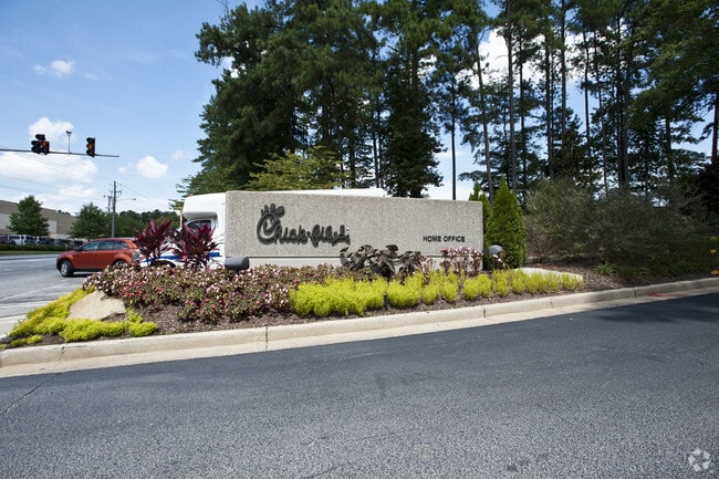
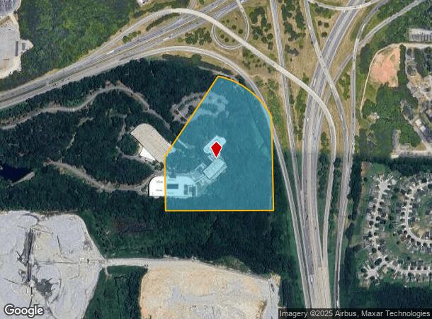
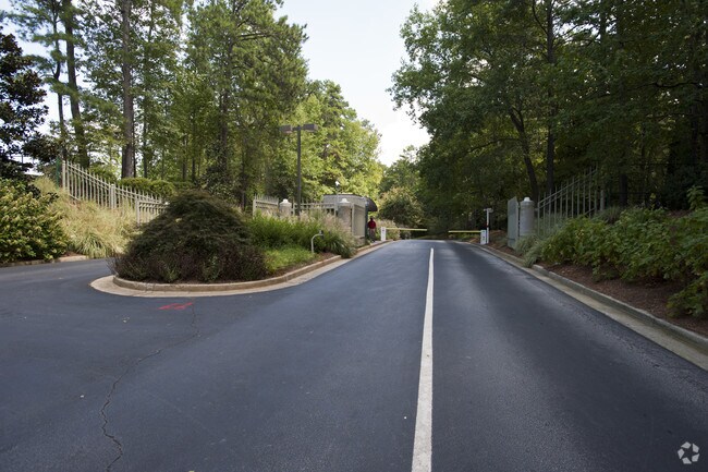
Property Record
5200 Buffington Rd, Atlanta, GA 30349
NEARBY LISTINGS FOR SALE OR LEASE
Property Detail
5200 Buffington Rd
13-0066-LL-018-7
7
Officebuilding
Fulton
X
Georgia
13121C0476F
7
2024
22.64 AC
2025
North Clayton/Airport
010529
Atlanta
230,068 SF
Atlanta-Sandy Springs-Roswell, GA
DEMOGRAPHICS near 5200 Buffington Rd
1 Mile
3 Mile
5 Mile
2024 Total Population
5,479
60,327
160,183
2029 Population
5,787
62,679
164,519
Pop Growth 2024-2029
+ 5.62%
+ 3.90%
+ 2.71%
Average Age
35
36
37
2024 Total Households
2,009
23,184
63,205
HH Growth 2024-2029
+ 5.57%
+ 3.91%
+ 2.69%
Median Household Inc
$48,181
$51,142
$52,776
Avg Household Size
2.70
2.50
2.50
2024 Avg HH Vehicles
2.00
2.00
2.00
Median Home Value
$136,926
$166,201
$189,870
Median Year Built
1977
1983
1987
Nearby Places
Map Layers
Map Styles
 Street
 Aerial
- Restaurants
- Banks
- Shops
- Fitness
- Groceries
PUBLIC TRANSPORTATION
AIRPORT
Hartsfield - Jackson Atlanta International
DRIVE
WALK
Distance
Hartsfield - Jackson Atlanta International
19 min
8.5 mi
Freight Ports
Georgia Ports - Savannah
DRIVE
WALK
Distance
Georgia Ports - Savannah
280 min
245.8 mi
Nearby Properties
Address
Land Use
TOTAL SIZE
Lot Size
Zoning
Address
Land Use
TOTAL SIZE
Lot Size
Zoning
28,000 SF
246.83 AC
I
Address
Land Use
TOTAL SIZE
Lot Size
Zoning
2,666 SF
46.88 AC
BP
Address
Land Use
TOTAL SIZE
Lot Size
Zoning
2,666 SF
0.43 AC
Address
Land Use
TOTAL SIZE
Lot Size
Zoning
2,666 SF
0.43 AC
Address
Land Use
TOTAL SIZE
Lot Size
Zoning
2,666 SF
0.43 AC
Address
Land Use
TOTAL SIZE
Lot Size
Zoning
2,666 SF
0.43 AC
Address
Land Use
TOTAL SIZE
Lot Size
Zoning
2,666 SF
0.43 AC
Address
Land Use
TOTAL SIZE
Lot Size
Zoning
2,666 SF
0.43 AC
Address
Land Use
TOTAL SIZE
Lot Size
Zoning
2,666 SF
0.43 AC
Address
Land Use
TOTAL SIZE
Lot Size
Zoning
2,666 SF
0.43 AC
Address
Land Use
TOTAL SIZE
Lot Size
Zoning
2,666 SF
0.43 AC
Address
Land Use
TOTAL SIZE
Lot Size
Zoning
2,666 SF
0.43 AC
Address
Land Use
TOTAL SIZE
Lot Size
Zoning
293,211 SF
23.51 AC
C
Address
Land Use
TOTAL SIZE
Lot Size
Zoning
929,571 SF
65.66 AC
M1
Address
Land Use
TOTAL SIZE
Lot Size
Zoning
270,503 SF
4.56 AC
C
Address
Land Use
TOTAL SIZE
Lot Size
Zoning
2,329,350 SF
32.55 AC
A
Address
Land Use
TOTAL SIZE
Lot Size
Zoning
115.30 AC
I
Address
Land Use
TOTAL SIZE
Lot Size
Zoning
6,402,340 SF
22.62 AC
MF
Address
Land Use
TOTAL SIZE
Lot Size
Zoning
699 SF
44.34 AC
RM
Address
Land Use
TOTAL SIZE
Lot Size
Zoning
1,231,833 SF
15.51 AC
C2
Address
Land Use
TOTAL SIZE
Lot Size
Zoning
1,026,040 SF
72.52 AC
M1
Address
Land Use
TOTAL SIZE
Lot Size
Zoning
4,381,104 SF
26.70 AC
AG1
Address
Land Use
TOTAL SIZE
Lot Size
Zoning
32,000 SF
8.86 AC
C
Address
Land Use
TOTAL SIZE
Lot Size
Zoning
137,475 SF
2 AC
C
Address
Land Use
TOTAL SIZE
Lot Size
Zoning
920,396 SF
62.40 AC
R3
Address
Land Use
TOTAL SIZE
Lot Size
Zoning
352 SF
32.69 AC
RM
Address
Land Use
TOTAL SIZE
Lot Size
Zoning
997,011 SF
68.07 AC
M1
Address
Land Use
TOTAL SIZE
Lot Size
Zoning
663,520 SF
62.96 AC
C1
Address
Land Use
TOTAL SIZE
Lot Size
Zoning
71.46 AC
C
Address
Land Use
TOTAL SIZE
Lot Size
Zoning
85,347 SF
49.56 AC
AG1
The World's #1 Commercial Real Estate Marketplace
Connect with us
© 2026 CoStar Group
The information above has been obtained from sources believed reliable. While we do not doubt its accuracy we have not verified it and make no guarantee, warranty or representation about it. It is your responsibility to independently confirm its accuracy and completeness. Any projections, opinions, assumptions, or estimates used are for example only and do not represent the current or future performance of the property. The value of this transaction to you depends on tax and other factors which should be evaluated by your tax, financial, and legal advisors. You and your advisors should conduct a careful, independent investigation of the property to determine to your satisfaction the suitability of the property for your needs.