Property Record
5200 Crayton Rd, Naples, FL 34103
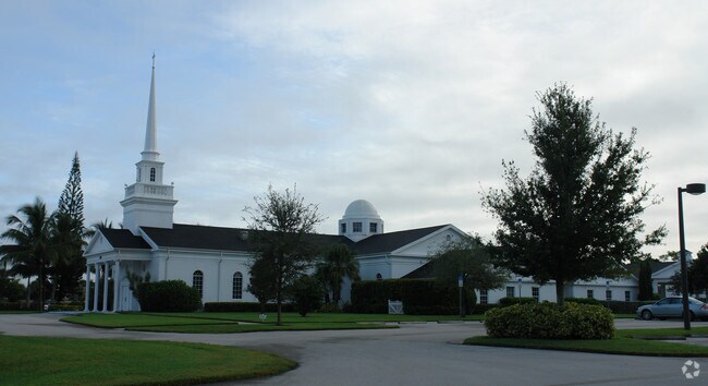

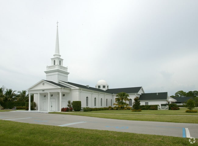
Property Detail
5200 Crayton Rd
16059920002
PARK SHORE UNIT 4 BLK 34 LOTS 23-29 & VACATED CRAYTON PLACE NORTH ROAD R/W & UNPLATTED LANDS NAPLES DESC AS 16-49-25 S 660FT OF N690FT OF W 330FT OF E 990FT OF NW1/4 OF NE1/4
Religious
Collier
NAPLES
Florida
AE The base floodplain where base flood elevations are provided. AE Zones are now used on new format FIRMs instead of A1-A30 Zones.
23
0
7.88 AC
2025
North Naples
000301
Southwest Florida
41,019 SF
Naples-Marco Island, FL
NEARBY LISTINGS FOR SALE OR LEASE
-
-
View all Naples listings for sale on LoopNet.com
DEMOGRAPHICS near 5200 Crayton Rd
1 mile
3 mile
5 mile
2025 Total Population
7,778
45,360
95,758
2030 Population
8,658
50,165
105,417
Pop Growth 2025-2030
+ 11.31%
+ 10.59%
+ 10.09%
Average Age
62
57
54
2025 Total Households
3,925
22,567
45,898
HH Growth 2025-2030
+ 11.18%
+ 10.34%
+ 9.77%
Median Household Inc
$146,893
$114,751
$107,482
Avg Household Size
1.90
1.90
2.00
2025 Avg HH Vehicles
2.00
2.00
2.00
Median Home Value
$1,086,951
$991,243
$898,584
Median Year Built
1986
1989
1992
Nearby Places
Map Layers
Map Styles
 Street
 Aerial
Transit
 Traffic
 Biking
Places
Listings with unknown addresses are not visible on the map
- Restaurants
- Banks
- Shops
- Fitness
- Groceries
PUBLIC TRANSPORTATION
AIRPORT
Southwest Florida International
Drive
Walk
Distance
Southwest Florida International
43 min
31.7 mi
Nearby Properties
Address
Land Use
TOTAL SIZE
Lot Size
Zoning
Address
Land Use
TOTAL SIZE
Lot Size
Zoning
905,326 SF
69.45 AC
GC
Address
Land Use
TOTAL SIZE
Lot Size
Zoning
735,070 SF
41.34 AC
A
Address
Land Use
TOTAL SIZE
Lot Size
Zoning
123,282 SF
6.50 AC
PUD
Address
Land Use
TOTAL SIZE
Lot Size
Zoning
250,674 SF
33.61 AC
NAPLES
Address
Land Use
TOTAL SIZE
Lot Size
Zoning
398,094 SF
17.31 AC
A
Address
Land Use
TOTAL SIZE
Lot Size
Zoning
363,275 SF
21.02 AC
PUD
Address
Land Use
TOTAL SIZE
Lot Size
Zoning
418,075 SF
38.19 AC
Address
Land Use
TOTAL SIZE
Lot Size
Zoning
453,819 SF
4.53 AC
Address
Land Use
TOTAL SIZE
Lot Size
Zoning
932,389 SF
36.28 AC
NAPLES
Address
Land Use
TOTAL SIZE
Lot Size
Zoning
256,507 SF
26.32 AC
PUD
Address
Land Use
TOTAL SIZE
Lot Size
Zoning
72,844 SF
15.94 AC
RSF-1
Address
Land Use
TOTAL SIZE
Lot Size
Zoning
71,516 SF
2.88 AC
NAPLES
Address
Land Use
TOTAL SIZE
Lot Size
Zoning
255,522 SF
21.83 AC
NAPLES
Address
Land Use
TOTAL SIZE
Lot Size
Zoning
82,382 SF
9.98 AC
PUD
Address
Land Use
TOTAL SIZE
Lot Size
Zoning
363,194 SF
2.51 AC
A
Address
Land Use
TOTAL SIZE
Lot Size
Zoning
203,171 SF
16.64 AC
NAPLES
Address
Land Use
TOTAL SIZE
Lot Size
Zoning
134,551 SF
19.50 AC
PUD
Address
Land Use
TOTAL SIZE
Lot Size
Zoning
145,061 SF
18.82 AC
PUD
Address
Land Use
TOTAL SIZE
Lot Size
Zoning
164,004 SF
2.66 AC
Address
Land Use
TOTAL SIZE
Lot Size
Zoning
133,302 SF
3.82 AC
NAPLES
Address
Land Use
TOTAL SIZE
Lot Size
Zoning
174,104 SF
13.36 AC
PUD
Address
Land Use
TOTAL SIZE
Lot Size
Zoning
153,644 SF
14.69 AC
PUD
Address
Land Use
TOTAL SIZE
Lot Size
Zoning
119,011 SF
13.50 AC
PD
Address
Land Use
TOTAL SIZE
Lot Size
Zoning
161,531 SF
18.72 AC
PUD
Address
Land Use
TOTAL SIZE
Lot Size
Zoning
21,704 SF
1.58 AC
Address
Land Use
TOTAL SIZE
Lot Size
Zoning
138,108 SF
14.46 AC
CPUD
Address
Land Use
TOTAL SIZE
Lot Size
Zoning
64,875 SF
6.30 AC
NAPLES
Address
Land Use
TOTAL SIZE
Lot Size
Zoning
101,829 SF
356.10 AC
NAPLES
Address
Land Use
TOTAL SIZE
Lot Size
Zoning
78,758 SF
11.73 AC
NAPLES
Address
Land Use
TOTAL SIZE
Lot Size
Zoning
27,006 SF
5.75 AC
C-4
The World's #1 Commercial Real Estate Marketplace
Connect with us
© 2026 CoStar Group
The information above has been obtained from sources believed reliable. While we do not doubt its accuracy we have not verified it and make no guarantee, warranty or representation about it. It is your responsibility to independently confirm its accuracy and completeness. Any projections, opinions, assumptions, or estimates used are for example only and do not represent the current or future performance of the property. The value of this transaction to you depends on tax and other factors which should be evaluated by your tax, financial, and legal advisors. You and your advisors should conduct a careful, independent investigation of the property to determine to your satisfaction the suitability of the property for your needs.