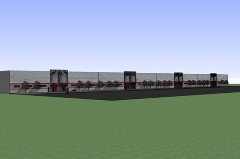
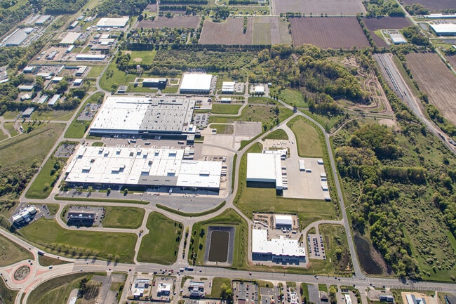
Property Record
Park Circle Dr, Kalamazoo, MI 49048

Current Lease Availabilities
Property Detail
Park Circle Dr
07-31-105-016
31-2-10 MIDLINK INDUSTRIAL SITE CONDO UNIT 16 NON-RENAISSANCE ZONE AREA SPLIT ON 12/26/05 FROM 31-102-054 INTO
Industrialacreage
KALAMAZOO
M
Michigan
B and X Area of moderate flood hazard, usually the area between the limits of the 100-year and 500-year floods.
2.78 AC
2025
Southern Kalamazoo County
2025
West Michigan
002204
Kalamazoo-Portage, MI
NEARBY LISTINGS FOR SALE OR LEASE
DEMOGRAPHICS near Park Circle Dr
1 mile
3 mile
5 mile
2025 Total Population
215
21,546
86,513
2030 Population
216
21,483
87,694
Pop Growth 2025-2030
+ 0.47%
(0.29%)
+ 1.37%
Average Age
44
37
38
2025 Total Households
83
8,670
36,483
HH Growth 2025-2030
0.00%
(0.52%)
+ 1.51%
Median Household Inc
$91,447
$61,322
$59,484
Avg Household Size
2.40
2.40
2.20
2025 Avg HH Vehicles
2.00
2.00
2.00
Median Home Value
$248,648
$146,620
$181,182
Median Year Built
1970
1956
1959
Nearby Places
Map Layers
Map Styles
 Street
 Aerial
Layers
 Traffic
 Biking
Places
Listings with unknown addresses are not visible on the map
- Restaurants
- Banks
- Shops
- Fitness
- Groceries
PUBLIC TRANSPORTATION
COMMUTER RAIL
Kalamazoo (Blue Water - Amtrak, Wolverine - Amtrak)
Drive
Walk
Distance
Kalamazoo (Blue Water - Amtrak, Wolverine - Amtrak)
10 min
5.6 mi
AIRPORT
Kalamazoo/Battle Creek International
Drive
Walk
Distance
Kalamazoo/Battle Creek International
9 min
2.5 mi
Freight Ports
Port of Toledo
Drive
Walk
Distance
Port of Toledo
171 min
142.2 mi
Nearby Properties
Address
Land Use
TOTAL SIZE
Lot Size
Zoning
Address
Land Use
TOTAL SIZE
Lot Size
Zoning
Address
Land Use
TOTAL SIZE
Lot Size
Zoning
82,520 SF
39.35 AC
I-1
Address
Land Use
TOTAL SIZE
Lot Size
Zoning
33.60 AC
Address
Land Use
TOTAL SIZE
Lot Size
Zoning
37.40 AC
I-2
Address
Land Use
TOTAL SIZE
Lot Size
Zoning
61.61 AC
Address
Land Use
TOTAL SIZE
Lot Size
Zoning
37.40 AC
I-2
Address
Land Use
TOTAL SIZE
Lot Size
Zoning
134,876 SF
16.45 AC
RM-15
Address
Land Use
TOTAL SIZE
Lot Size
Zoning
17,858 SF
15.27 AC
RM-1
Address
Land Use
TOTAL SIZE
Lot Size
Zoning
498,424 SF
41.72 AC
M-2
Address
Land Use
TOTAL SIZE
Lot Size
Zoning
298,908 SF
40.33 AC
Address
Land Use
TOTAL SIZE
Lot Size
Zoning
606,439 SF
34.61 AC
M-2
Address
Land Use
TOTAL SIZE
Lot Size
Zoning
Address
Land Use
TOTAL SIZE
Lot Size
Zoning
202,798 SF
17.67 AC
I-1
Address
Land Use
TOTAL SIZE
Lot Size
Zoning
Address
Land Use
TOTAL SIZE
Lot Size
Zoning
291,184 SF
26.35 AC
I-1
Address
Land Use
TOTAL SIZE
Lot Size
Zoning
80,064 SF
6.13 AC
M-1
Address
Land Use
TOTAL SIZE
Lot Size
Zoning
157,123 SF
M
Address
Land Use
TOTAL SIZE
Lot Size
Zoning
793,429 SF
36.48 AC
M
Address
Land Use
TOTAL SIZE
Lot Size
Zoning
393,522 SF
33.31 AC
M-2
Address
Land Use
TOTAL SIZE
Lot Size
Zoning
98,401 SF
2.94 AC
RM-15
Address
Land Use
TOTAL SIZE
Lot Size
Zoning
129,350 SF
42.30 AC
I-1
Address
Land Use
TOTAL SIZE
Lot Size
Zoning
104,366 SF
9.76 AC
B-3
Address
Land Use
TOTAL SIZE
Lot Size
Zoning
10.04 AC
I-1
Address
Land Use
TOTAL SIZE
Lot Size
Zoning
49,894 SF
7.09 AC
RM-15
Address
Land Use
TOTAL SIZE
Lot Size
Zoning
79,947 SF
12.13 AC
M
Address
Land Use
TOTAL SIZE
Lot Size
Zoning
69,987 SF
8.58 AC
RM-15
Address
Land Use
TOTAL SIZE
Lot Size
Zoning
2,286 SF
74.31 AC
Address
Land Use
TOTAL SIZE
Lot Size
Zoning
42,386 SF
1.55 AC
RM-15
Address
Land Use
TOTAL SIZE
Lot Size
Zoning
105,000 SF
10.04 AC
I-1
Address
Land Use
TOTAL SIZE
Lot Size
Zoning
142,107 SF
14.97 AC
M-1
The World's #1 Commercial Real Estate Marketplace
Connect with us
© 2026 CoStar Group
The information above has been obtained from sources believed reliable. While we do not doubt its accuracy we have not verified it and make no guarantee, warranty or representation about it. It is your responsibility to independently confirm its accuracy and completeness. Any projections, opinions, assumptions, or estimates used are for example only and do not represent the current or future performance of the property. The value of this transaction to you depends on tax and other factors which should be evaluated by your tax, financial, and legal advisors. You and your advisors should conduct a careful, independent investigation of the property to determine to your satisfaction the suitability of the property for your needs.