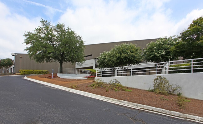
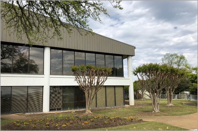
Property Record
5200 E Lake Blvd, Birmingham, AL 35217

NEARBY LISTINGS FOR SALE OR LEASE
Property Detail
5200 E Lake Blvd
Birmingham, AL
Airport Ind Pk Sec 1&3 23
23-00-09-3-000-001.004
LOT 2 PARCEL B SECTOR 3 AIRPORT INDUSTRIAL PARK SECTOR 1 & 3 139/56
Lightindustrial
Jefferson
X
Alabama
01073C0384H
2
2023
7.78 AC
2024
Fultondale
000400
Birmingham
154,952 SF
DEMOGRAPHICS near 5200 E Lake Blvd
1 Mile
3 Mile
5 Mile
2024 Total Population
3,864
45,756
118,329
2029 Population
3,890
46,034
117,551
Pop Growth 2024-2029
+ 0.67%
+ 0.61%
(0.66%)
Average Age
36
38
39
2024 Total Households
1,379
18,277
51,056
HH Growth 2024-2029
+ 0.58%
+ 0.56%
(0.74%)
Median Household Inc
$42,812
$31,580
$47,061
Avg Household Size
2.60
2.30
2.20
2024 Avg HH Vehicles
2.00
1.00
2.00
Median Home Value
$73,347
$96,421
$169,832
Median Year Built
1960
1961
1965
Nearby Places
Map Layers
Map Styles
 Street
 Aerial
- Restaurants
- Banks
- Shops
- Fitness
- Groceries
PUBLIC TRANSPORTATION
COMMUTER RAIL
Birmingham (Crescent - Amtrak)
DRIVE
WALK
Distance
Birmingham (Crescent - Amtrak)
11 min
5.8 mi
AIRPORT
Birmingham-Shuttlesworth International
DRIVE
WALK
Distance
Birmingham-Shuttlesworth International
10 min
5.2 mi
Freight Ports
Port of Mobile
DRIVE
WALK
Distance
Port of Mobile
289 min
261.7 mi
SALE & LEASE HISTORY
LISTING DATE
SALE/LEASE

May 18, 2018
For Sale
Nearby Properties
Address
Land Use
TOTAL SIZE
Lot Size
Zoning
Address
Land Use
TOTAL SIZE
Lot Size
Zoning
145,865 SF
142 AC
M1-M
Address
Land Use
TOTAL SIZE
Lot Size
Zoning
298,966 SF
73 AC
M1
Address
Land Use
TOTAL SIZE
Lot Size
Zoning
297,391 SF
27.10 AC
CR5
Address
Land Use
TOTAL SIZE
Lot Size
Zoning
225,000 SF
14 AC
B-2
Address
Land Use
TOTAL SIZE
Lot Size
Zoning
345,035 SF
39 AC
M1
Address
Land Use
TOTAL SIZE
Lot Size
Zoning
456,619 SF
27.30 AC
M2
Address
Land Use
TOTAL SIZE
Lot Size
Zoning
222,082 SF
46 AC
R3
Address
Land Use
TOTAL SIZE
Lot Size
Zoning
113,147 SF
115 AC
M1
Address
Land Use
TOTAL SIZE
Lot Size
Zoning
108,813 SF
156 AC
M-1
Address
Land Use
TOTAL SIZE
Lot Size
Zoning
29,095 SF
2.64 AC
B2
Address
Land Use
TOTAL SIZE
Lot Size
Zoning
150,750 SF
12.60 AC
CR5
Address
Land Use
TOTAL SIZE
Lot Size
Zoning
366,807 SF
25.30 AC
M2
Address
Land Use
TOTAL SIZE
Lot Size
Zoning
134,840 SF
7.80 AC
C1
Address
Land Use
TOTAL SIZE
Lot Size
Zoning
195,573 SF
12 AC
M2
Address
Land Use
TOTAL SIZE
Lot Size
Zoning
60,832 SF
162 AC
M1
Address
Land Use
TOTAL SIZE
Lot Size
Zoning
148,165 SF
15.65 AC
M1
Address
Land Use
TOTAL SIZE
Lot Size
Zoning
126,976 SF
25 AC
M1
Address
Land Use
TOTAL SIZE
Lot Size
Zoning
74,984 SF
1.25 AC
R5
Address
Land Use
TOTAL SIZE
Lot Size
Zoning
138,649 SF
7.75 AC
M1
Address
Land Use
TOTAL SIZE
Lot Size
Zoning
229,670 SF
12 AC
CM2
Address
Land Use
TOTAL SIZE
Lot Size
Zoning
13,072 SF
20.10 AC
M2
Address
Land Use
TOTAL SIZE
Lot Size
Zoning
102 AC
R2
Address
Land Use
TOTAL SIZE
Lot Size
Zoning
89,720 SF
3.75 AC
R8
Address
Land Use
TOTAL SIZE
Lot Size
Zoning
225,124 SF
15 AC
M2
Address
Land Use
TOTAL SIZE
Lot Size
Zoning
67,124 SF
4.45 AC
M1
Address
Land Use
TOTAL SIZE
Lot Size
Zoning
38,955 SF
109.30 AC
M3
Address
Land Use
TOTAL SIZE
Lot Size
Zoning
151 AC
R3B2
Address
Land Use
TOTAL SIZE
Lot Size
Zoning
72,597 SF
1.14 AC
R3
Address
Land Use
TOTAL SIZE
Lot Size
Zoning
1,728 SF
0.28 AC
I1
The World's #1 Commercial Real Estate Marketplace
Connect with us
© 2026 CoStar Group
The information above has been obtained from sources believed reliable. While we do not doubt its accuracy we have not verified it and make no guarantee, warranty or representation about it. It is your responsibility to independently confirm its accuracy and completeness. Any projections, opinions, assumptions, or estimates used are for example only and do not represent the current or future performance of the property. The value of this transaction to you depends on tax and other factors which should be evaluated by your tax, financial, and legal advisors. You and your advisors should conduct a careful, independent investigation of the property to determine to your satisfaction the suitability of the property for your needs.