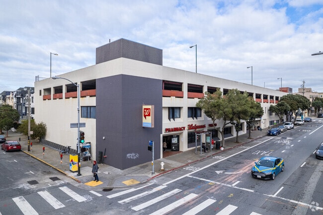
Property Record
5200 Geary Blvd, San Francisco, CA 94118

Current Lease Availabilities
NEARBY LISTINGS FOR SALE OR LEASE
Property Detail
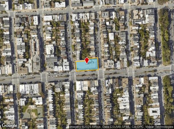
5200 Geary Blvd
San Francisco-Redwood City-South San Francisco, CA
Outside Land Bl 197
1448-045
San Francisco
Storemultistory
California
2024
45
2025
0.62 AC
042602
West of Van Ness
96,000 SF
San Francisco
DEMOGRAPHICS near 5200 Geary Blvd
1 Mile
3 Mile
5 Mile
2024 Total Population
52,196
321,465
715,228
2029 Population
48,566
297,461
662,674
Pop Growth 2024-2029
(6.95%)
(7.47%)
(7.35%)
Average Age
43
43
43
2024 Total Households
21,967
142,626
315,267
HH Growth 2024-2029
(7.49%)
(7.93%)
(7.72%)
Median Household Inc
$131,515
$145,233
$130,119
Avg Household Size
2.30
2.20
2.10
2024 Avg HH Vehicles
1.00
1.00
1.00
Median Home Value
$1,122,532
$1,116,505
$1,106,439
Median Year Built
1947
1947
1948
Nearby Places
Map Layers
Map Styles
 Street
 Aerial
- Restaurants
- Banks
- Shops
- Fitness
- Groceries
PUBLIC TRANSPORTATION
COMMUTER RAIL
San Francisco 4th & King (Caltrain - Caltrain (Caltrain))
DRIVE
WALK
Distance
San Francisco 4th & King (Caltrain - Caltrain (Caltrain))
14 min
5.4 mi
DRIVE
WALK
Distance
15 min
6.6 mi
AIRPORT
San Francisco International
DRIVE
WALK
Distance
San Francisco International
30 min
16.0 mi
Metro Oakland International
DRIVE
WALK
Distance
Metro Oakland International
41 min
23.4 mi
Nearby Properties
Address
Land Use
TOTAL SIZE
Lot Size
Zoning
Address
Land Use
TOTAL SIZE
Lot Size
Zoning
1,015,000 SF
2.43 AC
RC4
Address
Land Use
TOTAL SIZE
Lot Size
Zoning
718 SF
18.55 AC
RH2
Address
Land Use
TOTAL SIZE
Lot Size
Zoning
89,551 SF
0.73 AC
RC4
Address
Land Use
TOTAL SIZE
Lot Size
Zoning
409,895 SF
7.20 AC
RH3
Address
Land Use
TOTAL SIZE
Lot Size
Zoning
524,271 SF
1.06 AC
RC4
Address
Land Use
TOTAL SIZE
Lot Size
Zoning
2.40 AC
NC3
Address
Land Use
TOTAL SIZE
Lot Size
Zoning
250,843 SF
6.62 AC
NC3
Address
Land Use
TOTAL SIZE
Lot Size
Zoning
1.68 AC
RM2
Address
Land Use
TOTAL SIZE
Lot Size
Zoning
17.91 AC
RH-2
Address
Land Use
TOTAL SIZE
Lot Size
Zoning
126,849 SF
0.60 AC
CM
Address
Land Use
TOTAL SIZE
Lot Size
Zoning
420,000 SF
0.79 AC
NC-3
Address
Land Use
TOTAL SIZE
Lot Size
Zoning
1.14 AC
P
Address
Land Use
TOTAL SIZE
Lot Size
Zoning
4.41 AC
RH-3/RM-2
Address
Land Use
TOTAL SIZE
Lot Size
Zoning
905,491 SF
10.27 AC
RM1
Address
Land Use
TOTAL SIZE
Lot Size
Zoning
230,310 SF
0.65 AC
NC3
Address
Land Use
TOTAL SIZE
Lot Size
Zoning
140,380 SF
0.53 AC
NC3
Address
Land Use
TOTAL SIZE
Lot Size
Zoning
141,397 SF
0.88 AC
RM-4
Address
Land Use
TOTAL SIZE
Lot Size
Zoning
2.24 AC
RM3
Address
Land Use
TOTAL SIZE
Lot Size
Zoning
0.29 AC
RM4
Address
Land Use
TOTAL SIZE
Lot Size
Zoning
36,522 SF
0.38 AC
HAYES
Address
Land Use
TOTAL SIZE
Lot Size
Zoning
75,989 SF
0.72 AC
Address
Land Use
TOTAL SIZE
Lot Size
Zoning
116,000 SF
0.38 AC
RC4
Address
Land Use
TOTAL SIZE
Lot Size
Zoning
90,539 SF
2.28 AC
RH2
Address
Land Use
TOTAL SIZE
Lot Size
Zoning
95,303 SF
0.30 AC
RC4
Address
Land Use
TOTAL SIZE
Lot Size
Zoning
14,525 SF
0.46 AC
NC2
Address
Land Use
TOTAL SIZE
Lot Size
Zoning
107,588 SF
1.04 AC
RM1
Address
Land Use
TOTAL SIZE
Lot Size
Zoning
70,563 SF
0.42 AC
Address
Land Use
TOTAL SIZE
Lot Size
Zoning
88,402 SF
1.03 AC
RM1RM2
Address
Land Use
TOTAL SIZE
Lot Size
Zoning
165,485 SF
0.52 AC
RH2
Address
Land Use
TOTAL SIZE
Lot Size
Zoning
146,036 SF
0.49 AC
RH3
The World's #1 Commercial Real Estate Marketplace
Connect with us
© 2025 CoStar Group
The information above has been obtained from sources believed reliable. While we do not doubt its accuracy we have not verified it and make no guarantee, warranty or representation about it. It is your responsibility to independently confirm its accuracy and completeness. Any projections, opinions, assumptions, or estimates used are for example only and do not represent the current or future performance of the property. The value of this transaction to you depends on tax and other factors which should be evaluated by your tax, financial, and legal advisors. You and your advisors should conduct a careful, independent investigation of the property to determine to your satisfaction the suitability of the property for your needs.