Property Record
5200 Grantswood Rd, Birmingham, AL 35210


NEARBY LISTINGS FOR SALE OR LEASE
Property Detail
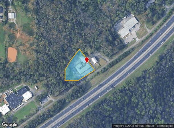
5200 Grantswood Rd
24-00-21-3-003-032.003
BEG AT SW COR OF SE 1/4 OF SW 1/4 SEC 21 TP 17S R 1W TH E 187 FT S TH NELY ALG N/L OF GRANTSWOOD RD ROW 201.5 FT TH NW 293.3 FT TH SWLY ALG C/L OF ABANDONED RR ROW 287.5 FT TH S 118.2 FT TO POB
Officebuilding
Jefferson
X
Alabama
01073C0417H
0.38 AC
2023
Trussville
2024
Birmingham
012701
Birmingham-Hoover, AL
12,457 SF
DEMOGRAPHICS near 5200 Grantswood Rd
1 Mile
3 Mile
5 Mile
2024 Total Population
709
9,770
56,247
2029 Population
698
9,527
55,140
Pop Growth 2024-2029
(1.55%)
(2.49%)
(1.97%)
Average Age
47
42
40
2024 Total Households
294
3,890
22,229
HH Growth 2024-2029
(1.70%)
(2.54%)
(2.14%)
Median Household Inc
$83,173
$75,583
$64,047
Avg Household Size
2.40
2.40
2.40
2024 Avg HH Vehicles
2.00
2.00
2.00
Median Home Value
$198,437
$237,108
$226,477
Median Year Built
1976
1979
1973
Nearby Places
Map Layers
Map Styles
 Street
 Aerial
- Restaurants
- Banks
- Shops
- Fitness
- Groceries
PUBLIC TRANSPORTATION
AIRPORT
Birmingham-Shuttlesworth International
DRIVE
WALK
Distance
Birmingham-Shuttlesworth International
15 min
9.2 mi
Freight Ports
Port of Mobile
DRIVE
WALK
Distance
Port of Mobile
283 min
258.7 mi
Nearby Properties
Address
Land Use
TOTAL SIZE
Lot Size
Zoning
Address
Land Use
TOTAL SIZE
Lot Size
Zoning
174,247 SF
46.70 AC
INST
Address
Land Use
TOTAL SIZE
Lot Size
Zoning
146,331 SF
161 AC
I3S&
Address
Land Use
TOTAL SIZE
Lot Size
Zoning
158,161 SF
15.48 AC
C1
Address
Land Use
TOTAL SIZE
Lot Size
Zoning
125,324 SF
53 AC
INST
Address
Land Use
TOTAL SIZE
Lot Size
Zoning
137,168 SF
63 AC
A1
Address
Land Use
TOTAL SIZE
Lot Size
Zoning
168,744 SF
8.46 AC
I1
Address
Land Use
TOTAL SIZE
Lot Size
Zoning
223,365 SF
15 AC
I1
Address
Land Use
TOTAL SIZE
Lot Size
Zoning
43,566 SF
18.99 AC
C1
Address
Land Use
TOTAL SIZE
Lot Size
Zoning
52,416 SF
7 AC
A1
Address
Land Use
TOTAL SIZE
Lot Size
Zoning
113,014 SF
8 AC
I1
Address
Land Use
TOTAL SIZE
Lot Size
Zoning
104,000 SF
7.66 AC
I1
Address
Land Use
TOTAL SIZE
Lot Size
Zoning
47,720 SF
5.21 AC
QB2
Address
Land Use
TOTAL SIZE
Lot Size
Zoning
64,859 SF
105 AC
INST
Address
Land Use
TOTAL SIZE
Lot Size
Zoning
97,021 SF
17.50 AC
R1
Address
Land Use
TOTAL SIZE
Lot Size
Zoning
63,798 SF
4.18 AC
I1
Address
Land Use
TOTAL SIZE
Lot Size
Zoning
119,300 SF
7.72 AC
I1
Address
Land Use
TOTAL SIZE
Lot Size
Zoning
89,526 SF
7.30 AC
C1&O
Address
Land Use
TOTAL SIZE
Lot Size
Zoning
76,037 SF
32.40 AC
A1
Address
Land Use
TOTAL SIZE
Lot Size
Zoning
14,432 SF
38.50 AC
I1
Address
Land Use
TOTAL SIZE
Lot Size
Zoning
96,670 SF
5.50 AC
C1PO
Address
Land Use
TOTAL SIZE
Lot Size
Zoning
31,103 SF
2 AC
C-2
Address
Land Use
TOTAL SIZE
Lot Size
Zoning
40,759 SF
5.40 AC
C-1
Address
Land Use
TOTAL SIZE
Lot Size
Zoning
28,068 SF
4.65 AC
C1
Address
Land Use
TOTAL SIZE
Lot Size
Zoning
22,866 SF
4.41 AC
A1
Address
Land Use
TOTAL SIZE
Lot Size
Zoning
228,928 SF
25 AC
C-1
Address
Land Use
TOTAL SIZE
Lot Size
Zoning
137,210 SF
14 AC
C-1
Address
Land Use
TOTAL SIZE
Lot Size
Zoning
31,128 SF
6.32 AC
C1
Address
Land Use
TOTAL SIZE
Lot Size
Zoning
89,670 SF
7 AC
C-2
Address
Land Use
TOTAL SIZE
Lot Size
Zoning
96,230 SF
0.91 AC
C1
Address
Land Use
TOTAL SIZE
Lot Size
Zoning
46,981 SF
92 AC
I3S&
The World's #1 Commercial Real Estate Marketplace
Connect with us
© 2025 CoStar Group
The information above has been obtained from sources believed reliable. While we do not doubt its accuracy we have not verified it and make no guarantee, warranty or representation about it. It is your responsibility to independently confirm its accuracy and completeness. Any projections, opinions, assumptions, or estimates used are for example only and do not represent the current or future performance of the property. The value of this transaction to you depends on tax and other factors which should be evaluated by your tax, financial, and legal advisors. You and your advisors should conduct a careful, independent investigation of the property to determine to your satisfaction the suitability of the property for your needs.