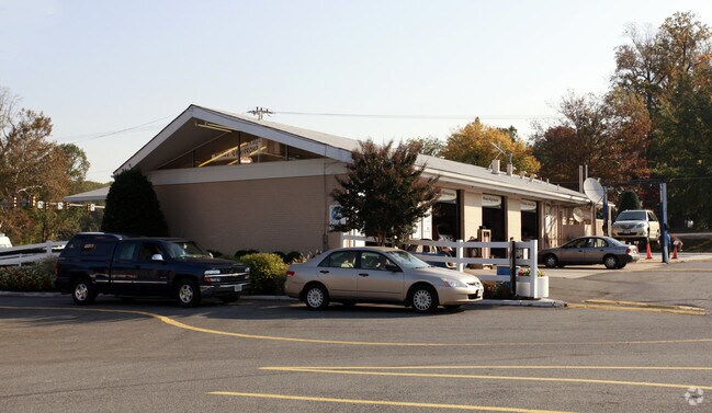
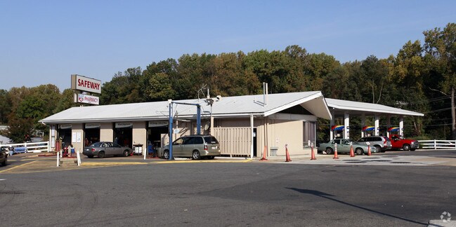
Property Record
5200 Port Royal Rd, Springfield, VA 22151
NEARBY LISTINGS FOR SALE OR LEASE
Property Detail
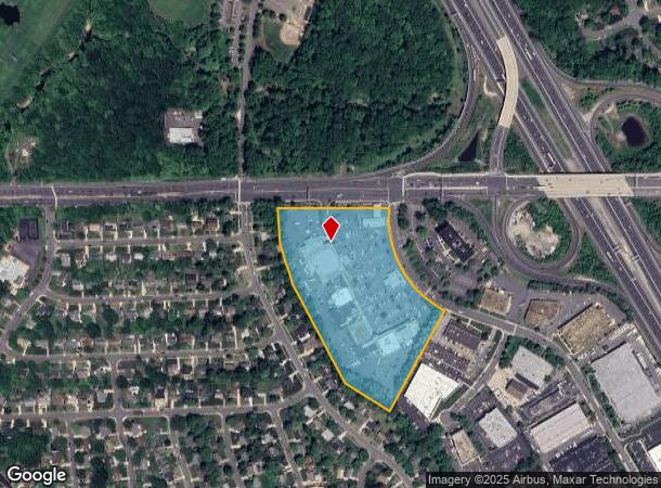
5200 Port Royal Rd
Washington-Arlington-Alexandria, DC-VA-MD-WV
Ravensworth Industrial Park
0704-10-0012
RAVENSWORTH INDUSTRIAL PARK PCL 12
Communitycenter
Fairfax
X
Virginia
5100540050D
12
2024
14.60 AC
2025
Springfield/Burke
452400
Washington, DC
124,351 SF
DEMOGRAPHICS near 5200 Port Royal Rd
1 Mile
3 Mile
5 Mile
2024 Total Population
14,256
118,537
359,672
2029 Population
14,006
116,472
354,334
Pop Growth 2024-2029
(1.75%)
(1.74%)
(1.48%)
Average Age
38
40
40
2024 Total Households
4,327
38,046
124,863
HH Growth 2024-2029
(1.87%)
(1.90%)
(1.62%)
Median Household Inc
$125,497
$135,536
$129,368
Avg Household Size
3.10
3.00
2.80
2024 Avg HH Vehicles
2.00
2.00
2.00
Median Home Value
$613,588
$653,057
$645,932
Median Year Built
1965
1968
1975
Nearby Places
- Restaurants
- Banks
- Shops
- Fitness
- Groceries
PUBLIC TRANSPORTATION
COMMUTER RAIL
Backlick Road (Manassas Line - Virginia Railway Express)
DRIVE
WALK
Distance
Backlick Road (Manassas Line - Virginia Railway Express)
7 min
3.3 mi
Rolling Road (Manassas Line - Virginia Railway Express)
DRIVE
WALK
Distance
Rolling Road (Manassas Line - Virginia Railway Express)
7 min
3.6 mi
AIRPORT
Ronald Reagan Washington Ntl
DRIVE
WALK
Distance
Ronald Reagan Washington Ntl
21 min
12.0 mi
Washington Dulles International
DRIVE
WALK
Distance
Washington Dulles International
38 min
24.0 mi
Freight Ports
Port of Baltimore
DRIVE
WALK
Distance
Port of Baltimore
75 min
55.7 mi
Nearby Properties
Address
Land Use
TOTAL SIZE
Lot Size
Zoning
Address
Land Use
TOTAL SIZE
Lot Size
Zoning
1,031,040 SF
36.16 AC
220
Address
Land Use
TOTAL SIZE
Lot Size
Zoning
429,735 SF
20 AC
560
Address
Land Use
TOTAL SIZE
Lot Size
Zoning
452,682 SF
20.74 AC
220
Address
Land Use
TOTAL SIZE
Lot Size
Zoning
415,368 SF
21.06 AC
220
Address
Land Use
TOTAL SIZE
Lot Size
Zoning
485,499 SF
19.11 AC
220
Address
Land Use
TOTAL SIZE
Lot Size
Zoning
293,471 SF
13.20 AC
220
Address
Land Use
TOTAL SIZE
Lot Size
Zoning
253,647 SF
5.99 AC
220
Address
Land Use
TOTAL SIZE
Lot Size
Zoning
339,028 SF
75.81 AC
120
Address
Land Use
TOTAL SIZE
Lot Size
Zoning
398,419 SF
18.54 AC
560
Address
Land Use
TOTAL SIZE
Lot Size
Zoning
153,341 SF
11.96 AC
460
Address
Land Use
TOTAL SIZE
Lot Size
Zoning
253,648 SF
10.72 AC
550
Address
Land Use
TOTAL SIZE
Lot Size
Zoning
533,660 SF
40.12 AC
303
Address
Land Use
TOTAL SIZE
Lot Size
Zoning
311,342 SF
4.24 AC
496
Address
Land Use
TOTAL SIZE
Lot Size
Zoning
436,023 SF
11.20 AC
597
Address
Land Use
TOTAL SIZE
Lot Size
Zoning
92,807 SF
10.09 AC
460
Address
Land Use
TOTAL SIZE
Lot Size
Zoning
176,211 SF
8.04 AC
220
Address
Land Use
TOTAL SIZE
Lot Size
Zoning
640 SF
30.12 AC
130
Address
Land Use
TOTAL SIZE
Lot Size
Zoning
172,107 SF
8.25 AC
140
Address
Land Use
TOTAL SIZE
Lot Size
Zoning
85,982 SF
7.76 AC
460
Address
Land Use
TOTAL SIZE
Lot Size
Zoning
110,762 SF
10.11 AC
460
Address
Land Use
TOTAL SIZE
Lot Size
Zoning
99,036 SF
6.80 AC
460
Address
Land Use
TOTAL SIZE
Lot Size
Zoning
119,052 SF
1.64 AC
400
Address
Land Use
TOTAL SIZE
Lot Size
Zoning
66,987 SF
6.79 AC
460
Address
Land Use
TOTAL SIZE
Lot Size
Zoning
85,777 SF
6.34 AC
460
Address
Land Use
TOTAL SIZE
Lot Size
Zoning
67,970 SF
5.11 AC
460
Address
Land Use
TOTAL SIZE
Lot Size
Zoning
110,598 SF
1.25 AC
400
Address
Land Use
TOTAL SIZE
Lot Size
Zoning
39 AC
120
Address
Land Use
TOTAL SIZE
Lot Size
Zoning
137,798 SF
6.83 AC
220
Address
Land Use
TOTAL SIZE
Lot Size
Zoning
80,967 SF
7.60 AC
460
The World's #1 Commercial Real Estate Marketplace
Connect with us
© 2025 CoStar Group
The information above has been obtained from sources believed reliable. While we do not doubt its accuracy we have not verified it and make no guarantee, warranty or representation about it. It is your responsibility to independently confirm its accuracy and completeness. Any projections, opinions, assumptions, or estimates used are for example only and do not represent the current or future performance of the property. The value of this transaction to you depends on tax and other factors which should be evaluated by your tax, financial, and legal advisors. You and your advisors should conduct a careful, independent investigation of the property to determine to your satisfaction the suitability of the property for your needs.