Property Record
5200 W 20Th St, Greeley, CO 80634
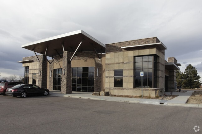

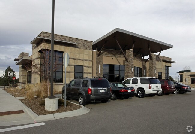

Property Detail
5200 W 20Th St
R4997308
GR POP BLDG ENV A-1 PINNACLE OFFICE PARK
Officebuilding
Weld
B and X Area of moderate flood hazard, usually the area between the limits of the 100-year and 500-year floods.
Colorado
2024
0.12 AC
2025
Weld County
001408
Denver
4,761 SF
Greeley, CO
NEARBY LISTINGS FOR SALE OR LEASE
DEMOGRAPHICS near 5200 W 20Th St
1 mile
3 mile
5 mile
2024 Total Population
9,756
84,708
148,640
2029 Population
11,632
100,074
175,167
Pop Growth 2024-2029
+ 19.23%
+ 18.14%
+ 17.85%
Average Age
45
38
36
2024 Total Households
3,867
31,548
53,030
HH Growth 2024-2029
+ 19.71%
+ 18.69%
+ 18.58%
Median Household Inc
$95,317
$79,429
$65,778
Avg Household Size
2.50
2.60
2.70
2024 Avg HH Vehicles
2.00
2.00
2.00
Median Home Value
$428,939
$365,297
$345,469
Median Year Built
1993
1995
1990
Nearby Places
Map Layers
Map Styles
 Street
 Aerial
Transit
 Traffic
 Biking
Places
Listings with unknown addresses are not visible on the map
- Restaurants
- Banks
- Shops
- Fitness
- Groceries
Nearby Properties
Address
Land Use
TOTAL SIZE
Lot Size
Zoning
Address
Land Use
TOTAL SIZE
Lot Size
Zoning
315,937 SF
22.73 AC
Address
Land Use
TOTAL SIZE
Lot Size
Zoning
1,181,203 SF
23.26 AC
Address
Land Use
TOTAL SIZE
Lot Size
Zoning
669,727 SF
180.71 AC
Address
Land Use
TOTAL SIZE
Lot Size
Zoning
280,000 SF
43.91 AC
Address
Land Use
TOTAL SIZE
Lot Size
Zoning
270,965 SF
99.08 AC
Address
Land Use
TOTAL SIZE
Lot Size
Zoning
46,025 SF
5.32 AC
Address
Land Use
TOTAL SIZE
Lot Size
Zoning
142,317 SF
34.34 AC
Address
Land Use
TOTAL SIZE
Lot Size
Zoning
67,456 SF
40.89 AC
Address
Land Use
TOTAL SIZE
Lot Size
Zoning
151,418 SF
16.96 AC
Address
Land Use
TOTAL SIZE
Lot Size
Zoning
113,715 SF
9.42 AC
Address
Land Use
TOTAL SIZE
Lot Size
Zoning
83,032 SF
9.23 AC
Address
Land Use
TOTAL SIZE
Lot Size
Zoning
146,843 SF
12.80 AC
Address
Land Use
TOTAL SIZE
Lot Size
Zoning
118,663 SF
13.36 AC
Address
Land Use
TOTAL SIZE
Lot Size
Zoning
138,446 SF
14.40 AC
Address
Land Use
TOTAL SIZE
Lot Size
Zoning
101,963 SF
45.74 AC
Address
Land Use
TOTAL SIZE
Lot Size
Zoning
88,284 SF
5.80 AC
Address
Land Use
TOTAL SIZE
Lot Size
Zoning
214,594 SF
22.70 AC
Address
Land Use
TOTAL SIZE
Lot Size
Zoning
289,203 SF
12.28 AC
Address
Land Use
TOTAL SIZE
Lot Size
Zoning
122,023 SF
12.29 AC
Address
Land Use
TOTAL SIZE
Lot Size
Zoning
437,527 SF
17.54 AC
Address
Land Use
TOTAL SIZE
Lot Size
Zoning
105,705 SF
9.24 AC
Address
Land Use
TOTAL SIZE
Lot Size
Zoning
202,130 SF
25.35 AC
Address
Land Use
TOTAL SIZE
Lot Size
Zoning
405,388 SF
17.36 AC
Address
Land Use
TOTAL SIZE
Lot Size
Zoning
125,372 SF
11.40 AC
Address
Land Use
TOTAL SIZE
Lot Size
Zoning
252,025 SF
10.15 AC
Address
Land Use
TOTAL SIZE
Lot Size
Zoning
80,202 SF
6 AC
Address
Land Use
TOTAL SIZE
Lot Size
Zoning
48,544 SF
7.92 AC
Address
Land Use
TOTAL SIZE
Lot Size
Zoning
71,614 SF
5.99 AC
Address
Land Use
TOTAL SIZE
Lot Size
Zoning
88,620 SF
5.11 AC
Address
Land Use
TOTAL SIZE
Lot Size
Zoning
45,141 SF
12.15 AC
The World's #1 Commercial Real Estate Marketplace
Connect with us
© 2026 CoStar Group
The information above has been obtained from sources believed reliable. While we do not doubt its accuracy we have not verified it and make no guarantee, warranty or representation about it. It is your responsibility to independently confirm its accuracy and completeness. Any projections, opinions, assumptions, or estimates used are for example only and do not represent the current or future performance of the property. The value of this transaction to you depends on tax and other factors which should be evaluated by your tax, financial, and legal advisors. You and your advisors should conduct a careful, independent investigation of the property to determine to your satisfaction the suitability of the property for your needs.