Property Record
5200 W Us Highway 377, Tolar, TX 76476
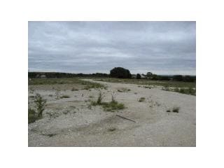

Property Detail
5200 W Us Highway 377
R000040417
ACRES: 16.268 ABST: E BOLTON - ABST 70
Commercialnec
HOOD
B and X Area of moderate flood hazard, usually the area between the limits of the 100-year and 500-year floods.
Texas
2025
16.27 AC
2025
Hood County
160302
Dallas/Ft Worth
6,000 SF
Granbury, TX
NEARBY LISTINGS FOR SALE OR LEASE
DEMOGRAPHICS near 5200 W Us Highway 377
1 mile
3 mile
5 mile
2024 Total Population
249
1,398
10,409
2029 Population
267
1,491
11,238
Pop Growth 2024-2029
+ 7.23%
+ 6.65%
+ 7.96%
Average Age
42
43
42
2024 Total Households
96
539
4,088
HH Growth 2024-2029
+ 6.25%
+ 6.12%
+ 7.51%
Median Household Inc
$69,499
$71,959
$79,676
Avg Household Size
2.60
2.50
2.40
2024 Avg HH Vehicles
2.00
2.00
2.00
Median Home Value
$302,500
$320,202
$276,060
Median Year Built
1985
1986
1987
Nearby Places
Map Layers
Map Styles
 Street
 Aerial
Transit
 Traffic
 Biking
Places
Listings with unknown addresses are not visible on the map
- Restaurants
- Banks
- Shops
- Fitness
- Groceries
Nearby Properties
Address
Land Use
TOTAL SIZE
Lot Size
Zoning
Address
Land Use
TOTAL SIZE
Lot Size
Zoning
3,070 SF
10.48 AC
Address
Land Use
TOTAL SIZE
Lot Size
Zoning
8,800 SF
8 AC
Address
Land Use
TOTAL SIZE
Lot Size
Zoning
23,360 SF
4.11 AC
Address
Land Use
TOTAL SIZE
Lot Size
Zoning
14,250 SF
7.41 AC
Address
Land Use
TOTAL SIZE
Lot Size
Zoning
Address
Land Use
TOTAL SIZE
Lot Size
Zoning
Address
Land Use
TOTAL SIZE
Lot Size
Zoning
1,920 SF
2 AC
Address
Land Use
TOTAL SIZE
Lot Size
Zoning
3,070 SF
4.32 AC
Address
Land Use
TOTAL SIZE
Lot Size
Zoning
7,606 SF
2 AC
Address
Land Use
TOTAL SIZE
Lot Size
Zoning
5,632 SF
5 AC
Address
Land Use
TOTAL SIZE
Lot Size
Zoning
Address
Land Use
TOTAL SIZE
Lot Size
Zoning
18,213 SF
6.05 AC
Address
Land Use
TOTAL SIZE
Lot Size
Zoning
13,470 SF
10.09 AC
Address
Land Use
TOTAL SIZE
Lot Size
Zoning
64.29 AC
Address
Land Use
TOTAL SIZE
Lot Size
Zoning
4.96 AC
Address
Land Use
TOTAL SIZE
Lot Size
Zoning
4,937 SF
1.37 AC
Address
Land Use
TOTAL SIZE
Lot Size
Zoning
7,200 SF
2 AC
Address
Land Use
TOTAL SIZE
Lot Size
Zoning
29,238 SF
4.16 AC
Address
Land Use
TOTAL SIZE
Lot Size
Zoning
16,960 SF
2.97 AC
Address
Land Use
TOTAL SIZE
Lot Size
Zoning
89.18 AC
Address
Land Use
TOTAL SIZE
Lot Size
Zoning
2,400 SF
19 AC
Address
Land Use
TOTAL SIZE
Lot Size
Zoning
65.09 AC
Address
Land Use
TOTAL SIZE
Lot Size
Zoning
576 SF
7.42 AC
Address
Land Use
TOTAL SIZE
Lot Size
Zoning
1,330 SF
37.37 AC
Address
Land Use
TOTAL SIZE
Lot Size
Zoning
16,875 SF
4 AC
Address
Land Use
TOTAL SIZE
Lot Size
Zoning
13,836 SF
8.60 AC
Address
Land Use
TOTAL SIZE
Lot Size
Zoning
14,170 SF
7.48 AC
Address
Land Use
TOTAL SIZE
Lot Size
Zoning
34.82 AC
Address
Land Use
TOTAL SIZE
Lot Size
Zoning
3,016 SF
2 AC
The World's #1 Commercial Real Estate Marketplace
Connect with us
© 2026 CoStar Group
The information above has been obtained from sources believed reliable. While we do not doubt its accuracy we have not verified it and make no guarantee, warranty or representation about it. It is your responsibility to independently confirm its accuracy and completeness. Any projections, opinions, assumptions, or estimates used are for example only and do not represent the current or future performance of the property. The value of this transaction to you depends on tax and other factors which should be evaluated by your tax, financial, and legal advisors. You and your advisors should conduct a careful, independent investigation of the property to determine to your satisfaction the suitability of the property for your needs.