Property Record
5201 Buckeystown Pike, Frederick, MD 21704

NEARBY LISTINGS FOR SALE OR LEASE
Property Detail
5201 Buckeystown Pike
Washington-Arlington-Alexandria, DC-VA-MD-WV
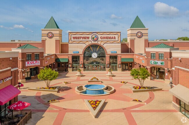
Westview
28-543301
LOT 2A 2.06 ACRES WESTVIEW
Theater
Frederick
X
Maryland
24021C0431E
2a
2024
22.94 AC
2025
Frederick
751003
Washington, DC
185,639 SF
DEMOGRAPHICS near 5201 Buckeystown Pike
1 Mile
3 Mile
5 Mile
2024 Total Population
5,233
45,883
118,768
2029 Population
6,062
52,346
134,885
Pop Growth 2024-2029
+ 15.84%
+ 14.09%
+ 13.57%
Average Age
36
38
38
2024 Total Households
1,972
17,865
44,346
HH Growth 2024-2029
+ 16.18%
+ 14.46%
+ 14.05%
Median Household Inc
$100,370
$88,665
$91,676
Avg Household Size
2.50
2.50
2.60
2024 Avg HH Vehicles
2.00
2.00
2.00
Median Home Value
$351,421
$329,562
$361,681
Median Year Built
1993
1992
1991
Nearby Places
Map Layers
Map Styles
 Street
 Aerial
- Restaurants
- Banks
- Shops
- Fitness
- Groceries
PUBLIC TRANSPORTATION
COMMUTER RAIL
DRIVE
WALK
Distance
7 min
2.1 mi
DRIVE
WALK
Distance
6 min
2.2 mi
AIRPORT
Hagerstown Regional/Richard A Henson Field
DRIVE
WALK
Distance
Hagerstown Regional/Richard A Henson Field
45 min
31.9 mi
Washington Dulles International
DRIVE
WALK
Distance
Washington Dulles International
69 min
43.9 mi
Freight Ports
Port of Baltimore
DRIVE
WALK
Distance
Port of Baltimore
64 min
50.6 mi
Nearby Properties
Address
Land Use
TOTAL SIZE
Lot Size
Zoning
Address
Land Use
TOTAL SIZE
Lot Size
Zoning
551,652 SF
27.47 AC
M1
Address
Land Use
TOTAL SIZE
Lot Size
Zoning
747,653 SF
57.55 AC
LI
Address
Land Use
TOTAL SIZE
Lot Size
Zoning
668,533 SF
45.39 AC
MXD
Address
Land Use
TOTAL SIZE
Lot Size
Zoning
372,920 SF
15.54 AC
PUD
Address
Land Use
TOTAL SIZE
Lot Size
Zoning
458,419 SF
25.94 AC
IST
Address
Land Use
TOTAL SIZE
Lot Size
Zoning
719,578 SF
48.06 AC
GC
Address
Land Use
TOTAL SIZE
Lot Size
Zoning
196,471 SF
7.49 AC
Address
Land Use
TOTAL SIZE
Lot Size
Zoning
459,536 SF
65.48 AC
LI
Address
Land Use
TOTAL SIZE
Lot Size
Zoning
252,725 SF
46.49 AC
IE
Address
Land Use
TOTAL SIZE
Lot Size
Zoning
221,825 SF
0.39 AC
IST
Address
Land Use
TOTAL SIZE
Lot Size
Zoning
281,360 SF
21.16 AC
MXD
Address
Land Use
TOTAL SIZE
Lot Size
Zoning
232,532 SF
11.15 AC
PND
Address
Land Use
TOTAL SIZE
Lot Size
Zoning
134,300 SF
12.62 AC
PUD
Address
Land Use
TOTAL SIZE
Lot Size
Zoning
129,448 SF
19.81 AC
PUD
Address
Land Use
TOTAL SIZE
Lot Size
Zoning
327,022 SF
15.61 AC
PUD
Address
Land Use
TOTAL SIZE
Lot Size
Zoning
82,480 SF
17.84 AC
LI
Address
Land Use
TOTAL SIZE
Lot Size
Zoning
378,000 SF
20.28 AC
LI
Address
Land Use
TOTAL SIZE
Lot Size
Zoning
152,684 SF
30.10 AC
A
Address
Land Use
TOTAL SIZE
Lot Size
Zoning
277,688 SF
28.05 AC
IST
Address
Land Use
TOTAL SIZE
Lot Size
Zoning
169,802 SF
11.76 AC
PUD
Address
Land Use
TOTAL SIZE
Lot Size
Zoning
228,787 SF
15.63 AC
Address
Land Use
TOTAL SIZE
Lot Size
Zoning
103,258 SF
10.46 AC
MXD
Address
Land Use
TOTAL SIZE
Lot Size
Zoning
108,999 SF
10.73 AC
IST
Address
Land Use
TOTAL SIZE
Lot Size
Zoning
170,940 SF
10.02 AC
LI
Address
Land Use
TOTAL SIZE
Lot Size
Zoning
211,811 SF
13.02 AC
MXD
Address
Land Use
TOTAL SIZE
Lot Size
Zoning
3,200 SF
33.09 AC
PRK
Address
Land Use
TOTAL SIZE
Lot Size
Zoning
213,234 SF
16.89 AC
ORI
Address
Land Use
TOTAL SIZE
Lot Size
Zoning
209,184 SF
25.94 AC
PB
Address
Land Use
TOTAL SIZE
Lot Size
Zoning
143,747 SF
55.18 AC
R3
The World's #1 Commercial Real Estate Marketplace
Connect with us
© 2026 CoStar Group
The information above has been obtained from sources believed reliable. While we do not doubt its accuracy we have not verified it and make no guarantee, warranty or representation about it. It is your responsibility to independently confirm its accuracy and completeness. Any projections, opinions, assumptions, or estimates used are for example only and do not represent the current or future performance of the property. The value of this transaction to you depends on tax and other factors which should be evaluated by your tax, financial, and legal advisors. You and your advisors should conduct a careful, independent investigation of the property to determine to your satisfaction the suitability of the property for your needs.