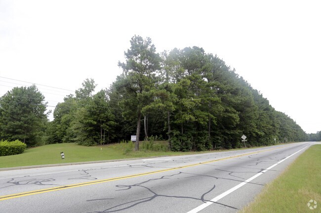
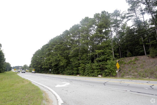
Property Record
5201 Highway 138 Sw, Oxford, GA 30054

NEARBY LISTINGS FOR SALE OR LEASE
Property Detail
5201 Highway 138 Sw
C053000000053A00
09139-Wg Comm South
Commercialacreage
10.96AC
A
Walton
13297C0225E
Georgia
2024
10.96 AC
2025
Walton County
110603
Atlanta
26,400 SF
Atlanta-Sandy Springs-Roswell, GA
DEMOGRAPHICS near 5201 Highway 138 Sw
1 Mile
3 Mile
5 Mile
2024 Total Population
1,631
9,637
25,144
2029 Population
1,877
11,042
28,599
Pop Growth 2024-2029
+ 15.08%
+ 14.58%
+ 13.74%
Average Age
38
40
41
2024 Total Households
556
3,263
8,665
HH Growth 2024-2029
+ 15.29%
+ 14.80%
+ 13.93%
Median Household Inc
$65,485
$73,462
$88,036
Avg Household Size
2.80
2.90
2.80
2024 Avg HH Vehicles
2.00
2.00
3.00
Median Home Value
$170,921
$233,167
$272,899
Median Year Built
1995
1996
1996
Nearby Places
Map Layers
Map Styles
 Street
 Aerial
- Restaurants
- Banks
- Shops
- Fitness
- Groceries
Nearby Properties
Address
Land Use
TOTAL SIZE
Lot Size
Zoning
Address
Land Use
TOTAL SIZE
Lot Size
Zoning
235,653 SF
103.54 AC
GPU
Address
Land Use
TOTAL SIZE
Lot Size
Zoning
56,491 SF
33.95 AC
A1 WP2
Address
Land Use
TOTAL SIZE
Lot Size
Zoning
2,646 SF
21.85 AC
A1 A2 WP2
Address
Land Use
TOTAL SIZE
Lot Size
Zoning
15,718 SF
45.40 AC
A1 WP2
Address
Land Use
TOTAL SIZE
Lot Size
Zoning
8,997 SF
4.03 AC
AR
Address
Land Use
TOTAL SIZE
Lot Size
Zoning
8,955 SF
20.14 AC
A1
Address
Land Use
TOTAL SIZE
Lot Size
Zoning
2,800 SF
6.14 AC
M1
Address
Land Use
TOTAL SIZE
Lot Size
Zoning
220.19 AC
A1
Address
Land Use
TOTAL SIZE
Lot Size
Zoning
38,400 SF
27.76 AC
C2 WP2
Address
Land Use
TOTAL SIZE
Lot Size
Zoning
238 AC
AR
Address
Land Use
TOTAL SIZE
Lot Size
Zoning
3,300 SF
6.35 AC
GPU
Address
Land Use
TOTAL SIZE
Lot Size
Zoning
170.63 AC
R1 WP2
Address
Land Use
TOTAL SIZE
Lot Size
Zoning
2,000 SF
12.10 AC
I1
Address
Land Use
TOTAL SIZE
Lot Size
Zoning
166.88 AC
R1
Address
Land Use
TOTAL SIZE
Lot Size
Zoning
136.32 AC
A1
Address
Land Use
TOTAL SIZE
Lot Size
Zoning
7,140 SF
3.24 AC
C1 WP2
Address
Land Use
TOTAL SIZE
Lot Size
Zoning
12,602 SF
4.08 AC
C1 WP2
Address
Land Use
TOTAL SIZE
Lot Size
Zoning
10,200 SF
17.56 AC
A1
Address
Land Use
TOTAL SIZE
Lot Size
Zoning
155.30 AC
AR
Address
Land Use
TOTAL SIZE
Lot Size
Zoning
151.99 AC
AR
Address
Land Use
TOTAL SIZE
Lot Size
Zoning
131.40 AC
A1 WP2
Address
Land Use
TOTAL SIZE
Lot Size
Zoning
6,538 SF
4.23 AC
GPU WP2
Address
Land Use
TOTAL SIZE
Lot Size
Zoning
117 AC
WP
Address
Land Use
TOTAL SIZE
Lot Size
Zoning
3,777 SF
4.56 AC
B3 WP2
Address
Land Use
TOTAL SIZE
Lot Size
Zoning
9,240 SF
1.49 AC
C2
Address
Land Use
TOTAL SIZE
Lot Size
Zoning
4,268 SF
9.56 AC
A1 WP2
Address
Land Use
TOTAL SIZE
Lot Size
Zoning
60.27 AC
AR
Address
Land Use
TOTAL SIZE
Lot Size
Zoning
11.10 AC
C1 WP2
Address
Land Use
TOTAL SIZE
Lot Size
Zoning
9,650 SF
3.43 AC
C2
The World's #1 Commercial Real Estate Marketplace
Connect with us
© 2026 CoStar Group
The information above has been obtained from sources believed reliable. While we do not doubt its accuracy we have not verified it and make no guarantee, warranty or representation about it. It is your responsibility to independently confirm its accuracy and completeness. Any projections, opinions, assumptions, or estimates used are for example only and do not represent the current or future performance of the property. The value of this transaction to you depends on tax and other factors which should be evaluated by your tax, financial, and legal advisors. You and your advisors should conduct a careful, independent investigation of the property to determine to your satisfaction the suitability of the property for your needs.