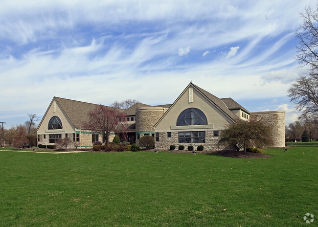
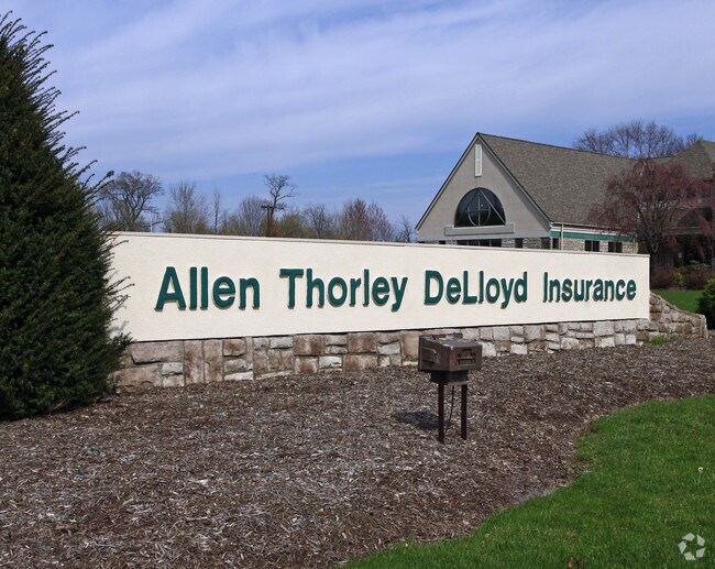
Property Record
5201 N Abbe Rd, Sheffield Lake, OH 44054

NEARBY LISTINGS FOR SALE OR LEASE
Property Detail
5201 N Abbe Rd
Cleveland-Elyria, OH
Sheffield
03-00-001-000-134
FROM -056 & -059
Officebuilding
Lorain
X
Ohio
39093C0137D
1
2024
2.01 AC
2024
Lorain County
028100
Cleveland
12,508 SF
DEMOGRAPHICS near 5201 N Abbe Rd
1 Mile
3 Mile
5 Mile
2024 Total Population
4,163
43,723
131,661
2029 Population
4,339
45,495
136,967
Pop Growth 2024-2029
+ 4.23%
+ 4.05%
+ 4.03%
Average Age
44
41
41
2024 Total Households
1,783
17,317
53,217
HH Growth 2024-2029
+ 4.26%
+ 4.05%
+ 3.99%
Median Household Inc
$76,458
$71,164
$60,733
Avg Household Size
2.30
2.50
2.40
2024 Avg HH Vehicles
2.00
2.00
2.00
Median Home Value
$198,715
$208,858
$171,958
Median Year Built
1989
1975
1970
Nearby Places
Map Layers
Map Styles
 Street
 Aerial
- Restaurants
- Banks
- Shops
- Fitness
- Groceries
PUBLIC TRANSPORTATION
COMMUTER RAIL
Elyria Amtrak (Capitol Limited - Amtrak, Lake Shore Limited - Amtrak)
DRIVE
WALK
Distance
Elyria Amtrak (Capitol Limited - Amtrak, Lake Shore Limited - Amtrak)
8 min
4.4 mi
AIRPORT
Cleveland-Hopkins International
DRIVE
WALK
Distance
Cleveland-Hopkins International
31 min
18.6 mi
Freight Ports
Port of Toledo
DRIVE
WALK
Distance
Port of Toledo
108 min
90.4 mi
Nearby Properties
Address
Land Use
TOTAL SIZE
Lot Size
Zoning
Address
Land Use
TOTAL SIZE
Lot Size
Zoning
908,481 SF
48.80 AC
Address
Land Use
TOTAL SIZE
Lot Size
Zoning
221,566 SF
26.09 AC
Address
Land Use
TOTAL SIZE
Lot Size
Zoning
17,669 SF
22.09 AC
Address
Land Use
TOTAL SIZE
Lot Size
Zoning
85,502 SF
15.47 AC
Address
Land Use
TOTAL SIZE
Lot Size
Zoning
67,074 SF
8.08 AC
Address
Land Use
TOTAL SIZE
Lot Size
Zoning
163,892 SF
46.81 AC
Address
Land Use
TOTAL SIZE
Lot Size
Zoning
50,761 SF
46.25 AC
Address
Land Use
TOTAL SIZE
Lot Size
Zoning
129,277 SF
17.35 AC
Address
Land Use
TOTAL SIZE
Lot Size
Zoning
66,474 SF
43.04 AC
Address
Land Use
TOTAL SIZE
Lot Size
Zoning
41,842 SF
10.38 AC
Address
Land Use
TOTAL SIZE
Lot Size
Zoning
41,684 SF
3.51 AC
Address
Land Use
TOTAL SIZE
Lot Size
Zoning
346,114 SF
37.97 AC
Address
Land Use
TOTAL SIZE
Lot Size
Zoning
46,764 SF
2.98 AC
Address
Land Use
TOTAL SIZE
Lot Size
Zoning
79,556 SF
17.55 AC
Address
Land Use
TOTAL SIZE
Lot Size
Zoning
67,590 SF
23.66 AC
Address
Land Use
TOTAL SIZE
Lot Size
Zoning
44,646 SF
6.46 AC
Address
Land Use
TOTAL SIZE
Lot Size
Zoning
126,448 SF
22.54 AC
Address
Land Use
TOTAL SIZE
Lot Size
Zoning
159,052 SF
36.16 AC
Address
Land Use
TOTAL SIZE
Lot Size
Zoning
169,280 SF
15.56 AC
Address
Land Use
TOTAL SIZE
Lot Size
Zoning
90,319 SF
10.88 AC
Address
Land Use
TOTAL SIZE
Lot Size
Zoning
60,452 SF
0.61 AC
Address
Land Use
TOTAL SIZE
Lot Size
Zoning
42,138 SF
24.78 AC
Address
Land Use
TOTAL SIZE
Lot Size
Zoning
18,827 SF
1.68 AC
Address
Land Use
TOTAL SIZE
Lot Size
Zoning
971,475 SF
54.21 AC
Address
Land Use
TOTAL SIZE
Lot Size
Zoning
42,138 SF
25.24 AC
Address
Land Use
TOTAL SIZE
Lot Size
Zoning
100,025 SF
9.06 AC
Address
Land Use
TOTAL SIZE
Lot Size
Zoning
29,864 SF
3.96 AC
Address
Land Use
TOTAL SIZE
Lot Size
Zoning
61,309 SF
19.26 AC
Address
Land Use
TOTAL SIZE
Lot Size
Zoning
33,624 SF
13.17 AC
Address
Land Use
TOTAL SIZE
Lot Size
Zoning
81,720 SF
5.71 AC
The World's #1 Commercial Real Estate Marketplace
Connect with us
© 2025 CoStar Group
The information above has been obtained from sources believed reliable. While we do not doubt its accuracy we have not verified it and make no guarantee, warranty or representation about it. It is your responsibility to independently confirm its accuracy and completeness. Any projections, opinions, assumptions, or estimates used are for example only and do not represent the current or future performance of the property. The value of this transaction to you depends on tax and other factors which should be evaluated by your tax, financial, and legal advisors. You and your advisors should conduct a careful, independent investigation of the property to determine to your satisfaction the suitability of the property for your needs.