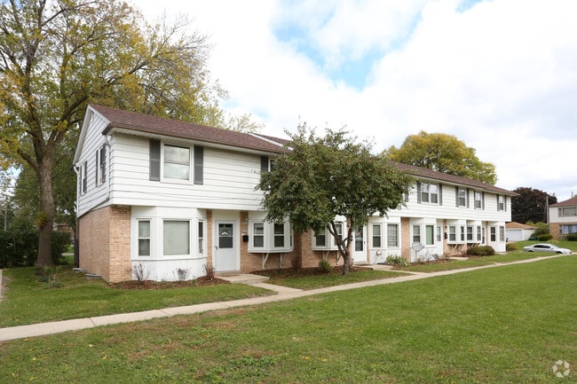
Property Record
5201 N Mohawk Ave, Milwaukee, WI 53217

Save to a Folder
{{folder.Name}}
{{folder.ListingIds.length}} Properties
{{folder.ListingIds.length}} Property
Create a New Folder
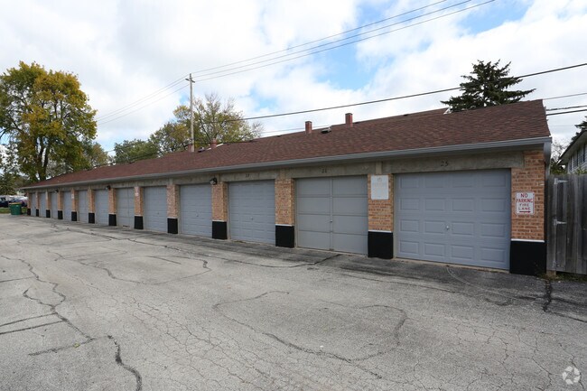
Property Detail
5201 N Mohawk Ave
197-8960-000
COM 395.24 E & 45 N OF SW COR OF NE 1/4 SEC. 32-8-22; TH N 535.64; E 276.69; S 535.64; W 275.36 M/L TO P.O.B. EXC. E 10 FOR ST.
Commercialnec
MILWAUKEE
B and X Area of moderate flood hazard, usually the area between the limits of the 100-year and 500-year floods.
Wisconsin
2024
3.28 AC
2025
Outer Brown Deer
060200
Milwaukee/Madison
47,160 SF
Milwaukee-Waukesha, WI
NEARBY LISTINGS FOR SALE OR LEASE
DEMOGRAPHICS near 5201 N Mohawk Ave
1 mile
3 mile
5 mile
2025 Total Population
12,370
116,940
321,128
2030 Population
12,280
116,893
322,041
Pop Growth 2025-2030
(0.73%)
(0.04%)
+ 0.28%
Average Age
40
38
36
2025 Total Households
4,998
47,503
134,146
HH Growth 2025-2030
(0.66%)
(0.25%)
+ 0.16%
Median Household Inc
$108,574
$52,541
$52,225
Avg Household Size
2.40
2.40
2.20
2025 Avg HH Vehicles
2.00
1.00
1.00
Median Home Value
$399,542
$253,363
$204,261
Median Year Built
1950
1948
1951
Nearby Places
Map Layers
Map Styles
 Street
 Aerial
Layers
 Traffic
 Biking
Places
Listings with unknown addresses are not visible on the map
- Restaurants
- Banks
- Shops
- Fitness
- Groceries
PUBLIC TRANSPORTATION
COMMUTER RAIL
Milwaukee (Empire Builder - Amtrak)
Drive
Walk
Distance
Milwaukee (Empire Builder - Amtrak)
13 min
6.1 mi
AIRPORT
General Mitchell International
Drive
Walk
Distance
General Mitchell International
24 min
12.7 mi
Freight Ports
Port Milwaukee
Drive
Walk
Distance
Port Milwaukee
16 min
8.5 mi
Nearby Properties
Address
Land Use
TOTAL SIZE
Lot Size
Zoning
Address
Land Use
TOTAL SIZE
Lot Size
Zoning
5,104 SF
0.11 AC
LB1
Address
Land Use
TOTAL SIZE
Lot Size
Zoning
42.90 AC
TL
Address
Land Use
TOTAL SIZE
Lot Size
Zoning
305,573 SF
3.20 AC
Address
Land Use
TOTAL SIZE
Lot Size
Zoning
66,245 SF
10.21 AC
Address
Land Use
TOTAL SIZE
Lot Size
Zoning
85,000 SF
1.13 AC
Address
Land Use
TOTAL SIZE
Lot Size
Zoning
527,776 SF
33.23 AC
Address
Land Use
TOTAL SIZE
Lot Size
Zoning
12.97 AC
TL
Address
Land Use
TOTAL SIZE
Lot Size
Zoning
685,390 SF
26.20 AC
Address
Land Use
TOTAL SIZE
Lot Size
Zoning
152,640 SF
10.50 AC
Address
Land Use
TOTAL SIZE
Lot Size
Zoning
171,170 SF
25.88 AC
Address
Land Use
TOTAL SIZE
Lot Size
Zoning
224,756 SF
12 AC
RESIDENTIA
Address
Land Use
TOTAL SIZE
Lot Size
Zoning
145,218 SF
10.23 AC
Address
Land Use
TOTAL SIZE
Lot Size
Zoning
165,296 SF
1.04 AC
Address
Land Use
TOTAL SIZE
Lot Size
Zoning
213,218 SF
11 AC
Address
Land Use
TOTAL SIZE
Lot Size
Zoning
145,605 SF
2.64 AC
Address
Land Use
TOTAL SIZE
Lot Size
Zoning
241,520 SF
6.60 AC
Address
Land Use
TOTAL SIZE
Lot Size
Zoning
113,542 SF
2.31 AC
Address
Land Use
TOTAL SIZE
Lot Size
Zoning
294,553 SF
6.19 AC
Address
Land Use
TOTAL SIZE
Lot Size
Zoning
235,364 SF
7.20 AC
Address
Land Use
TOTAL SIZE
Lot Size
Zoning
90,714 SF
4.18 AC
Address
Land Use
TOTAL SIZE
Lot Size
Zoning
72,121 SF
10.93 AC
TL
Address
Land Use
TOTAL SIZE
Lot Size
Zoning
195,507 SF
1.92 AC
Address
Land Use
TOTAL SIZE
Lot Size
Zoning
2.15 AC
RT4
Address
Land Use
TOTAL SIZE
Lot Size
Zoning
0.80 AC
RT4
Address
Land Use
TOTAL SIZE
Lot Size
Zoning
66.42 AC
IL1
Address
Land Use
TOTAL SIZE
Lot Size
Zoning
72,676 SF
6.22 AC
Address
Land Use
TOTAL SIZE
Lot Size
Zoning
229,111 SF
Address
Land Use
TOTAL SIZE
Lot Size
Zoning
140,418 SF
1.25 AC
Address
Land Use
TOTAL SIZE
Lot Size
Zoning
137,100 SF
6.69 AC
IL2
Address
Land Use
TOTAL SIZE
Lot Size
Zoning
74,526 SF
5.42 AC
The World's #1 Commercial Real Estate Marketplace
Connect with us
© 2026 CoStar Group
The information above has been obtained from sources believed reliable. While we do not doubt its accuracy we have not verified it and make no guarantee, warranty or representation about it. It is your responsibility to independently confirm its accuracy and completeness. Any projections, opinions, assumptions, or estimates used are for example only and do not represent the current or future performance of the property. The value of this transaction to you depends on tax and other factors which should be evaluated by your tax, financial, and legal advisors. You and your advisors should conduct a careful, independent investigation of the property to determine to your satisfaction the suitability of the property for your needs.