Property Record
521 Byron St, Chesapeake, VA 23320
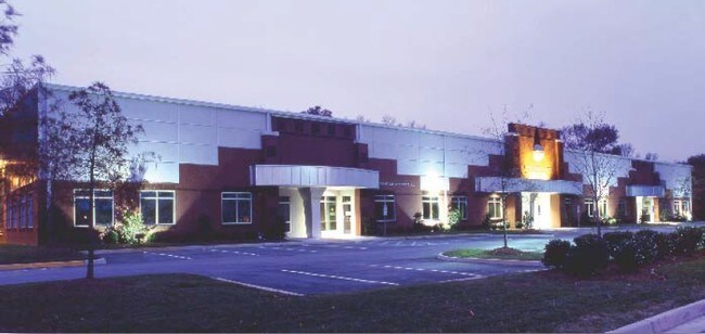

Property Detail
521 Byron St
0360000002500
PT 5 JAS SAUNDERS EST 1.55 AC
Industrialgeneral
Chesapeake City
M1: LIGHT
Virginia
B and X Area of moderate flood hazard, usually the area between the limits of the 100-year and 500-year floods.
1.55 AC
2024
Bainbridge
2025
Hampton Roads
020911
Virginia Beach-Chesapeake-Norfolk, VA-NC
17,329 SF
NEARBY LISTINGS FOR SALE OR LEASE
DEMOGRAPHICS near 521 Byron St
1 mile
3 mile
5 mile
2025 Total Population
8,484
67,413
209,080
2030 Population
8,560
68,164
211,121
Pop Growth 2025-2030
+ 0.90%
+ 1.11%
+ 0.98%
Average Age
39
40
39
2025 Total Households
3,619
27,710
79,200
HH Growth 2025-2030
+ 0.91%
+ 1.20%
+ 1.00%
Median Household Inc
$75,793
$80,305
$83,226
Avg Household Size
2.30
2.40
2.60
2025 Avg HH Vehicles
2.00
2.00
2.00
Median Home Value
$328,215
$334,721
$352,700
Median Year Built
1993
1990
1986
Nearby Places
Map Layers
Map Styles
 Street
 Aerial
Transit
 Traffic
 Biking
Places
Listings with unknown addresses are not visible on the map
- Restaurants
- Banks
- Shops
- Fitness
- Groceries
PUBLIC TRANSPORTATION
AIRPORT
Norfolk International
Drive
Walk
Distance
Norfolk International
22 min
13.3 mi
Newport News/Williamsburg International
Drive
Walk
Distance
Newport News/Williamsburg International
56 min
37.6 mi
SALE & LEASE HISTORY
LISTING DATE
SALE/LEASE

May 23, 2017
For Lease
May 20, 2022
For Lease
Jul 22, 2022
For Lease
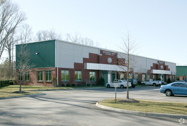
Nearby Properties
Address
Land Use
TOTAL SIZE
Lot Size
Zoning
Address
Land Use
TOTAL SIZE
Lot Size
Zoning
470,098 SF
14.10 AC
O-I: OFFIC
Address
Land Use
TOTAL SIZE
Lot Size
Zoning
405,992 SF
40.22 AC
PUD: PLANN
Address
Land Use
TOTAL SIZE
Lot Size
Zoning
6,820 SF
89.90 AC
R15S: RESI
Address
Land Use
TOTAL SIZE
Lot Size
Zoning
141,461 SF
169.22 AC
C1: CONSER
Address
Land Use
TOTAL SIZE
Lot Size
Zoning
439,870 SF
24.90 AC
PUD: PLANN
Address
Land Use
TOTAL SIZE
Lot Size
Zoning
743,121 SF
57.42 AC
RMF1: MULT
Address
Land Use
TOTAL SIZE
Lot Size
Zoning
358,908 SF
22.21 AC
MULTI: MUL
Address
Land Use
TOTAL SIZE
Lot Size
Zoning
299,727 SF
170.79 AC
C1: CONSER
Address
Land Use
TOTAL SIZE
Lot Size
Zoning
154,540 SF
1.68 AC
O-I: OFFIC
Address
Land Use
TOTAL SIZE
Lot Size
Zoning
209,403 SF
2.81 AC
PUD: PLANN
Address
Land Use
TOTAL SIZE
Lot Size
Zoning
95,354 SF
39.53 AC
B2: GENERA
Address
Land Use
TOTAL SIZE
Lot Size
Zoning
264,213 SF
17.59 AC
PUD: PLANN
Address
Land Use
TOTAL SIZE
Lot Size
Zoning
145,522 SF
15.51 AC
PUD: PLANN
Address
Land Use
TOTAL SIZE
Lot Size
Zoning
286,936 SF
15 AC
RMF1: MULT
Address
Land Use
TOTAL SIZE
Lot Size
Zoning
168,391 SF
28.39 AC
B2: GENERA
Address
Land Use
TOTAL SIZE
Lot Size
Zoning
218,812 SF
45.15 AC
PUD: PLANN
Address
Land Use
TOTAL SIZE
Lot Size
Zoning
32,163 SF
17.59 AC
MULTI: MUL
Address
Land Use
TOTAL SIZE
Lot Size
Zoning
140,369 SF
10.35 AC
PUD: PLANN
Address
Land Use
TOTAL SIZE
Lot Size
Zoning
26.63 AC
Address
Land Use
TOTAL SIZE
Lot Size
Zoning
92,723 SF
28.83 AC
R6: RESIDE
Address
Land Use
TOTAL SIZE
Lot Size
Zoning
270,962 SF
6.17 AC
MXD-U: MIX
Address
Land Use
TOTAL SIZE
Lot Size
Zoning
262,920 SF
20.94 AC
PUD: PLANN
Address
Land Use
TOTAL SIZE
Lot Size
Zoning
401,302 SF
18.74 AC
M2: GENERA
Address
Land Use
TOTAL SIZE
Lot Size
Zoning
142,656 SF
22.17 AC
RMF1: MULT
Address
Land Use
TOTAL SIZE
Lot Size
Zoning
277,846 SF
12.50 AC
RMF1: MULT
Address
Land Use
TOTAL SIZE
Lot Size
Zoning
287,268 SF
83.63 AC
MULTI: MUL
Address
Land Use
TOTAL SIZE
Lot Size
Zoning
240,547 SF
6.18 AC
PUD: PLANN
Address
Land Use
TOTAL SIZE
Lot Size
Zoning
75,936 SF
11.13 AC
MULTI: MUL
Address
Land Use
TOTAL SIZE
Lot Size
Zoning
127,755 SF
14.68 AC
PUD: PLANN
Address
Land Use
TOTAL SIZE
Lot Size
Zoning
188,683 SF
13.14 AC
O-I: OFFIC
The World's #1 Commercial Real Estate Marketplace
Connect with us
© 2026 CoStar Group
The information above has been obtained from sources believed reliable. While we do not doubt its accuracy we have not verified it and make no guarantee, warranty or representation about it. It is your responsibility to independently confirm its accuracy and completeness. Any projections, opinions, assumptions, or estimates used are for example only and do not represent the current or future performance of the property. The value of this transaction to you depends on tax and other factors which should be evaluated by your tax, financial, and legal advisors. You and your advisors should conduct a careful, independent investigation of the property to determine to your satisfaction the suitability of the property for your needs.