Property Record
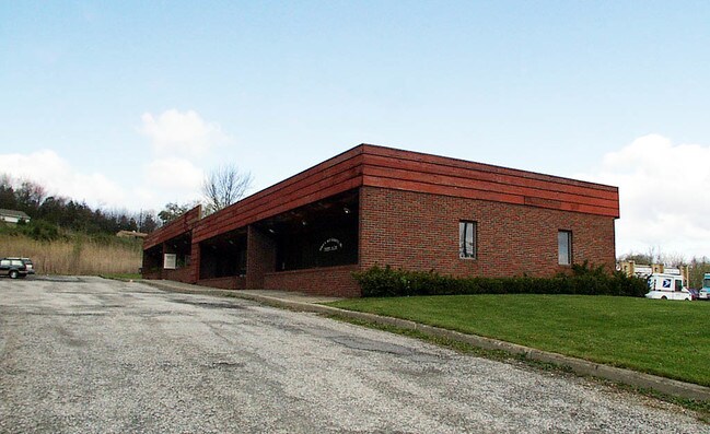
521 Route 515, Vernon, NJ 07462


NEARBY LISTINGS FOR SALE OR LEASE
Property Detail
521 Route 515
22-00142-0000-00009
Site Plan And Parcel Map Lot 9 Block 142
Officebuilding
Sussex
X
New Jersey
34037C0205E
9
2024
0.51 AC
2025
Sussex County
371600
Northern New Jersey
4,080 SF
Newark, NJ-PA
DEMOGRAPHICS near 521 Route 515
1 Mile
3 Mile
5 Mile
2024 Total Population
615
14,661
27,423
2029 Population
629
15,016
28,105
Pop Growth 2024-2029
+ 2.28%
+ 2.42%
+ 2.49%
Average Age
42
42
43
2024 Total Households
284
5,916
10,688
HH Growth 2024-2029
+ 2.46%
+ 2.55%
+ 2.61%
Median Household Inc
$73,722
$101,379
$108,892
Avg Household Size
2.20
2.40
2.50
2024 Avg HH Vehicles
2.00
2.00
2.00
Median Home Value
$210,377
$264,947
$284,197
Median Year Built
1981
1975
1977
Nearby Places
Map Layers
Map Styles
 Street
 Aerial
- Restaurants
- Banks
- Shops
- Fitness
- Groceries
PUBLIC TRANSPORTATION
AIRPORT
New York Stewart International
DRIVE
WALK
Distance
New York Stewart International
58 min
36.2 mi
Freight Ports
Maher Terminal
DRIVE
WALK
Distance
Maher Terminal
72 min
50.7 mi
SALE & LEASE HISTORY
LISTING DATE
SALE/LEASE

Nov 20, 2022
For Sale
Nearby Properties
Address
Land Use
TOTAL SIZE
Lot Size
Zoning
Address
Land Use
TOTAL SIZE
Lot Size
Zoning
28,375 SF
24.67 AC
TC
Address
Land Use
TOTAL SIZE
Lot Size
Zoning
115,384 SF
49.34 AC
R2
Address
Land Use
TOTAL SIZE
Lot Size
Zoning
98,112 SF
59 AC
R2
Address
Land Use
TOTAL SIZE
Lot Size
Zoning
Address
Land Use
TOTAL SIZE
Lot Size
Zoning
Address
Land Use
TOTAL SIZE
Lot Size
Zoning
3,164 SF
1.44 AC
TC
Address
Land Use
TOTAL SIZE
Lot Size
Zoning
17,936 SF
15.21 AC
Address
Land Use
TOTAL SIZE
Lot Size
Zoning
2,056 SF
1,112.15 AC
P
Address
Land Use
TOTAL SIZE
Lot Size
Zoning
Address
Land Use
TOTAL SIZE
Lot Size
Zoning
31,520 SF
18.40 AC
TC
Address
Land Use
TOTAL SIZE
Lot Size
Zoning
381.50 AC
Address
Land Use
TOTAL SIZE
Lot Size
Zoning
31,960 SF
20 AC
Address
Land Use
TOTAL SIZE
Lot Size
Zoning
72.15 AC
CR
Address
Land Use
TOTAL SIZE
Lot Size
Zoning
25,236 SF
14.69 AC
Address
Land Use
TOTAL SIZE
Lot Size
Zoning
16,728 SF
70.63 AC
Address
Land Use
TOTAL SIZE
Lot Size
Zoning
34,276 SF
7.64 AC
R2
Address
Land Use
TOTAL SIZE
Lot Size
Zoning
4.11 AC
LI
Address
Land Use
TOTAL SIZE
Lot Size
Zoning
14,048 SF
158.54 AC
CR
Address
Land Use
TOTAL SIZE
Lot Size
Zoning
2,239 SF
56.62 AC
MR
Address
Land Use
TOTAL SIZE
Lot Size
Zoning
12,630 SF
15 AC
Address
Land Use
TOTAL SIZE
Lot Size
Zoning
39,238 SF
14.34 AC
AET
Address
Land Use
TOTAL SIZE
Lot Size
Zoning
Address
Land Use
TOTAL SIZE
Lot Size
Zoning
30,016 SF
6.11 AC
LI
Address
Land Use
TOTAL SIZE
Lot Size
Zoning
8,008 SF
6.11 AC
Address
Land Use
TOTAL SIZE
Lot Size
Zoning
1,120 SF
193.34 AC
PLC
Address
Land Use
TOTAL SIZE
Lot Size
Zoning
2,778 SF
12.14 AC
CR
Address
Land Use
TOTAL SIZE
Lot Size
Zoning
13,500 SF
9.59 AC
TC
Address
Land Use
TOTAL SIZE
Lot Size
Zoning
16,266 SF
3.42 AC
TC
Address
Land Use
TOTAL SIZE
Lot Size
Zoning
24,900 SF
13.65 AC
R4
Address
Land Use
TOTAL SIZE
Lot Size
Zoning
9,676 SF
1.69 AC
TC
The World's #1 Commercial Real Estate Marketplace
Connect with us
© 2025 CoStar Group
The information above has been obtained from sources believed reliable. While we do not doubt its accuracy we have not verified it and make no guarantee, warranty or representation about it. It is your responsibility to independently confirm its accuracy and completeness. Any projections, opinions, assumptions, or estimates used are for example only and do not represent the current or future performance of the property. The value of this transaction to you depends on tax and other factors which should be evaluated by your tax, financial, and legal advisors. You and your advisors should conduct a careful, independent investigation of the property to determine to your satisfaction the suitability of the property for your needs.