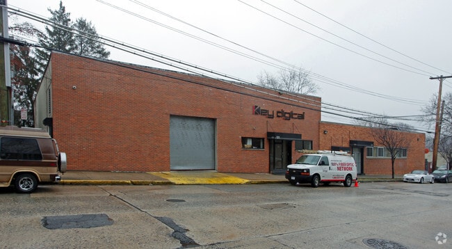
Property Record
521 E 3Rd St, Mount Vernon, NY 10553


NEARBY LISTINGS FOR SALE OR LEASE
Property Detail
521 E 3Rd St
New York-Jersey City-White Plains, NY-NJ
Map Of Vernon Park
0800-165-082-04028-000-0008
Westchester
Storesoffices
New York
X
8.000
36119C0337F
0.48 AC
2025
Southeast
2024
Westchester/So Connecticut
003400
DEMOGRAPHICS near 521 E 3Rd St
1 Mile
3 Mile
5 Mile
2024 Total Population
38,409
328,435
852,198
2029 Population
37,038
309,550
804,002
Pop Growth 2024-2029
(3.57%)
(5.75%)
(5.66%)
Average Age
40
41
40
2024 Total Households
14,023
123,798
314,653
HH Growth 2024-2029
(3.62%)
(5.87%)
(6.01%)
Median Household Inc
$85,190
$75,880
$67,098
Avg Household Size
2.60
2.50
2.60
2024 Avg HH Vehicles
1.00
1.00
1.00
Median Home Value
$475,574
$513,988
$557,102
Median Year Built
1947
1952
1951
Nearby Places
Map Layers
Map Styles
 Street
 Aerial
- Restaurants
- Banks
- Shops
- Fitness
- Groceries
PUBLIC TRANSPORTATION
TRANSIT/SUBWAY
Pelham Station (New Haven Line - Metro-North Commuter Railroad Company (Metro-North))
DRIVE
WALK
Distance
Pelham Station (New Haven Line - Metro-North Commuter Railroad Company (Metro-North))
2 min
12 min
0.6 mi
Mount Vernon East Station (New Haven Line - Metro-North Commuter Railroad Company (Metro-North))
DRIVE
WALK
Distance
Mount Vernon East Station (New Haven Line - Metro-North Commuter Railroad Company (Metro-North))
3 min
17 min
0.9 mi
COMMUTER RAIL
Pelham Station (New Haven Line - Metro-North Commuter Railroad Company (Metro-North))
DRIVE
WALK
Distance
Pelham Station (New Haven Line - Metro-North Commuter Railroad Company (Metro-North))
2 min
12 min
0.6 mi
Mount Vernon East Station (New Haven Line - Metro-North Commuter Railroad Company (Metro-North))
DRIVE
WALK
Distance
Mount Vernon East Station (New Haven Line - Metro-North Commuter Railroad Company (Metro-North))
3 min
17 min
0.9 mi
AIRPORT
LaGuardia
DRIVE
WALK
Distance
LaGuardia
25 min
13.7 mi
Westchester County
DRIVE
WALK
Distance
Westchester County
26 min
16.9 mi
John F Kennedy International
DRIVE
WALK
Distance
John F Kennedy International
31 min
21.3 mi
Freight Ports
NY - Red Hook Container Terminal
DRIVE
WALK
Distance
NY - Red Hook Container Terminal
40 min
24.2 mi
SALE & LEASE HISTORY
LISTING DATE
SALE/LEASE

Sep 08, 2021
For Sale
Oct 03, 2023
For Sale
Nearby Properties
Address
Land Use
TOTAL SIZE
Lot Size
Zoning
Address
Land Use
TOTAL SIZE
Lot Size
Zoning
18,000 SF
13.85 AC
A
Address
Land Use
TOTAL SIZE
Lot Size
Zoning
201,590 SF
4.13 AC
BA
Address
Land Use
TOTAL SIZE
Lot Size
Zoning
1,132,500 SF
62.44 AC
R6
Address
Land Use
TOTAL SIZE
Lot Size
Zoning
301,156 SF
13.94 AC
A
Address
Land Use
TOTAL SIZE
Lot Size
Zoning
70,737 SF
1.67 AC
BB
Address
Land Use
TOTAL SIZE
Lot Size
Zoning
4,000 SF
19.83 AC
BUS
Address
Land Use
TOTAL SIZE
Lot Size
Zoning
617,567 SF
3.19 AC
R7-1
Address
Land Use
TOTAL SIZE
Lot Size
Zoning
545,388 SF
29.07 AC
C4-3
Address
Land Use
TOTAL SIZE
Lot Size
Zoning
Address
Land Use
TOTAL SIZE
Lot Size
Zoning
Address
Land Use
TOTAL SIZE
Lot Size
Zoning
269,100 SF
1.63 AC
R4
Address
Land Use
TOTAL SIZE
Lot Size
Zoning
64,165 SF
3.24 AC
B
Address
Land Use
TOTAL SIZE
Lot Size
Zoning
165,529 SF
7.05 AC
RA3
Address
Land Use
TOTAL SIZE
Lot Size
Zoning
1,028,976 SF
23.03 AC
R5
Address
Land Use
TOTAL SIZE
Lot Size
Zoning
191,800 SF
13.39 AC
C4-3
Address
Land Use
TOTAL SIZE
Lot Size
Zoning
1,038,034 SF
23.41 AC
R5
Address
Land Use
TOTAL SIZE
Lot Size
Zoning
12,150 SF
482.09 AC
PARK
Address
Land Use
TOTAL SIZE
Lot Size
Zoning
5,170 SF
9.08 AC
B
Address
Land Use
TOTAL SIZE
Lot Size
Zoning
240,000 SF
6.49 AC
C4-3
Address
Land Use
TOTAL SIZE
Lot Size
Zoning
306,540 SF
11.67 AC
R5
Address
Land Use
TOTAL SIZE
Lot Size
Zoning
560 SF
61.32 AC
PARK
Address
Land Use
TOTAL SIZE
Lot Size
Zoning
336,240 SF
8.45 AC
R5
Address
Land Use
TOTAL SIZE
Lot Size
Zoning
125,143 SF
2.21 AC
R4
Address
Land Use
TOTAL SIZE
Lot Size
Zoning
219,285 SF
15.51 AC
R4
Address
Land Use
TOTAL SIZE
Lot Size
Zoning
181,092 SF
3.47 AC
R4
Address
Land Use
TOTAL SIZE
Lot Size
Zoning
103,158 SF
1.82 AC
R4
Address
Land Use
TOTAL SIZE
Lot Size
Zoning
141,156 SF
9.37 AC
C4-1
Address
Land Use
TOTAL SIZE
Lot Size
Zoning
107,473 SF
2.40 AC
R5
Address
Land Use
TOTAL SIZE
Lot Size
Zoning
Address
Land Use
TOTAL SIZE
Lot Size
Zoning
38,912 SF
19.25 AC
R4
The World's #1 Commercial Real Estate Marketplace
Connect with us
© 2025 CoStar Group
The information above has been obtained from sources believed reliable. While we do not doubt its accuracy we have not verified it and make no guarantee, warranty or representation about it. It is your responsibility to independently confirm its accuracy and completeness. Any projections, opinions, assumptions, or estimates used are for example only and do not represent the current or future performance of the property. The value of this transaction to you depends on tax and other factors which should be evaluated by your tax, financial, and legal advisors. You and your advisors should conduct a careful, independent investigation of the property to determine to your satisfaction the suitability of the property for your needs.