Property Record
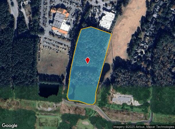
521 Fording Island Rd, Bluffton, SC 29910
NEARBY LISTINGS FOR SALE OR LEASE
Property Detail
521 Fording Island Rd
Other Market Areas
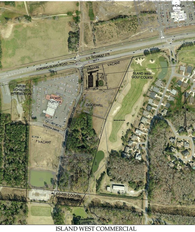
Island West Commercial
Hilton Head Island-Bluffton-Beaufort, SC
LOT B-2B ISLAND WEST COMMERCIAL TOT AC INCL 1.52 AC WETLAND PB129 P104 PB131 P10
R600-021-000-0659-0000
Beaufort
Commercialnec
South Carolina
2025
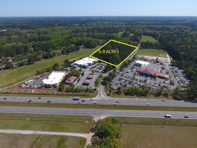
7.83 AC
2024
Hilton Head/Beaufort
002107
DEMOGRAPHICS near 521 Fording Island Rd
1 Mile
3 Mile
5 Mile
2024 Total Population
1,668
27,245
62,581
2029 Population
1,852
30,826
70,764
Pop Growth 2024-2029
+ 11.03%
+ 13.14%
+ 13.08%
Average Age
42
49
47
2024 Total Households
626
11,407
25,772
HH Growth 2024-2029
+ 10.86%
+ 13.22%
+ 13.05%
Median Household Inc
$90,858
$83,688
$78,156
Avg Household Size
2.60
2.30
2.30
2024 Avg HH Vehicles
2.00
2.00
2.00
Median Home Value
$363,559
$373,000
$364,265
Median Year Built
2007
2005
2005
Nearby Places
Map Layers
Map Styles
 Street
 Aerial
- Restaurants
- Banks
- Shops
- Fitness
- Groceries
PUBLIC TRANSPORTATION
AIRPORT
Hilton Head
DRIVE
WALK
Distance
Hilton Head
24 min
16.0 mi
Savannah/Hilton Head International
DRIVE
WALK
Distance
Savannah/Hilton Head International
41 min
29.4 mi
Freight Ports
Georgia Ports - Savannah
DRIVE
WALK
Distance
Georgia Ports - Savannah
37 min
27.8 mi
SALE & LEASE HISTORY
LISTING DATE
SALE/LEASE

Sep 24, 2016
For Sale
Apr 30, 2021
For Sale
Nearby Properties
Address
Land Use
TOTAL SIZE
Lot Size
Zoning
Address
Land Use
TOTAL SIZE
Lot Size
Zoning
359,002 SF
29.31 AC
6106
Address
Land Use
TOTAL SIZE
Lot Size
Zoning
2.61 AC
RC
Address
Land Use
TOTAL SIZE
Lot Size
Zoning
188,132 SF
10.59 AC
Address
Land Use
TOTAL SIZE
Lot Size
Zoning
90,696 SF
62.80 AC
6616
Address
Land Use
TOTAL SIZE
Lot Size
Zoning
4,536 SF
17.73 AC
6606
Address
Land Use
TOTAL SIZE
Lot Size
Zoning
61,102 SF
12.20 AC
6606
Address
Land Use
TOTAL SIZE
Lot Size
Zoning
696 SF
41.71 AC
6116
Address
Land Use
TOTAL SIZE
Lot Size
Zoning
65,304 SF
27.78 AC
6606
Address
Land Use
TOTAL SIZE
Lot Size
Zoning
67,941 SF
15.45 AC
Address
Land Use
TOTAL SIZE
Lot Size
Zoning
119,800 SF
9.37 AC
Address
Land Use
TOTAL SIZE
Lot Size
Zoning
Address
Land Use
TOTAL SIZE
Lot Size
Zoning
7.22 AC
Address
Land Use
TOTAL SIZE
Lot Size
Zoning
40,847 SF
3.79 AC
Address
Land Use
TOTAL SIZE
Lot Size
Zoning
81,625 SF
5.43 AC
Address
Land Use
TOTAL SIZE
Lot Size
Zoning
30,305 SF
0.93 AC
Address
Land Use
TOTAL SIZE
Lot Size
Zoning
54,614 SF
142.72 AC
6616
Address
Land Use
TOTAL SIZE
Lot Size
Zoning
38,694 SF
9.56 AC
Address
Land Use
TOTAL SIZE
Lot Size
Zoning
29,549 SF
17.88 AC
6106
Address
Land Use
TOTAL SIZE
Lot Size
Zoning
89,537 SF
12.29 AC
Address
Land Use
TOTAL SIZE
Lot Size
Zoning
79,616 SF
23.51 AC
6616
Address
Land Use
TOTAL SIZE
Lot Size
Zoning
76,410 SF
27.89 AC
6616
Address
Land Use
TOTAL SIZE
Lot Size
Zoning
65,592 SF
3.33 AC
6606
Address
Land Use
TOTAL SIZE
Lot Size
Zoning
65,544 SF
3.43 AC
Address
Land Use
TOTAL SIZE
Lot Size
Zoning
43,031 SF
5.92 AC
6606
Address
Land Use
TOTAL SIZE
Lot Size
Zoning
53,860 SF
3.49 AC
Address
Land Use
TOTAL SIZE
Lot Size
Zoning
17,304 SF
28.46 AC
6816
Address
Land Use
TOTAL SIZE
Lot Size
Zoning
2,925 SF
563.49 AC
6816
Address
Land Use
TOTAL SIZE
Lot Size
Zoning
840 SF
3.48 AC
RC
Address
Land Use
TOTAL SIZE
Lot Size
Zoning
21,600 SF
2.37 AC
6616
The World's #1 Commercial Real Estate Marketplace
Connect with us
© 2025 CoStar Group
The information above has been obtained from sources believed reliable. While we do not doubt its accuracy we have not verified it and make no guarantee, warranty or representation about it. It is your responsibility to independently confirm its accuracy and completeness. Any projections, opinions, assumptions, or estimates used are for example only and do not represent the current or future performance of the property. The value of this transaction to you depends on tax and other factors which should be evaluated by your tax, financial, and legal advisors. You and your advisors should conduct a careful, independent investigation of the property to determine to your satisfaction the suitability of the property for your needs.