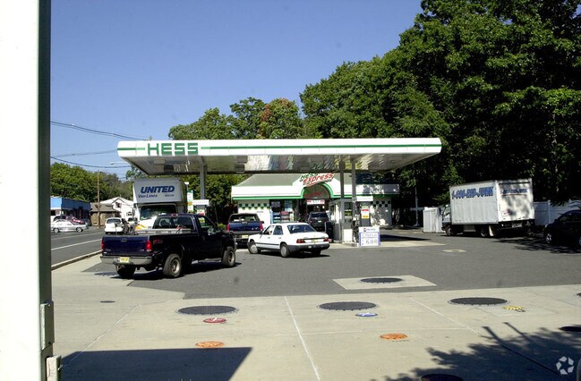
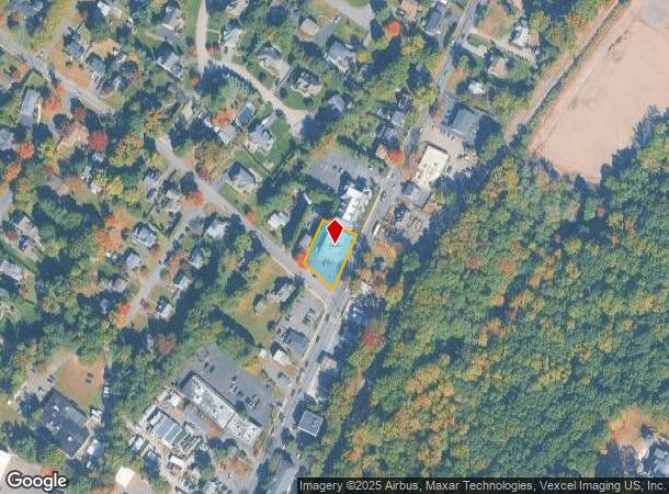
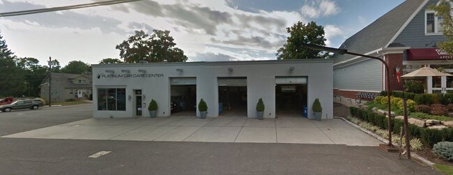
Property Record
521 Goffle Rd, Wyckoff, NJ 07481

NEARBY LISTINGS FOR SALE OR LEASE
Property Detail
521 Goffle Rd
New York-Jersey City-White Plains, NY-NJ
Franklin Terrace
70-00498-0000-00100-01
141X102
Commercialnec
Bergen
X
New Jersey
34003C0157J
100.1
2024
0.33 AC
2025
Western Bergen
061400
Northern New Jersey
DEMOGRAPHICS near 521 Goffle Rd
1 Mile
3 Mile
5 Mile
2024 Total Population
12,799
118,360
354,916
2029 Population
12,619
116,628
347,214
Pop Growth 2024-2029
(1.41%)
(1.46%)
(2.17%)
Average Age
41
41
40
2024 Total Households
4,610
40,860
118,796
HH Growth 2024-2029
(1.65%)
(1.64%)
(2.23%)
Median Household Inc
$137,056
$134,885
$94,111
Avg Household Size
2.80
2.80
2.90
2024 Avg HH Vehicles
2.00
2.00
2.00
Median Home Value
$692,371
$676,682
$605,288
Median Year Built
1955
1954
1956
Nearby Places
Map Layers
Map Styles
 Street
 Aerial
- Restaurants
- Banks
- Shops
- Fitness
- Groceries
PUBLIC TRANSPORTATION
COMMUTER RAIL
Glen Rock Main Line (Main/Port Jervis Line - NJ Transit Commuter Rail (NJ Transit))
DRIVE
WALK
Distance
Glen Rock Main Line (Main/Port Jervis Line - NJ Transit Commuter Rail (NJ Transit))
4 min
1.5 mi
Glen Rock Boro Hall (Bergen County/Port Jervis Line - NJ Transit Commuter Rail (NJ Transit))
DRIVE
WALK
Distance
Glen Rock Boro Hall (Bergen County/Port Jervis Line - NJ Transit Commuter Rail (NJ Transit))
5 min
1.8 mi
AIRPORT
LaGuardia
DRIVE
WALK
Distance
LaGuardia
38 min
25.7 mi
Newark Liberty International
DRIVE
WALK
Distance
Newark Liberty International
32 min
26.0 mi
Westchester County
DRIVE
WALK
Distance
Westchester County
58 min
37.5 mi
Freight Ports
Port Newark Container Terminal
DRIVE
WALK
Distance
Port Newark Container Terminal
37 min
25.0 mi
Nearby Properties
Address
Land Use
TOTAL SIZE
Lot Size
Zoning
Address
Land Use
TOTAL SIZE
Lot Size
Zoning
15.57 AC
H
Address
Land Use
TOTAL SIZE
Lot Size
Zoning
2,252 SF
19.04 AC
Address
Land Use
TOTAL SIZE
Lot Size
Zoning
61.98 AC
Address
Land Use
TOTAL SIZE
Lot Size
Zoning
9.96 AC
MU
Address
Land Use
TOTAL SIZE
Lot Size
Zoning
57,680 SF
20.01 AC
CR
Address
Land Use
TOTAL SIZE
Lot Size
Zoning
80.80 AC
Address
Land Use
TOTAL SIZE
Lot Size
Zoning
23.19 AC
R1
Address
Land Use
TOTAL SIZE
Lot Size
Zoning
Address
Land Use
TOTAL SIZE
Lot Size
Zoning
19.20 AC
Address
Land Use
TOTAL SIZE
Lot Size
Zoning
824,024 SF
39.71 AC
I1
Address
Land Use
TOTAL SIZE
Lot Size
Zoning
20.30 AC
Address
Land Use
TOTAL SIZE
Lot Size
Zoning
90.48 AC
Address
Land Use
TOTAL SIZE
Lot Size
Zoning
3,165 SF
2.07 AC
VC2
Address
Land Use
TOTAL SIZE
Lot Size
Zoning
Address
Land Use
TOTAL SIZE
Lot Size
Zoning
5.88 AC
Address
Land Use
TOTAL SIZE
Lot Size
Zoning
9.58 AC
R125
Address
Land Use
TOTAL SIZE
Lot Size
Zoning
27.25 AC
Address
Land Use
TOTAL SIZE
Lot Size
Zoning
12.69 AC
A40
Address
Land Use
TOTAL SIZE
Lot Size
Zoning
Address
Land Use
TOTAL SIZE
Lot Size
Zoning
2.67 AC
AH2
Address
Land Use
TOTAL SIZE
Lot Size
Zoning
3.63 AC
Address
Land Use
TOTAL SIZE
Lot Size
Zoning
6.11 AC
OB1
Address
Land Use
TOTAL SIZE
Lot Size
Zoning
21.82 AC
Address
Land Use
TOTAL SIZE
Lot Size
Zoning
11.89 AC
Address
Land Use
TOTAL SIZE
Lot Size
Zoning
3.58 AC
Address
Land Use
TOTAL SIZE
Lot Size
Zoning
9.23 AC
Address
Land Use
TOTAL SIZE
Lot Size
Zoning
150,790 SF
10.30 AC
I1
Address
Land Use
TOTAL SIZE
Lot Size
Zoning
2 AC
R110
Address
Land Use
TOTAL SIZE
Lot Size
Zoning
13.39 AC
R2
Address
Land Use
TOTAL SIZE
Lot Size
Zoning
The World's #1 Commercial Real Estate Marketplace
Connect with us
© 2025 CoStar Group
The information above has been obtained from sources believed reliable. While we do not doubt its accuracy we have not verified it and make no guarantee, warranty or representation about it. It is your responsibility to independently confirm its accuracy and completeness. Any projections, opinions, assumptions, or estimates used are for example only and do not represent the current or future performance of the property. The value of this transaction to you depends on tax and other factors which should be evaluated by your tax, financial, and legal advisors. You and your advisors should conduct a careful, independent investigation of the property to determine to your satisfaction the suitability of the property for your needs.