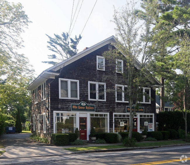
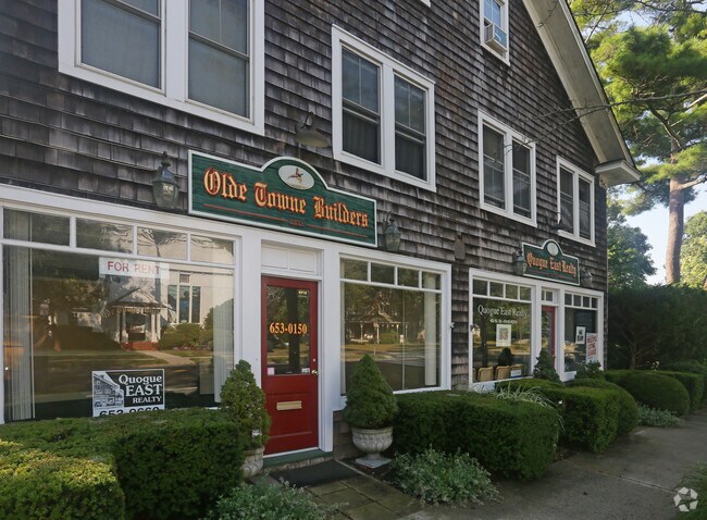
Property Record
521 Montauk Hwy, East Quogue, NY 11942
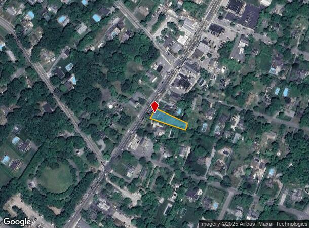
NEARBY LISTINGS FOR SALE OR LEASE
Property Detail
521 Montauk Hwy
0900-341-00-01-00-050-000
88 LD EQ +3035
Commercialnec
Suffolk
X
New York
36103C0779H
50
2024
0.25 AC
2024
Eastern Suffolk
123703
Long Island (New York)
3,600 SF
Nassau County-Suffolk County, NY
DEMOGRAPHICS near 521 Montauk Hwy
1 Mile
3 Mile
5 Mile
2024 Total Population
2,663
11,776
35,555
2029 Population
2,684
11,992
36,747
Pop Growth 2024-2029
+ 0.79%
+ 1.83%
+ 3.35%
Average Age
43
43
43
2024 Total Households
1,034
4,547
13,223
HH Growth 2024-2029
+ 0.58%
+ 1.67%
+ 3.43%
Median Household Inc
$89,661
$96,811
$109,825
Avg Household Size
2.50
2.60
2.60
2024 Avg HH Vehicles
2.00
2.00
2.00
Median Home Value
$762,477
$759,827
$746,856
Median Year Built
1973
1977
1975
Nearby Places
- Restaurants
- Banks
- Shops
- Fitness
- Groceries
PUBLIC TRANSPORTATION
COMMUTER RAIL
Hampton Bays Station (Montauk Branch - Long Island Rail Road)
DRIVE
WALK
Distance
Hampton Bays Station (Montauk Branch - Long Island Rail Road)
7 min
4.3 mi
Westhampton Station (Montauk Branch - Long Island Rail Road)
DRIVE
WALK
Distance
Westhampton Station (Montauk Branch - Long Island Rail Road)
8 min
5.1 mi
AIRPORT
Long Island MacArthur
DRIVE
WALK
Distance
Long Island MacArthur
47 min
31.0 mi
Freight Ports
Port of New Haven
DRIVE
WALK
Distance
Port of New Haven
159 min
67.3 mi
Nearby Properties
Address
Land Use
TOTAL SIZE
Lot Size
Zoning
Address
Land Use
TOTAL SIZE
Lot Size
Zoning
11,129 SF
2.40 AC
R80
Address
Land Use
TOTAL SIZE
Lot Size
Zoning
9,191 SF
14.39 AC
VILLA
Address
Land Use
TOTAL SIZE
Lot Size
Zoning
6.28 AC
R80
Address
Land Use
TOTAL SIZE
Lot Size
Zoning
26.76 AC
CR200
Address
Land Use
TOTAL SIZE
Lot Size
Zoning
2,947 SF
8.59 AC
VILLA
Address
Land Use
TOTAL SIZE
Lot Size
Zoning
12,001 SF
2.80 AC
VILLA
Address
Land Use
TOTAL SIZE
Lot Size
Zoning
9,952 SF
2.30 AC
VILLA
Address
Land Use
TOTAL SIZE
Lot Size
Zoning
17,772 SF
8.86 AC
VILLA
Address
Land Use
TOTAL SIZE
Lot Size
Zoning
22,629 SF
2.10 AC
VILLA
Address
Land Use
TOTAL SIZE
Lot Size
Zoning
13.88 AC
CR200
Address
Land Use
TOTAL SIZE
Lot Size
Zoning
8,418 SF
2.40 AC
R80
Address
Land Use
TOTAL SIZE
Lot Size
Zoning
2.04 AC
VILLA
Address
Land Use
TOTAL SIZE
Lot Size
Zoning
9.30 AC
R80
Address
Land Use
TOTAL SIZE
Lot Size
Zoning
12.90 AC
R80
Address
Land Use
TOTAL SIZE
Lot Size
Zoning
24,396 SF
7.60 AC
R80
Address
Land Use
TOTAL SIZE
Lot Size
Zoning
30,124 SF
10.20 AC
R20
Address
Land Use
TOTAL SIZE
Lot Size
Zoning
6,673 SF
4.50 AC
R20
Address
Land Use
TOTAL SIZE
Lot Size
Zoning
19,866 SF
14.37 AC
LI200
Address
Land Use
TOTAL SIZE
Lot Size
Zoning
3.76 AC
R80
Address
Land Use
TOTAL SIZE
Lot Size
Zoning
6,720 SF
1.96 AC
VILLA
Address
Land Use
TOTAL SIZE
Lot Size
Zoning
1,792 SF
59.30 AC
RTPDD
Address
Land Use
TOTAL SIZE
Lot Size
Zoning
67,796 SF
7 AC
SCB
Address
Land Use
TOTAL SIZE
Lot Size
Zoning
2.10 AC
VILLA
Address
Land Use
TOTAL SIZE
Lot Size
Zoning
8,238 SF
1.40 AC
VILLA
Address
Land Use
TOTAL SIZE
Lot Size
Zoning
150 SF
22.20 AC
R40
Address
Land Use
TOTAL SIZE
Lot Size
Zoning
1.34 AC
R80
Address
Land Use
TOTAL SIZE
Lot Size
Zoning
6,406 SF
0.74 AC
VILLA
Address
Land Use
TOTAL SIZE
Lot Size
Zoning
13,420 SF
2.05 AC
VILLA
Address
Land Use
TOTAL SIZE
Lot Size
Zoning
3,846 SF
1.40 AC
VILLA
Address
Land Use
TOTAL SIZE
Lot Size
Zoning
5.39 AC
VILLA
The World's #1 Commercial Real Estate Marketplace
Connect with us
© 2025 CoStar Group
The information above has been obtained from sources believed reliable. While we do not doubt its accuracy we have not verified it and make no guarantee, warranty or representation about it. It is your responsibility to independently confirm its accuracy and completeness. Any projections, opinions, assumptions, or estimates used are for example only and do not represent the current or future performance of the property. The value of this transaction to you depends on tax and other factors which should be evaluated by your tax, financial, and legal advisors. You and your advisors should conduct a careful, independent investigation of the property to determine to your satisfaction the suitability of the property for your needs.