Property Record
521 Ron Rd, Marion, TX 78124
This Property Is For Sale
NEARBY LISTINGS FOR SALE OR LEASE
Property Detail
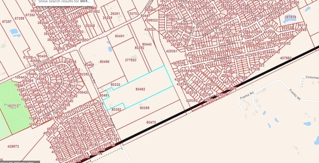
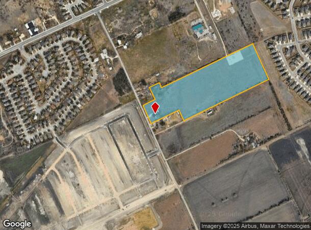
521 Ron Rd
San Antonio-New Braunfels, TX
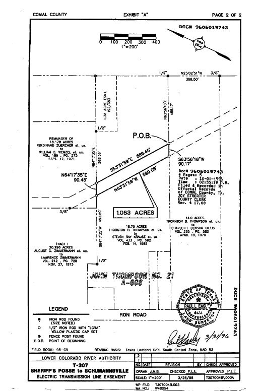
A-608 Sur- 21 J Thompson
76-0608-0530-00
Comal
Mobilemanufacturedhomeregardlessoflandownership
Texas
X
18.56 AC
48091C0445F
Comal County
1,792 SF
San Antonio
DEMOGRAPHICS near 521 Ron Rd
1 Mile
3 Mile
5 Mile
2024 Total Population
5,007
44,993
88,968
2029 Population
6,932
58,362
115,754
Pop Growth 2024-2029
+ 38.45%
+ 29.71%
+ 30.11%
Average Age
34
36
38
2024 Total Households
1,648
15,808
32,787
HH Growth 2024-2029
+ 38.17%
+ 29.98%
+ 30.66%
Median Household Inc
$82,767
$82,561
$83,846
Avg Household Size
3.00
2.80
2.60
2024 Avg HH Vehicles
2.00
2.00
2.00
Median Home Value
$259,792
$254,700
$278,642
Median Year Built
2009
2003
2001
Nearby Places
- Restaurants
- Banks
- Shops
- Fitness
- Groceries
PUBLIC TRANSPORTATION
AIRPORT
San Antonio International
DRIVE
WALK
Distance
San Antonio International
31 min
24.0 mi
Freight Ports
Calhoun Port
DRIVE
WALK
Distance
Calhoun Port
175 min
145.8 mi
Nearby Properties
Address
Land Use
TOTAL SIZE
Lot Size
Zoning
Address
Land Use
TOTAL SIZE
Lot Size
Zoning
331,725 SF
106.42 AC
Address
Land Use
TOTAL SIZE
Lot Size
Zoning
234,823 SF
72.17 AC
Address
Land Use
TOTAL SIZE
Lot Size
Zoning
Address
Land Use
TOTAL SIZE
Lot Size
Zoning
135,975 SF
39.25 AC
Address
Land Use
TOTAL SIZE
Lot Size
Zoning
397,600 SF
25.95 AC
Address
Land Use
TOTAL SIZE
Lot Size
Zoning
132,319 SF
8.80 AC
Address
Land Use
TOTAL SIZE
Lot Size
Zoning
97,200 SF
12.87 AC
Address
Land Use
TOTAL SIZE
Lot Size
Zoning
198,793 SF
9.38 AC
Address
Land Use
TOTAL SIZE
Lot Size
Zoning
130,210 SF
13.57 AC
Address
Land Use
TOTAL SIZE
Lot Size
Zoning
205,071 SF
23.66 AC
Address
Land Use
TOTAL SIZE
Lot Size
Zoning
156,335 SF
9.94 AC
Address
Land Use
TOTAL SIZE
Lot Size
Zoning
102,000 SF
8.26 AC
Address
Land Use
TOTAL SIZE
Lot Size
Zoning
Address
Land Use
TOTAL SIZE
Lot Size
Zoning
52,898 SF
39.39 AC
Address
Land Use
TOTAL SIZE
Lot Size
Zoning
3,372 SF
76.62 AC
Address
Land Use
TOTAL SIZE
Lot Size
Zoning
969.31 AC
Address
Land Use
TOTAL SIZE
Lot Size
Zoning
79,573 SF
4 AC
Address
Land Use
TOTAL SIZE
Lot Size
Zoning
55,492 SF
6.13 AC
Address
Land Use
TOTAL SIZE
Lot Size
Zoning
137,524 SF
15.34 AC
Address
Land Use
TOTAL SIZE
Lot Size
Zoning
77,487 SF
9 AC
Address
Land Use
TOTAL SIZE
Lot Size
Zoning
92,496 SF
6.91 AC
Address
Land Use
TOTAL SIZE
Lot Size
Zoning
52,722 SF
11.76 AC
Address
Land Use
TOTAL SIZE
Lot Size
Zoning
141,551 SF
16 AC
Address
Land Use
TOTAL SIZE
Lot Size
Zoning
Address
Land Use
TOTAL SIZE
Lot Size
Zoning
5,000 SF
30.89 AC
Address
Land Use
TOTAL SIZE
Lot Size
Zoning
78,677 SF
21.12 AC
Address
Land Use
TOTAL SIZE
Lot Size
Zoning
47,846 SF
3.47 AC
Address
Land Use
TOTAL SIZE
Lot Size
Zoning
55,764 SF
4.52 AC
Address
Land Use
TOTAL SIZE
Lot Size
Zoning
49,227 SF
15.82 AC
Address
Land Use
TOTAL SIZE
Lot Size
Zoning
52,547 SF
14.34 AC
The World's #1 Commercial Real Estate Marketplace
Connect with us
© 2025 CoStar Group
The information above has been obtained from sources believed reliable. While we do not doubt its accuracy we have not verified it and make no guarantee, warranty or representation about it. It is your responsibility to independently confirm its accuracy and completeness. Any projections, opinions, assumptions, or estimates used are for example only and do not represent the current or future performance of the property. The value of this transaction to you depends on tax and other factors which should be evaluated by your tax, financial, and legal advisors. You and your advisors should conduct a careful, independent investigation of the property to determine to your satisfaction the suitability of the property for your needs.