Property Record
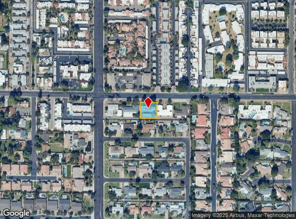
521 W Maryland Ave, Phoenix, AZ 85013


This Property Is For Sale
NEARBY LISTINGS FOR SALE OR LEASE
Property Detail
521 W Maryland Ave
Phoenix-Mesa-Scottsdale, AZ
Ambassador Ests
161-31-003
AMBASSADOR ESTS MCR 61/14
Multifamilydwelling
Maricopa
X
Arizona
04013C1740L
3
2025
0.28 AC
2025
North Phoenix
106600
Phoenix
2,884 SF
DEMOGRAPHICS near 521 W Maryland Ave
1 Mile
3 Mile
5 Mile
2024 Total Population
15,678
199,222
436,234
2029 Population
16,280
207,291
453,459
Pop Growth 2024-2029
+ 3.84%
+ 4.05%
+ 3.95%
Average Age
41
37
37
2024 Total Households
6,512
81,461
174,470
HH Growth 2024-2029
+ 3.76%
+ 4.29%
+ 4.25%
Median Household Inc
$90,711
$68,217
$68,667
Avg Household Size
2.30
2.30
2.40
2024 Avg HH Vehicles
2.00
2.00
2.00
Median Home Value
$724,315
$482,989
$444,900
Median Year Built
1970
1972
1973
Nearby Places
- Restaurants
- Banks
- Shops
- Fitness
- Groceries
PUBLIC TRANSPORTATION
AIRPORT
Phoenix Sky Harbor International
DRIVE
WALK
Distance
Phoenix Sky Harbor International
19 min
11.2 mi
Phoenix-Mesa Gateway
DRIVE
WALK
Distance
Phoenix-Mesa Gateway
52 min
38.0 mi
Freight Ports
Port of San Diego
DRIVE
WALK
Distance
Port of San Diego
402 min
359.0 mi
Nearby Properties
Address
Land Use
TOTAL SIZE
Lot Size
Zoning
Address
Land Use
TOTAL SIZE
Lot Size
Zoning
96,183 SF
11.04 AC
R-6
Address
Land Use
TOTAL SIZE
Lot Size
Zoning
63,018 SF
4.77 AC
C-T
Address
Land Use
TOTAL SIZE
Lot Size
Zoning
913,637 SF
35.53 AC
M-H
Address
Land Use
TOTAL SIZE
Lot Size
Zoning
21,587 SF
3.66 AC
R-10
Address
Land Use
TOTAL SIZE
Lot Size
Zoning
956,022 SF
14.86 AC
Address
Land Use
TOTAL SIZE
Lot Size
Zoning
558,361 SF
14.61 AC
C-2
Address
Land Use
TOTAL SIZE
Lot Size
Zoning
367,399 SF
14.88 AC
C-1
Address
Land Use
TOTAL SIZE
Lot Size
Zoning
496,222 SF
29.53 AC
C-R
Address
Land Use
TOTAL SIZE
Lot Size
Zoning
423,681 SF
8.29 AC
Address
Land Use
TOTAL SIZE
Lot Size
Zoning
515,418 SF
19.72 AC
R-3
Address
Land Use
TOTAL SIZE
Lot Size
Zoning
474,952 SF
13.68 AC
C-C
Address
Land Use
TOTAL SIZE
Lot Size
Zoning
536,856 SF
20.27 AC
PSC
Address
Land Use
TOTAL SIZE
Lot Size
Zoning
5.67 AC
Address
Land Use
TOTAL SIZE
Lot Size
Zoning
51,836 SF
43.32 AC
RE35
Address
Land Use
TOTAL SIZE
Lot Size
Zoning
7,665 SF
1.29 AC
C-T
Address
Land Use
TOTAL SIZE
Lot Size
Zoning
430,586 SF
15.85 AC
R16
Address
Land Use
TOTAL SIZE
Lot Size
Zoning
595,514 SF
4.08 AC
C-C
Address
Land Use
TOTAL SIZE
Lot Size
Zoning
299,513 SF
43.10 AC
M-H
Address
Land Use
TOTAL SIZE
Lot Size
Zoning
401,203 SF
7.25 AC
C2
Address
Land Use
TOTAL SIZE
Lot Size
Zoning
146,867 SF
12.95 AC
CPGCP
Address
Land Use
TOTAL SIZE
Lot Size
Zoning
2.90 AC
M-M
Address
Land Use
TOTAL SIZE
Lot Size
Zoning
294,674 SF
20.64 AC
M-H
Address
Land Use
TOTAL SIZE
Lot Size
Zoning
364,236 SF
2.99 AC
WU
Address
Land Use
TOTAL SIZE
Lot Size
Zoning
369,277 SF
3.31 AC
PAD
Address
Land Use
TOTAL SIZE
Lot Size
Zoning
194,523 SF
37.27 AC
R-6
Address
Land Use
TOTAL SIZE
Lot Size
Zoning
314,171 SF
3.83 AC
C-T
Address
Land Use
TOTAL SIZE
Lot Size
Zoning
394,793 SF
3.60 AC
PUD
Address
Land Use
TOTAL SIZE
Lot Size
Zoning
36,324 SF
9.40 AC
R-35
Address
Land Use
TOTAL SIZE
Lot Size
Zoning
540,839 SF
8.28 AC
M-H
Address
Land Use
TOTAL SIZE
Lot Size
Zoning
291,437 SF
5.12 AC
M-H
The World's #1 Commercial Real Estate Marketplace
Connect with us
© 2025 CoStar Group
The information above has been obtained from sources believed reliable. While we do not doubt its accuracy we have not verified it and make no guarantee, warranty or representation about it. It is your responsibility to independently confirm its accuracy and completeness. Any projections, opinions, assumptions, or estimates used are for example only and do not represent the current or future performance of the property. The value of this transaction to you depends on tax and other factors which should be evaluated by your tax, financial, and legal advisors. You and your advisors should conduct a careful, independent investigation of the property to determine to your satisfaction the suitability of the property for your needs.