Property Record
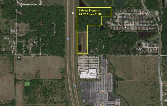
5210 29Th St E, Ellenton, FL 34222
Property Detail
5210 29Th St E
8137-0000-2
SW1/4 OF NE1/4 OF NW1/4 OF SEC 9, LESS STRIP OF LAND ALG THE S SIDE AMOUNTING TO .67 AC SOLD TO TAMPA SOUTHERN RR FOR RR R/W (NOW FPL CO); ALSO LESS PARCEL CONVEYED TO DOT IN OR 887
Commercialacreage
MANATEE
PD-MU
Florida
B and X Area of moderate flood hazard, usually the area between the limits of the 100-year and 500-year floods.
4.97 AC
2023
Manatee
2025
Tampa/St Petersburg
001908
North Port-Bradenton-Sarasota, FL
NEARBY LISTINGS FOR SALE OR LEASE
DEMOGRAPHICS near 5210 29Th St E
1 mile
3 mile
5 mile
2025 Total Population
6,277
47,670
131,348
2030 Population
7,029
53,530
148,325
Pop Growth 2025-2030
+ 11.98%
+ 12.29%
+ 12.93%
Average Age
43
46
45
2025 Total Households
2,474
19,819
53,090
HH Growth 2025-2030
+ 12.29%
+ 12.56%
+ 13.22%
Median Household Inc
$82,826
$82,838
$79,158
Avg Household Size
2.50
2.40
2.40
2025 Avg HH Vehicles
2.00
2.00
2.00
Median Home Value
$342,570
$373,868
$381,503
Median Year Built
2005
2001
2001
Nearby Places
Map Layers
Map Styles
 Street
 Aerial
Transit
 Traffic
 Biking
Places
Listings with unknown addresses are not visible on the map
- Restaurants
- Banks
- Shops
- Fitness
- Groceries
PUBLIC TRANSPORTATION
AIRPORT
Sarasota/Bradenton International
Drive
Walk
Distance
Sarasota/Bradenton International
32 min
19.7 mi
St Pete-Clearwater International
Drive
Walk
Distance
St Pete-Clearwater International
50 min
36.2 mi
Freight Ports
Port Manatee
Drive
Walk
Distance
Port Manatee
15 min
8.9 mi
SALE & LEASE HISTORY
LISTING DATE
SALE/LEASE

Sep 24, 2016
For Sale
Nov 02, 2020
For Sale
Jun 19, 2017
For Sale
Jul 10, 2019
For Sale
Aug 06, 2021
For Sale
Nearby Properties
Address
Land Use
TOTAL SIZE
Lot Size
Zoning
Address
Land Use
TOTAL SIZE
Lot Size
Zoning
622,266 SF
68.76 AC
PD-MU
Address
Land Use
TOTAL SIZE
Lot Size
Zoning
881,490 SF
83.09 AC
BR_R-3
Address
Land Use
TOTAL SIZE
Lot Size
Zoning
359,241 SF
27.68 AC
PD-MU
Address
Land Use
TOTAL SIZE
Lot Size
Zoning
294,300 SF
10.33 AC
PD-MU
Address
Land Use
TOTAL SIZE
Lot Size
Zoning
319,679 SF
31.78 AC
BR_R-1
Address
Land Use
TOTAL SIZE
Lot Size
Zoning
427,250 SF
38.18 AC
A-1 SUBURB
Address
Land Use
TOTAL SIZE
Lot Size
Zoning
30,717 SF
79.79 AC
A-1 SUBURB
Address
Land Use
TOTAL SIZE
Lot Size
Zoning
225,768 SF
18.47 AC
BR_R-1
Address
Land Use
TOTAL SIZE
Lot Size
Zoning
313,422 SF
47.93 AC
PD-C
Address
Land Use
TOTAL SIZE
Lot Size
Zoning
456,375 SF
112.07 AC
PD-MU
Address
Land Use
TOTAL SIZE
Lot Size
Zoning
885,776 SF
46.22 AC
LM LIGHT M
Address
Land Use
TOTAL SIZE
Lot Size
Zoning
270,900 SF
44.35 AC
PD-MU
Address
Land Use
TOTAL SIZE
Lot Size
Zoning
608,665 SF
30 AC
PD-MU
Address
Land Use
TOTAL SIZE
Lot Size
Zoning
456,317 SF
46.75 AC
PD-R
Address
Land Use
TOTAL SIZE
Lot Size
Zoning
276,469 SF
10.90 AC
PD-MU
Address
Land Use
TOTAL SIZE
Lot Size
Zoning
312,546 SF
39.60 AC
A-1 SUBURB
Address
Land Use
TOTAL SIZE
Lot Size
Zoning
191,100 SF
30.35 AC
PD-C
Address
Land Use
TOTAL SIZE
Lot Size
Zoning
171,461 SF
7.56 AC
PL_CHI
Address
Land Use
TOTAL SIZE
Lot Size
Zoning
185,272 SF
18.11 AC
PD-R
Address
Land Use
TOTAL SIZE
Lot Size
Zoning
357,639 SF
33.13 AC
PD-MU
Address
Land Use
TOTAL SIZE
Lot Size
Zoning
74,968 SF
10.71 AC
PD-R
Address
Land Use
TOTAL SIZE
Lot Size
Zoning
61,770 SF
79.85 AC
A,A-1
Address
Land Use
TOTAL SIZE
Lot Size
Zoning
56.39 AC
Address
Land Use
TOTAL SIZE
Lot Size
Zoning
59,222 SF
4.49 AC
PD-C
Address
Land Use
TOTAL SIZE
Lot Size
Zoning
93,750 SF
9.75 AC
PL_CHI
Address
Land Use
TOTAL SIZE
Lot Size
Zoning
33.49 AC
Address
Land Use
TOTAL SIZE
Lot Size
Zoning
56,442 SF
6.18 AC
GC GENERA
Address
Land Use
TOTAL SIZE
Lot Size
Zoning
107.99 AC
Address
Land Use
TOTAL SIZE
Lot Size
Zoning
138,258 SF
9.59 AC
PD-MU
Address
Land Use
TOTAL SIZE
Lot Size
Zoning
61,721 SF
5.50 AC
PD-C
The World's #1 Commercial Real Estate Marketplace
Connect with us
© 2026 CoStar Group
The information above has been obtained from sources believed reliable. While we do not doubt its accuracy we have not verified it and make no guarantee, warranty or representation about it. It is your responsibility to independently confirm its accuracy and completeness. Any projections, opinions, assumptions, or estimates used are for example only and do not represent the current or future performance of the property. The value of this transaction to you depends on tax and other factors which should be evaluated by your tax, financial, and legal advisors. You and your advisors should conduct a careful, independent investigation of the property to determine to your satisfaction the suitability of the property for your needs.