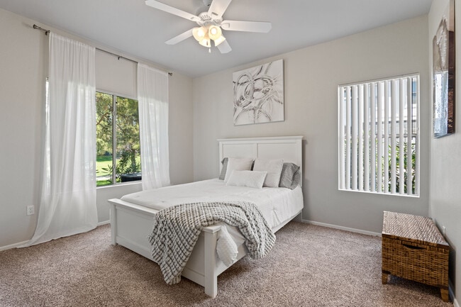
Property Record
5210 E Hampton Ave, Mesa, AZ 85206
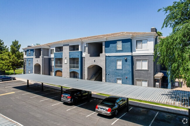


Property Detail
5210 E Hampton Ave
141-53-038E
TH PT NW4 SEC 35 DAF COM NW COR SD SEC TH S 1309.18F TH E 33F TPOB TH N 455.08F TH E 650.07F TH N 804.59F TH E 636.75F TH S 1276.17F TH WLY 100F TH N 84D 42M W 104.11F TH WLY 103.49F TH W 663.47F TH W LY 111.70F TH S 88D 12M W 104.28F TH WLY 100F TO
Apartment
Maricopa
M-H
Arizona
C and X Area of minimal flood hazard, usually depicted on FIRMs as above the 500-year flood level.
23.71 AC
2025
Superstition Springs
2025
Phoenix
422638
Phoenix-Mesa-Chandler, AZ
425,158 SF
NEARBY LISTINGS FOR SALE OR LEASE
DEMOGRAPHICS near 5210 E Hampton Ave
1 mile
3 mile
5 mile
2025 Total Population
13,072
124,327
328,941
2030 Population
13,622
129,090
342,081
Pop Growth 2025-2030
+ 4.21%
+ 3.83%
+ 3.99%
Average Age
44
44
42
2025 Total Households
5,361
51,408
127,896
HH Growth 2025-2030
+ 4.50%
+ 4.27%
+ 4.36%
Median Household Inc
$80,520
$77,809
$82,941
Avg Household Size
2.30
2.30
2.50
2025 Avg HH Vehicles
2.00
2.00
2.00
Median Home Value
$419,062
$394,899
$409,240
Median Year Built
1991
1989
1990
Nearby Places
Map Layers
Map Styles
 Street
 Aerial
Layers
 Traffic
 Biking
Places
Listings with unknown addresses are not visible on the map
- Restaurants
- Banks
- Shops
- Fitness
- Groceries
PUBLIC TRANSPORTATION
AIRPORT
Phoenix-Mesa Gateway
Drive
Walk
Distance
Phoenix-Mesa Gateway
16 min
9.0 mi
Phoenix Sky Harbor International
Drive
Walk
Distance
Phoenix Sky Harbor International
29 min
20.7 mi
Freight Ports
Port of San Diego
Drive
Walk
Distance
Port of San Diego
416 min
379.0 mi
Nearby Properties
Address
Land Use
TOTAL SIZE
Lot Size
Zoning
Address
Land Use
TOTAL SIZE
Lot Size
Zoning
1,522,034 SF
32.67 AC
C-N
Address
Land Use
TOTAL SIZE
Lot Size
Zoning
981,158 SF
43.42 AC
C-G
Address
Land Use
TOTAL SIZE
Lot Size
Zoning
403,171 SF
34.53 AC
PF
Address
Land Use
TOTAL SIZE
Lot Size
Zoning
441,928 SF
17.31 AC
RM3
Address
Land Use
TOTAL SIZE
Lot Size
Zoning
461,845 SF
21.62 AC
LI
Address
Land Use
TOTAL SIZE
Lot Size
Zoning
185,382 SF
23.37 AC
C-G
Address
Land Use
TOTAL SIZE
Lot Size
Zoning
18.75 AC
PF
Address
Land Use
TOTAL SIZE
Lot Size
Zoning
711,933 SF
45.84 AC
Address
Land Use
TOTAL SIZE
Lot Size
Zoning
63,507 SF
83.58 AC
PF
Address
Land Use
TOTAL SIZE
Lot Size
Zoning
142,871 SF
40.83 AC
PF
Address
Land Use
TOTAL SIZE
Lot Size
Zoning
129,201 SF
24.65 AC
LI
Address
Land Use
TOTAL SIZE
Lot Size
Zoning
160,296 SF
33.63 AC
PF
Address
Land Use
TOTAL SIZE
Lot Size
Zoning
269,763 SF
17.49 AC
M-H
Address
Land Use
TOTAL SIZE
Lot Size
Zoning
344,619 SF
13.85 AC
M-H
Address
Land Use
TOTAL SIZE
Lot Size
Zoning
100,580 SF
22.70 AC
C-G
Address
Land Use
TOTAL SIZE
Lot Size
Zoning
98,852 SF
1.23 AC
C-G
Address
Land Use
TOTAL SIZE
Lot Size
Zoning
224,633 SF
13.55 AC
M-M
Address
Land Use
TOTAL SIZE
Lot Size
Zoning
223,174 SF
11.32 AC
M-M
Address
Land Use
TOTAL SIZE
Lot Size
Zoning
233,188 SF
7.34 AC
RM4
Address
Land Use
TOTAL SIZE
Lot Size
Zoning
307,545 SF
17.61 AC
M-H
Address
Land Use
TOTAL SIZE
Lot Size
Zoning
208,046 SF
23.54 AC
I-1
Address
Land Use
TOTAL SIZE
Lot Size
Zoning
219,041 SF
5.71 AC
I-1
Address
Land Use
TOTAL SIZE
Lot Size
Zoning
8.82 AC
Address
Land Use
TOTAL SIZE
Lot Size
Zoning
309,059 SF
15.49 AC
M-M
Address
Land Use
TOTAL SIZE
Lot Size
Zoning
1.61 AC
LC
Address
Land Use
TOTAL SIZE
Lot Size
Zoning
225,660 SF
10.36 AC
M-H
Address
Land Use
TOTAL SIZE
Lot Size
Zoning
212,942 SF
12.80 AC
M-H
Address
Land Use
TOTAL SIZE
Lot Size
Zoning
160,843 SF
22.07 AC
PF
Address
Land Use
TOTAL SIZE
Lot Size
Zoning
203,722 SF
11.73 AC
C-G
The World's #1 Commercial Real Estate Marketplace
Connect with us
© 2026 CoStar Group
The information above has been obtained from sources believed reliable. While we do not doubt its accuracy we have not verified it and make no guarantee, warranty or representation about it. It is your responsibility to independently confirm its accuracy and completeness. Any projections, opinions, assumptions, or estimates used are for example only and do not represent the current or future performance of the property. The value of this transaction to you depends on tax and other factors which should be evaluated by your tax, financial, and legal advisors. You and your advisors should conduct a careful, independent investigation of the property to determine to your satisfaction the suitability of the property for your needs.