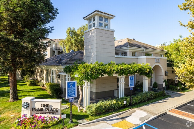
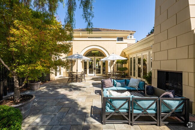
Property Record
5210 Terner Way, San Jose, CA 95136

Property Detail
5210 Terner Way
458-11-016
LOT 2 RECORDERS BOOK 672 PAGE 14
Multifamilydwelling
SANTA CLARA
APD
California
D Areas with possible but undetermined flood hazards.
4.60 AC
2024
Erikson
2025
South Bay/San Jose
512024
San Jose-Sunnyvale-Santa Clara, CA
NEARBY LISTINGS FOR SALE OR LEASE
DEMOGRAPHICS near 5210 Terner Way
1 mile
3 mile
5 mile
2025 Total Population
23,781
217,996
473,020
2030 Population
24,291
221,832
481,529
Pop Growth 2025-2030
+ 2.14%
+ 1.76%
+ 1.80%
Average Age
41
40
40
2025 Total Households
8,734
72,524
156,291
HH Growth 2025-2030
+ 2.10%
+ 1.78%
+ 1.84%
Median Household Inc
$124,923
$145,710
$140,269
Avg Household Size
2.70
2.90
2.90
2025 Avg HH Vehicles
2.00
2.00
2.00
Median Home Value
$1,076,946
$1,094,737
$1,089,522
Median Year Built
1978
1973
1974
Nearby Places
Map Layers
Map Styles
 Street
 Aerial
Layers
 Traffic
 Biking
Places
Listings with unknown addresses are not visible on the map
- Restaurants
- Banks
- Shops
- Fitness
- Groceries
PUBLIC TRANSPORTATION
TRANSIT/SUBWAY
Ohlone-Chynoweth Station (Baypointe - Santa Teresa - VTA, Baypointe - Santa Teresa Modified-S - VTA)
Drive
Walk
Distance
Ohlone-Chynoweth Station (Baypointe - Santa Teresa - VTA, Baypointe - Santa Teresa Modified-S - VTA)
0 min
5 min
0.2 mi
COMMUTER RAIL
Capitol Caltrain Station Southbound (South Santa Clara County Connector - Caltrain (Caltrain))
Drive
Walk
Distance
Capitol Caltrain Station Southbound (South Santa Clara County Connector - Caltrain (Caltrain))
7 min
4.2 mi
Blossom Hill Caltrain Station Southbound (South Santa Clara County Connector - Caltrain (Caltrain))
Drive
Walk
Distance
Blossom Hill Caltrain Station Southbound (South Santa Clara County Connector - Caltrain (Caltrain))
10 min
5.2 mi
AIRPORT
Norman Y Mineta San Jose International
Drive
Walk
Distance
Norman Y Mineta San Jose International
16 min
9.9 mi
Freight Ports
Port of Redwood City
Drive
Walk
Distance
Port of Redwood City
37 min
29.1 mi
Nearby Properties
Address
Land Use
TOTAL SIZE
Lot Size
Zoning
Address
Land Use
TOTAL SIZE
Lot Size
Zoning
526,700 SF
29.03 AC
APD
Address
Land Use
TOTAL SIZE
Lot Size
Zoning
414,727 SF
16.59 AC
PD
Address
Land Use
TOTAL SIZE
Lot Size
Zoning
323,496 SF
12.02 AC
R140
Address
Land Use
TOTAL SIZE
Lot Size
Zoning
212,532 SF
7.12 AC
APD
Address
Land Use
TOTAL SIZE
Lot Size
Zoning
0.13 AC
R1B6
Address
Land Use
TOTAL SIZE
Lot Size
Zoning
241,800 SF
15.07 AC
R4
Address
Land Use
TOTAL SIZE
Lot Size
Zoning
209,128 SF
13.13 AC
R1PD
Address
Land Use
TOTAL SIZE
Lot Size
Zoning
279,086 SF
10.74 AC
R3
Address
Land Use
TOTAL SIZE
Lot Size
Zoning
5,000 SF
3.52 AC
CN
Address
Land Use
TOTAL SIZE
Lot Size
Zoning
8.72 AC
A-PD
Address
Land Use
TOTAL SIZE
Lot Size
Zoning
121,648 SF
5.80 AC
R1B6
Address
Land Use
TOTAL SIZE
Lot Size
Zoning
155,286 SF
9.50 AC
R3
Address
Land Use
TOTAL SIZE
Lot Size
Zoning
20,150.53 AC
SJ
Address
Land Use
TOTAL SIZE
Lot Size
Zoning
6.24 AC
A-PD
Address
Land Use
TOTAL SIZE
Lot Size
Zoning
113.46 AC
M4
Address
Land Use
TOTAL SIZE
Lot Size
Zoning
216,589 SF
20.22 AC
C3
Address
Land Use
TOTAL SIZE
Lot Size
Zoning
21.67 AC
R3B
Address
Land Use
TOTAL SIZE
Lot Size
Zoning
163,904 SF
9.48 AC
R3APD
Address
Land Use
TOTAL SIZE
Lot Size
Zoning
5.05 AC
APD
Address
Land Use
TOTAL SIZE
Lot Size
Zoning
151,200 SF
5.82 AC
APD
Address
Land Use
TOTAL SIZE
Lot Size
Zoning
189,598 SF
2.20 AC
APD
Address
Land Use
TOTAL SIZE
Lot Size
Zoning
46,440 SF
3.57 AC
R-1-8
Address
Land Use
TOTAL SIZE
Lot Size
Zoning
133,513 SF
7.83 AC
R3
Address
Land Use
TOTAL SIZE
Lot Size
Zoning
252,868 SF
4.75 AC
R1-8
Address
Land Use
TOTAL SIZE
Lot Size
Zoning
20,160.11 AC
SJ
Address
Land Use
TOTAL SIZE
Lot Size
Zoning
30,136 SF
4.66 AC
CG
Address
Land Use
TOTAL SIZE
Lot Size
Zoning
72,588 SF
4.63 AC
R1PD
Address
Land Use
TOTAL SIZE
Lot Size
Zoning
287,782 SF
10.87 AC
R3B
Address
Land Use
TOTAL SIZE
Lot Size
Zoning
250,758 SF
7.91 AC
R3
Address
Land Use
TOTAL SIZE
Lot Size
Zoning
211,685 SF
13.63 AC
C1
The World's #1 Commercial Real Estate Marketplace
Connect with us
© 2026 CoStar Group
The information above has been obtained from sources believed reliable. While we do not doubt its accuracy we have not verified it and make no guarantee, warranty or representation about it. It is your responsibility to independently confirm its accuracy and completeness. Any projections, opinions, assumptions, or estimates used are for example only and do not represent the current or future performance of the property. The value of this transaction to you depends on tax and other factors which should be evaluated by your tax, financial, and legal advisors. You and your advisors should conduct a careful, independent investigation of the property to determine to your satisfaction the suitability of the property for your needs.