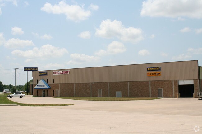
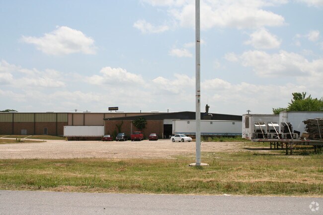
Property Record
5210 W State Highway 266, Springfield, MO 65802

Save to a Folder
{{folder.Name}}
{{folder.ListingIds.length}} Properties
{{folder.ListingIds.length}} Property
Create a New Folder
Property Detail
5210 W State Highway 266
14-24-100-041
BEG 42.8 FT S & 961 FT W NE COR NE1/4 NE1/4 S 450 FT M/L W 1 86 FT S TO I-44R/W NELY ALG R/W TO BEG
Manufacturinglight
Greene
M-1
Missouri
B and X Area of moderate flood hazard, usually the area between the limits of the 100-year and 500-year floods.
10.60 AC
2025
Outlying Greene County
2025
Springfield
004900
Springfield, MO
99,756 SF
NEARBY LISTINGS FOR SALE OR LEASE
DEMOGRAPHICS near 5210 W State Highway 266
1 mile
3 mile
5 mile
2025 Total Population
2,141
19,417
69,850
2030 Population
2,209
20,004
71,981
Pop Growth 2025-2030
+ 3.18%
+ 3.02%
+ 3.05%
Average Age
37
38
38
2025 Total Households
832
7,492
29,017
HH Growth 2025-2030
+ 3.37%
+ 3.15%
+ 3.27%
Median Household Inc
$90,324
$67,336
$53,263
Avg Household Size
2.60
2.50
2.30
2025 Avg HH Vehicles
2.00
2.00
2.00
Median Home Value
$216,786
$182,581
$175,353
Median Year Built
1998
1995
1989
Nearby Places
Map Layers
Map Styles
 Street
 Aerial
Layers
 Traffic
 Biking
Places
Listings with unknown addresses are not visible on the map
- Restaurants
- Banks
- Shops
- Fitness
- Groceries
PUBLIC TRANSPORTATION
AIRPORT
Springfield-Branson Ntl
Drive
Walk
Distance
Springfield-Branson Ntl
19 min
7.9 mi
Freight Ports
Tulsa Port of Inola
Drive
Walk
Distance
Tulsa Port of Inola
186 min
166.5 mi
Nearby Properties
Address
Land Use
TOTAL SIZE
Lot Size
Zoning
Address
Land Use
TOTAL SIZE
Lot Size
Zoning
82.16 AC
Address
Land Use
TOTAL SIZE
Lot Size
Zoning
320,532 SF
33.54 AC
INC
Address
Land Use
TOTAL SIZE
Lot Size
Zoning
22.64 AC
INC
Address
Land Use
TOTAL SIZE
Lot Size
Zoning
11 AC
INC
Address
Land Use
TOTAL SIZE
Lot Size
Zoning
511.19 AC
Address
Land Use
TOTAL SIZE
Lot Size
Zoning
102,925 SF
57.24 AC
INC
Address
Land Use
TOTAL SIZE
Lot Size
Zoning
157,773 SF
18.55 AC
INC
Address
Land Use
TOTAL SIZE
Lot Size
Zoning
154,470 SF
16.97 AC
INC
Address
Land Use
TOTAL SIZE
Lot Size
Zoning
16.39 AC
INC
Address
Land Use
TOTAL SIZE
Lot Size
Zoning
20.54 AC
Address
Land Use
TOTAL SIZE
Lot Size
Zoning
83,380 SF
7.20 AC
INC
Address
Land Use
TOTAL SIZE
Lot Size
Zoning
12.39 AC
Address
Land Use
TOTAL SIZE
Lot Size
Zoning
8.12 AC
INC
Address
Land Use
TOTAL SIZE
Lot Size
Zoning
28.99 AC
Address
Land Use
TOTAL SIZE
Lot Size
Zoning
77,160 SF
6.31 AC
INC
Address
Land Use
TOTAL SIZE
Lot Size
Zoning
75,000 SF
8.92 AC
INC
Address
Land Use
TOTAL SIZE
Lot Size
Zoning
52,772 SF
5.12 AC
INC
Address
Land Use
TOTAL SIZE
Lot Size
Zoning
7.95 AC
INC
Address
Land Use
TOTAL SIZE
Lot Size
Zoning
13.80 AC
C-2
Address
Land Use
TOTAL SIZE
Lot Size
Zoning
148,940 SF
10.08 AC
M-2
Address
Land Use
TOTAL SIZE
Lot Size
Zoning
Address
Land Use
TOTAL SIZE
Lot Size
Zoning
115,000 SF
10.71 AC
INC
Address
Land Use
TOTAL SIZE
Lot Size
Zoning
7.90 AC
INC
Address
Land Use
TOTAL SIZE
Lot Size
Zoning
11.87 AC
INC
Address
Land Use
TOTAL SIZE
Lot Size
Zoning
238,700 SF
14.05 AC
INC
Address
Land Use
TOTAL SIZE
Lot Size
Zoning
7.26 AC
INC
Address
Land Use
TOTAL SIZE
Lot Size
Zoning
50,000 SF
7.30 AC
INC
Address
Land Use
TOTAL SIZE
Lot Size
Zoning
17.36 AC
Address
Land Use
TOTAL SIZE
Lot Size
Zoning
9.84 AC
C-2
Address
Land Use
TOTAL SIZE
Lot Size
Zoning
75,000 SF
5.69 AC
INC
The World's #1 Commercial Real Estate Marketplace
Connect with us
© 2026 CoStar Group
The information above has been obtained from sources believed reliable. While we do not doubt its accuracy we have not verified it and make no guarantee, warranty or representation about it. It is your responsibility to independently confirm its accuracy and completeness. Any projections, opinions, assumptions, or estimates used are for example only and do not represent the current or future performance of the property. The value of this transaction to you depends on tax and other factors which should be evaluated by your tax, financial, and legal advisors. You and your advisors should conduct a careful, independent investigation of the property to determine to your satisfaction the suitability of the property for your needs.