Property Record
52129 Sw Columbia River Hwy, Scappoose, OR 97056

NEARBY LISTINGS FOR SALE OR LEASE
Property Detail
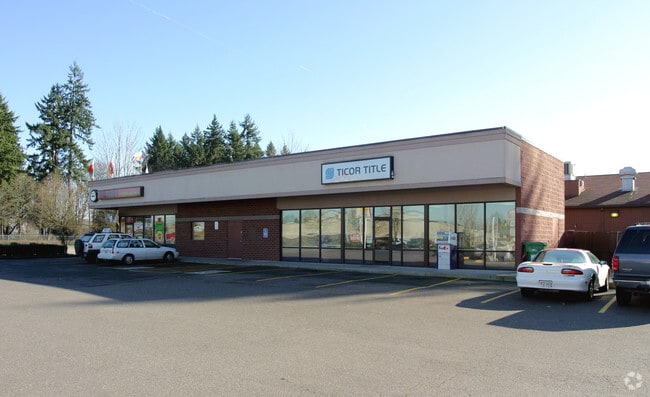
52129 Sw Columbia River Hwy
Restaurantdrivein
Columbia
X
Oregon
41067C0100E
3.32 AC
2025
Columbia County
2025
Portland
971000
Portland-Vancouver-Hillsboro, OR-WA
2,435 SF
0101032120340160000
DEMOGRAPHICS near 52129 Sw Columbia River Hwy
1 Mile
3 Mile
5 Mile
2024 Total Population
7,836
11,185
14,277
2029 Population
8,216
11,717
14,908
Pop Growth 2024-2029
+ 4.85%
+ 4.76%
+ 4.42%
Average Age
41
42
43
2024 Total Households
3,093
4,453
5,648
HH Growth 2024-2029
+ 4.88%
+ 4.81%
+ 4.39%
Median Household Inc
$93,370
$97,379
$96,394
Avg Household Size
2.50
2.50
2.50
2024 Avg HH Vehicles
2.00
2.00
2.00
Median Home Value
$373,328
$389,637
$408,818
Median Year Built
1985
1985
1984
Nearby Places
- Restaurants
- Banks
- Shops
- Fitness
- Groceries
PUBLIC TRANSPORTATION
AIRPORT
Portland International
DRIVE
WALK
Distance
Portland International
50 min
26.0 mi
Freight Ports
Port of Vancouver
DRIVE
WALK
Distance
Port of Vancouver
45 min
23.7 mi
Nearby Properties
Address
Land Use
TOTAL SIZE
Lot Size
Zoning
Address
Land Use
TOTAL SIZE
Lot Size
Zoning
49.56 AC
SC:PUA
Address
Land Use
TOTAL SIZE
Lot Size
Zoning
155,350 SF
10.86 AC
SC:EC
Address
Land Use
TOTAL SIZE
Lot Size
Zoning
17.25 AC
SC:PUA
Address
Land Use
TOTAL SIZE
Lot Size
Zoning
45,294 SF
1.92 AC
SC:EC
Address
Land Use
TOTAL SIZE
Lot Size
Zoning
49,852 SF
5.58 AC
SC:A-1
Address
Land Use
TOTAL SIZE
Lot Size
Zoning
2,336 SF
28.60 AC
SC:PUA
Address
Land Use
TOTAL SIZE
Lot Size
Zoning
874 SF
3.94 AC
SC:MH
Address
Land Use
TOTAL SIZE
Lot Size
Zoning
31,350 SF
2.89 AC
SC:EC
Address
Land Use
TOTAL SIZE
Lot Size
Zoning
19.20 AC
SC:C
Address
Land Use
TOTAL SIZE
Lot Size
Zoning
28,986 SF
3.03 AC
SC:EC
Address
Land Use
TOTAL SIZE
Lot Size
Zoning
36,760 SF
4.12 AC
CO:RIPD
Address
Land Use
TOTAL SIZE
Lot Size
Zoning
73,154 SF
5.76 AC
CO:M-2
Address
Land Use
TOTAL SIZE
Lot Size
Zoning
28,986 SF
3.03 AC
SC:EC
Address
Land Use
TOTAL SIZE
Lot Size
Zoning
19,986 SF
2.11 AC
SC:A-1
Address
Land Use
TOTAL SIZE
Lot Size
Zoning
43,950 SF
2.57 AC
SC:LI
Address
Land Use
TOTAL SIZE
Lot Size
Zoning
14.14 AC
SC:PL-R
Address
Land Use
TOTAL SIZE
Lot Size
Zoning
16,206 SF
0.67 AC
SC:EC
Address
Land Use
TOTAL SIZE
Lot Size
Zoning
14,000 SF
0.88 AC
CO:RIPD
Address
Land Use
TOTAL SIZE
Lot Size
Zoning
9,856 SF
1.27 AC
SC:EC
Address
Land Use
TOTAL SIZE
Lot Size
Zoning
13,352 SF
0.45 AC
SC:EC
Address
Land Use
TOTAL SIZE
Lot Size
Zoning
15,750 SF
1.86 AC
SC:MH
Address
Land Use
TOTAL SIZE
Lot Size
Zoning
17.36 AC
SC:PL-R
Address
Land Use
TOTAL SIZE
Lot Size
Zoning
4,986 SF
1.26 AC
SC:C
Address
Land Use
TOTAL SIZE
Lot Size
Zoning
5,320 SF
0.98 AC
SC:EC
Address
Land Use
TOTAL SIZE
Lot Size
Zoning
10 SF
1.33 AC
SC:EC
Address
Land Use
TOTAL SIZE
Lot Size
Zoning
8.36 AC
SC:R-4
Address
Land Use
TOTAL SIZE
Lot Size
Zoning
16,040 SF
0.63 AC
SC:C
Address
Land Use
TOTAL SIZE
Lot Size
Zoning
12,840 SF
1 AC
SC:EC
Address
Land Use
TOTAL SIZE
Lot Size
Zoning
17,670 SF
8.53 AC
CO:EC
The World's #1 Commercial Real Estate Marketplace
Connect with us
© 2025 CoStar Group
The information above has been obtained from sources believed reliable. While we do not doubt its accuracy we have not verified it and make no guarantee, warranty or representation about it. It is your responsibility to independently confirm its accuracy and completeness. Any projections, opinions, assumptions, or estimates used are for example only and do not represent the current or future performance of the property. The value of this transaction to you depends on tax and other factors which should be evaluated by your tax, financial, and legal advisors. You and your advisors should conduct a careful, independent investigation of the property to determine to your satisfaction the suitability of the property for your needs.