Property Record
5215 Concord Pike, Wilmington, DE 19803


NEARBY LISTINGS FOR SALE OR LEASE
Property Detail
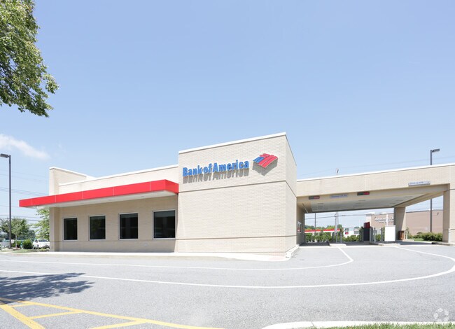
5215 Concord Pike
06-020.00-313
Tally-Ho Shopping Center
Financialbuilding
New Castle
X
Delaware
10003C0060K
a
2024
1 AC
2024
North New Castle County
011201
Philadelphia
4,653 SF
Philadelphia-Camden-Wilmington, PA-NJ-DE-MD
DEMOGRAPHICS near 5215 Concord Pike
1 Mile
3 Mile
5 Mile
2024 Total Population
4,684
45,575
128,489
2029 Population
4,780
46,034
129,564
Pop Growth 2024-2029
+ 2.05%
+ 1.01%
+ 0.84%
Average Age
43
44
44
2024 Total Households
1,801
17,793
52,543
HH Growth 2024-2029
+ 2.11%
+ 1.07%
+ 0.88%
Median Household Inc
$125,346
$121,807
$97,139
Avg Household Size
2.50
2.50
2.40
2024 Avg HH Vehicles
2.00
2.00
2.00
Median Home Value
$417,217
$413,588
$384,513
Median Year Built
1971
1969
1967
Nearby Places
Map Layers
Map Styles
 Street
 Aerial
- Restaurants
- Banks
- Shops
- Fitness
- Groceries
PUBLIC TRANSPORTATION
COMMUTER RAIL
Claymont Transportation Center (Wilmington/Newark Line - SEPTA)
DRIVE
WALK
Distance
Claymont Transportation Center (Wilmington/Newark Line - SEPTA)
12 min
5.9 mi
Claymont (R2 - Southeastern Pennsylvania Transportation Authority Regional Rail (SEPTA Regional Rail))
DRIVE
WALK
Distance
Claymont (R2 - Southeastern Pennsylvania Transportation Authority Regional Rail (SEPTA Regional Rail))
13 min
6.0 mi
AIRPORT
Philadelphia International
DRIVE
WALK
Distance
Philadelphia International
29 min
17.7 mi
Freight Ports
Port of Wilmington, RI
DRIVE
WALK
Distance
Port of Wilmington, RI
22 min
10.0 mi
Nearby Properties
Address
Land Use
TOTAL SIZE
Lot Size
Zoning
Address
Land Use
TOTAL SIZE
Lot Size
Zoning
36,463 SF
13 AC
Address
Land Use
TOTAL SIZE
Lot Size
Zoning
32,649 SF
23.70 AC
Address
Land Use
TOTAL SIZE
Lot Size
Zoning
Address
Land Use
TOTAL SIZE
Lot Size
Zoning
596,916 SF
5.97 AC
OR
Address
Land Use
TOTAL SIZE
Lot Size
Zoning
371,733 SF
10.37 AC
OR
Address
Land Use
TOTAL SIZE
Lot Size
Zoning
266,702 SF
20.04 AC
OR
Address
Land Use
TOTAL SIZE
Lot Size
Zoning
199,099 SF
49 AC
S
Address
Land Use
TOTAL SIZE
Lot Size
Zoning
162,643 SF
30.61 AC
CR
Address
Land Use
TOTAL SIZE
Lot Size
Zoning
205,529 SF
42.34 AC
S
Address
Land Use
TOTAL SIZE
Lot Size
Zoning
346,808 SF
17.92 AC
OR
Address
Land Use
TOTAL SIZE
Lot Size
Zoning
96,745 SF
17.07 AC
S
Address
Land Use
TOTAL SIZE
Lot Size
Zoning
197,332 SF
12.13 AC
S
Address
Land Use
TOTAL SIZE
Lot Size
Zoning
113,460 SF
11.40 AC
Address
Land Use
TOTAL SIZE
Lot Size
Zoning
380 SF
21.54 AC
S
Address
Land Use
TOTAL SIZE
Lot Size
Zoning
478,925 SF
59.10 AC
OR
Address
Land Use
TOTAL SIZE
Lot Size
Zoning
196,466 SF
11.50 AC
OR
Address
Land Use
TOTAL SIZE
Lot Size
Zoning
63,000 SF
3.67 AC
Address
Land Use
TOTAL SIZE
Lot Size
Zoning
173.29 AC
Address
Land Use
TOTAL SIZE
Lot Size
Zoning
15,848 SF
52.13 AC
Address
Land Use
TOTAL SIZE
Lot Size
Zoning
61,912 SF
31.94 AC
ST
Address
Land Use
TOTAL SIZE
Lot Size
Zoning
43,332 SF
3.36 AC
CR
Address
Land Use
TOTAL SIZE
Lot Size
Zoning
Address
Land Use
TOTAL SIZE
Lot Size
Zoning
148,870 SF
5.45 AC
OR
Address
Land Use
TOTAL SIZE
Lot Size
Zoning
124,677 SF
4.61 AC
CR
Address
Land Use
TOTAL SIZE
Lot Size
Zoning
180,096 SF
10.62 AC
ON
Address
Land Use
TOTAL SIZE
Lot Size
Zoning
91,500 SF
49.03 AC
SE
Address
Land Use
TOTAL SIZE
Lot Size
Zoning
41.71 AC
Address
Land Use
TOTAL SIZE
Lot Size
Zoning
222,748 SF
29.82 AC
CR
Address
Land Use
TOTAL SIZE
Lot Size
Zoning
149,462 SF
2.81 AC
CR
Address
Land Use
TOTAL SIZE
Lot Size
Zoning
72,000 SF
4.44 AC
The World's #1 Commercial Real Estate Marketplace
Connect with us
© 2025 CoStar Group
The information above has been obtained from sources believed reliable. While we do not doubt its accuracy we have not verified it and make no guarantee, warranty or representation about it. It is your responsibility to independently confirm its accuracy and completeness. Any projections, opinions, assumptions, or estimates used are for example only and do not represent the current or future performance of the property. The value of this transaction to you depends on tax and other factors which should be evaluated by your tax, financial, and legal advisors. You and your advisors should conduct a careful, independent investigation of the property to determine to your satisfaction the suitability of the property for your needs.