Property Record
5215 E State Road 64, Bradenton, FL 34208
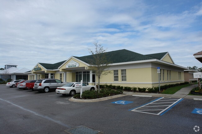

Property Detail
5215 E State Road 64
11156-1155-9
LOT A 64 CENTER PROFESSIONAL A SUBDIVISION AS REC IN PB 44/193-194 PI#11156.1155/9
Medicalbuilding
MANATEE
BR_SCC
Florida
B and X Area of moderate flood hazard, usually the area between the limits of the 100-year and 500-year floods.
a
2024
0.60 AC
2025
Manatee
002003
Tampa/St Petersburg
7,230 SF
North Port-Bradenton-Sarasota, FL
NEARBY LISTINGS FOR SALE OR LEASE
DEMOGRAPHICS near 5215 E State Road 64
1 mile
3 mile
5 mile
2025 Total Population
7,944
46,229
151,707
2030 Population
8,926
51,753
170,162
Pop Growth 2025-2030
+ 12.36%
+ 11.95%
+ 12.16%
Average Age
43
46
46
2025 Total Households
3,499
19,489
62,274
HH Growth 2025-2030
+ 12.46%
+ 12.15%
+ 12.52%
Median Household Inc
$78,598
$77,458
$76,106
Avg Household Size
2.30
2.30
2.30
2025 Avg HH Vehicles
2.00
2.00
2.00
Median Home Value
$399,999
$418,613
$397,109
Median Year Built
2001
1998
1998
Nearby Places
Map Layers
Map Styles
 Street
 Aerial
Layers
 Traffic
 Biking
Places
Listings with unknown addresses are not visible on the map
- Restaurants
- Banks
- Shops
- Fitness
- Groceries
PUBLIC TRANSPORTATION
AIRPORT
Sarasota/Bradenton International
Drive
Walk
Distance
Sarasota/Bradenton International
24 min
12.3 mi
St Pete-Clearwater International
Drive
Walk
Distance
St Pete-Clearwater International
60 min
39.8 mi
Tampa International
Drive
Walk
Distance
Tampa International
66 min
47.7 mi
Nearby Properties
Address
Land Use
TOTAL SIZE
Lot Size
Zoning
Address
Land Use
TOTAL SIZE
Lot Size
Zoning
622,266 SF
68.76 AC
PD-MU
Address
Land Use
TOTAL SIZE
Lot Size
Zoning
881,490 SF
83.09 AC
BR_R-3
Address
Land Use
TOTAL SIZE
Lot Size
Zoning
513,465 SF
78.39 AC
PD-MU
Address
Land Use
TOTAL SIZE
Lot Size
Zoning
707,409 SF
27.98 AC
PD-MU
Address
Land Use
TOTAL SIZE
Lot Size
Zoning
319,679 SF
31.78 AC
BR_R-1
Address
Land Use
TOTAL SIZE
Lot Size
Zoning
311,669 SF
34.55 AC
BR_R-2
Address
Land Use
TOTAL SIZE
Lot Size
Zoning
225,768 SF
18.47 AC
BR_R-1
Address
Land Use
TOTAL SIZE
Lot Size
Zoning
270,900 SF
44.35 AC
PD-MU
Address
Land Use
TOTAL SIZE
Lot Size
Zoning
89,137 SF
11.61 AC
Address
Land Use
TOTAL SIZE
Lot Size
Zoning
348,901 SF
27 AC
BR_R-2
Address
Land Use
TOTAL SIZE
Lot Size
Zoning
191,100 SF
30.35 AC
PD-C
Address
Land Use
TOTAL SIZE
Lot Size
Zoning
160,163 SF
16.35 AC
PD-MU
Address
Land Use
TOTAL SIZE
Lot Size
Zoning
107,298 SF
12.91 AC
PD-MU
Address
Land Use
TOTAL SIZE
Lot Size
Zoning
220,706 SF
24.13 AC
PD-C, A-1
Address
Land Use
TOTAL SIZE
Lot Size
Zoning
234,818 SF
18.20 AC
BR_R-2
Address
Land Use
TOTAL SIZE
Lot Size
Zoning
201,982 SF
16.65 AC
BR_SCC
Address
Land Use
TOTAL SIZE
Lot Size
Zoning
201,632 SF
7.23 AC
A-1 SUBURB
Address
Land Use
TOTAL SIZE
Lot Size
Zoning
185,272 SF
18.11 AC
PD-R
Address
Land Use
TOTAL SIZE
Lot Size
Zoning
13,621 SF
61.72 AC
PD-RV,RSF-
Address
Land Use
TOTAL SIZE
Lot Size
Zoning
92,466 SF
18.80 AC
A-1 SUBURB
Address
Land Use
TOTAL SIZE
Lot Size
Zoning
89,912 SF
5.05 AC
Address
Land Use
TOTAL SIZE
Lot Size
Zoning
61,770 SF
79.85 AC
A,A-1
Address
Land Use
TOTAL SIZE
Lot Size
Zoning
151,596 SF
29.79 AC
BR_PDP
Address
Land Use
TOTAL SIZE
Lot Size
Zoning
117,072 SF
8.95 AC
BR_FBC,BR_
Address
Land Use
TOTAL SIZE
Lot Size
Zoning
138,535 SF
13.94 AC
BR_SCC
Address
Land Use
TOTAL SIZE
Lot Size
Zoning
222,285 SF
13.52 AC
BR_R-2
Address
Land Use
TOTAL SIZE
Lot Size
Zoning
91,918 SF
6.03 AC
PD-C
Address
Land Use
TOTAL SIZE
Lot Size
Zoning
69,192 SF
3.71 AC
Address
Land Use
TOTAL SIZE
Lot Size
Zoning
63,563 SF
4.44 AC
Address
Land Use
TOTAL SIZE
Lot Size
Zoning
59,222 SF
4.49 AC
PD-C
The World's #1 Commercial Real Estate Marketplace
Connect with us
© 2026 CoStar Group
The information above has been obtained from sources believed reliable. While we do not doubt its accuracy we have not verified it and make no guarantee, warranty or representation about it. It is your responsibility to independently confirm its accuracy and completeness. Any projections, opinions, assumptions, or estimates used are for example only and do not represent the current or future performance of the property. The value of this transaction to you depends on tax and other factors which should be evaluated by your tax, financial, and legal advisors. You and your advisors should conduct a careful, independent investigation of the property to determine to your satisfaction the suitability of the property for your needs.