Property Record
5215 S Us Highway 83 Hwy, Laredo, TX 78046
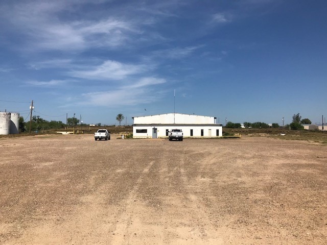
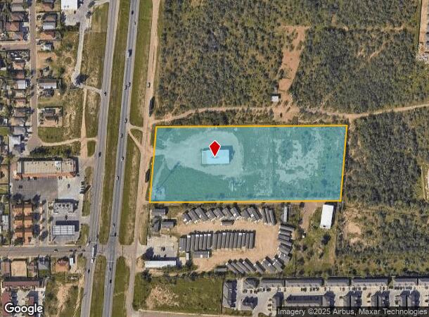
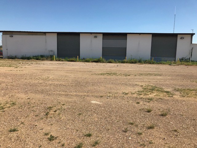
This Property Is For Sale
NEARBY LISTINGS FOR SALE OR LEASE
-
-
View all Laredo listings for sale on LoopNet.com
Property Detail
5215 S Us Highway 83 Hwy
207883
Abst 0410 Porcion 37 J B Chapa
Commercialnec
ABST 410 POR 37 J B CHAPA 8 ACS
X
Webb
48479C1380C
Texas
2024
8 AC
2025
Texas South Area
001822
Other Market Areas
8,334 SF
Laredo, TX
DEMOGRAPHICS near 5215 S Us Highway 83 Hwy
1 Mile
3 Mile
5 Mile
2024 Total Population
22,461
52,393
93,736
2029 Population
23,095
53,360
95,116
Pop Growth 2024-2029
+ 2.82%
+ 1.85%
+ 1.47%
Average Age
30
30
32
2024 Total Households
5,413
13,058
25,163
HH Growth 2024-2029
+ 2.88%
+ 1.84%
+ 1.43%
Median Household Inc
$34,355
$39,183
$44,969
Avg Household Size
3.90
3.80
3.60
2024 Avg HH Vehicles
2.00
2.00
2.00
Median Home Value
$97,170
$118,085
$127,407
Median Year Built
2002
2001
1997
Nearby Places
Map Layers
Map Styles
 Street
 Aerial
- Restaurants
- Banks
- Shops
- Fitness
- Groceries
PUBLIC TRANSPORTATION
AIRPORT
Laredo International
DRIVE
WALK
Distance
Laredo International
19 min
11.0 mi
Nearby Properties
Address
Land Use
TOTAL SIZE
Lot Size
Zoning
Address
Land Use
TOTAL SIZE
Lot Size
Zoning
423,977 SF
1.27 AC
R2
Address
Land Use
TOTAL SIZE
Lot Size
Zoning
318,944 SF
59.72 AC
R1A
Address
Land Use
TOTAL SIZE
Lot Size
Zoning
165,608 SF
28.50 AC
R2
Address
Land Use
TOTAL SIZE
Lot Size
Zoning
178,302 SF
45.97 AC
R3
Address
Land Use
TOTAL SIZE
Lot Size
Zoning
169,339 SF
28 AC
Address
Land Use
TOTAL SIZE
Lot Size
Zoning
138,494 SF
50 AC
R1A
Address
Land Use
TOTAL SIZE
Lot Size
Zoning
137,182 SF
9.67 AC
R1
Address
Land Use
TOTAL SIZE
Lot Size
Zoning
118,165 SF
14 AC
Address
Land Use
TOTAL SIZE
Lot Size
Zoning
108,994 SF
15.39 AC
Address
Land Use
TOTAL SIZE
Lot Size
Zoning
119,908 SF
11.03 AC
Address
Land Use
TOTAL SIZE
Lot Size
Zoning
101,034 SF
20 AC
R1A
Address
Land Use
TOTAL SIZE
Lot Size
Zoning
98,447 SF
20 AC
R1A
Address
Land Use
TOTAL SIZE
Lot Size
Zoning
136,195 SF
9.50 AC
Address
Land Use
TOTAL SIZE
Lot Size
Zoning
87,789 SF
10.70 AC
Address
Land Use
TOTAL SIZE
Lot Size
Zoning
214,365 SF
18.11 AC
R2
Address
Land Use
TOTAL SIZE
Lot Size
Zoning
77,788 SF
19.67 AC
Address
Land Use
TOTAL SIZE
Lot Size
Zoning
55,094 SF
44.55 AC
B3
Address
Land Use
TOTAL SIZE
Lot Size
Zoning
164,360 SF
7.49 AC
R1
Address
Land Use
TOTAL SIZE
Lot Size
Zoning
72,897 SF
8 AC
R1
Address
Land Use
TOTAL SIZE
Lot Size
Zoning
218,710 SF
27.27 AC
B3
Address
Land Use
TOTAL SIZE
Lot Size
Zoning
172,999 SF
10 AC
R2
Address
Land Use
TOTAL SIZE
Lot Size
Zoning
100,697 SF
1.77 AC
R2
Address
Land Use
TOTAL SIZE
Lot Size
Zoning
83,761 SF
Address
Land Use
TOTAL SIZE
Lot Size
Zoning
30,880 SF
16.09 AC
B4
Address
Land Use
TOTAL SIZE
Lot Size
Zoning
31,922 SF
92.91 AC
Address
Land Use
TOTAL SIZE
Lot Size
Zoning
34,490 SF
13.42 AC
R1MH
Address
Land Use
TOTAL SIZE
Lot Size
Zoning
62,390 SF
3.25 AC
Address
Land Use
TOTAL SIZE
Lot Size
Zoning
75,613 SF
1.77 AC
R2
Address
Land Use
TOTAL SIZE
Lot Size
Zoning
50,194 SF
5.90 AC
R2
Address
Land Use
TOTAL SIZE
Lot Size
Zoning
21,506 SF
1.65 AC
B3
The World's #1 Commercial Real Estate Marketplace
Connect with us
© 2025 CoStar Group
The information above has been obtained from sources believed reliable. While we do not doubt its accuracy we have not verified it and make no guarantee, warranty or representation about it. It is your responsibility to independently confirm its accuracy and completeness. Any projections, opinions, assumptions, or estimates used are for example only and do not represent the current or future performance of the property. The value of this transaction to you depends on tax and other factors which should be evaluated by your tax, financial, and legal advisors. You and your advisors should conduct a careful, independent investigation of the property to determine to your satisfaction the suitability of the property for your needs.