Property Record
5219 City Bank Pkwy, Lubbock, TX 79407
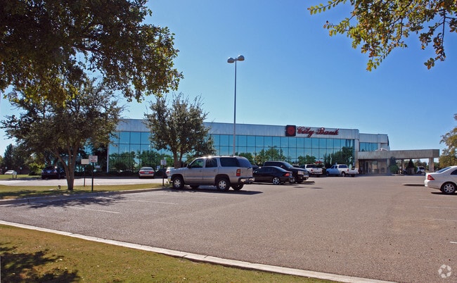

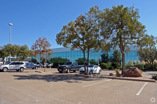
Property Detail
5219 City Bank Pkwy
Lubbock, TX
CITY BANK TR B LESS NE/PT & E/PT OF TR A (CITY BANK PKWY)
R92603
LUBBOCK
Officebuilding
Texas
B and X Area of moderate flood hazard, usually the area between the limits of the 100-year and 500-year floods.
c
2024
9.88 AC
2025
Southwest Inner Loop
001709
Lubbock
128,198 SF
NEARBY LISTINGS FOR SALE OR LEASE
DEMOGRAPHICS near 5219 City Bank Pkwy
1 mile
3 mile
5 mile
2025 Total Population
14,148
98,914
230,626
2030 Population
14,685
102,777
239,932
Pop Growth 2025-2030
+ 3.80%
+ 3.91%
+ 4.04%
Average Age
35
36
36
2025 Total Households
5,903
42,681
91,819
HH Growth 2025-2030
+ 4.17%
+ 4.34%
+ 4.48%
Median Household Inc
$54,414
$55,459
$55,785
Avg Household Size
2.30
2.20
2.40
2025 Avg HH Vehicles
2.00
2.00
2.00
Median Home Value
$162,302
$206,909
$217,262
Median Year Built
1969
1979
1984
Nearby Places
Map Layers
Map Styles
 Street
 Aerial
Transit
 Traffic
 Biking
Places
Listings with unknown addresses are not visible on the map
- Restaurants
- Banks
- Shops
- Fitness
- Groceries
PUBLIC TRANSPORTATION
AIRPORT
Lubbock Preston Smith International
Drive
Walk
Distance
Lubbock Preston Smith International
28 min
15.4 mi
SALE & LEASE HISTORY
LISTING DATE
SALE/LEASE

Oct 30, 2018
For Lease
Oct 12, 2017
For Lease
Nearby Properties
Address
Land Use
TOTAL SIZE
Lot Size
Zoning
Address
Land Use
TOTAL SIZE
Lot Size
Zoning
791,096 SF
63.76 AC
Address
Land Use
TOTAL SIZE
Lot Size
Zoning
380,785 SF
36.72 AC
Address
Land Use
TOTAL SIZE
Lot Size
Zoning
360,108 SF
18.63 AC
Address
Land Use
TOTAL SIZE
Lot Size
Zoning
274,547 SF
18.92 AC
Address
Land Use
TOTAL SIZE
Lot Size
Zoning
473,857 SF
17.64 AC
Address
Land Use
TOTAL SIZE
Lot Size
Zoning
355,384 SF
19.63 AC
Address
Land Use
TOTAL SIZE
Lot Size
Zoning
244,834 SF
14.54 AC
Address
Land Use
TOTAL SIZE
Lot Size
Zoning
236,871 SF
6.77 AC
Address
Land Use
TOTAL SIZE
Lot Size
Zoning
276,552 SF
12.05 AC
Address
Land Use
TOTAL SIZE
Lot Size
Zoning
290,322 SF
11.96 AC
Address
Land Use
TOTAL SIZE
Lot Size
Zoning
106,894 SF
5.83 AC
Address
Land Use
TOTAL SIZE
Lot Size
Zoning
303,724 SF
17.32 AC
Address
Land Use
TOTAL SIZE
Lot Size
Zoning
102,209 SF
14 AC
Address
Land Use
TOTAL SIZE
Lot Size
Zoning
64,800 SF
0.94 AC
Address
Land Use
TOTAL SIZE
Lot Size
Zoning
153,416 SF
3.14 AC
Address
Land Use
TOTAL SIZE
Lot Size
Zoning
289,796 SF
14.67 AC
Address
Land Use
TOTAL SIZE
Lot Size
Zoning
247,870 SF
11.48 AC
Address
Land Use
TOTAL SIZE
Lot Size
Zoning
176,412 SF
12.27 AC
Address
Land Use
TOTAL SIZE
Lot Size
Zoning
67,759 SF
6.37 AC
Address
Land Use
TOTAL SIZE
Lot Size
Zoning
219,352 SF
21.90 AC
Address
Land Use
TOTAL SIZE
Lot Size
Zoning
207,374 SF
15.51 AC
Address
Land Use
TOTAL SIZE
Lot Size
Zoning
108,363 SF
11.35 AC
Address
Land Use
TOTAL SIZE
Lot Size
Zoning
143,905 SF
0.28 AC
Address
Land Use
TOTAL SIZE
Lot Size
Zoning
169,556 SF
12 AC
Address
Land Use
TOTAL SIZE
Lot Size
Zoning
196,103 SF
12.33 AC
Address
Land Use
TOTAL SIZE
Lot Size
Zoning
246,478 SF
13 AC
Address
Land Use
TOTAL SIZE
Lot Size
Zoning
177,643 SF
10.13 AC
Address
Land Use
TOTAL SIZE
Lot Size
Zoning
156,495 SF
15.85 AC
Address
Land Use
TOTAL SIZE
Lot Size
Zoning
41,592 SF
13.72 AC
Address
Land Use
TOTAL SIZE
Lot Size
Zoning
138,202 SF
11.33 AC
The World's #1 Commercial Real Estate Marketplace
Connect with us
© 2026 CoStar Group
The information above has been obtained from sources believed reliable. While we do not doubt its accuracy we have not verified it and make no guarantee, warranty or representation about it. It is your responsibility to independently confirm its accuracy and completeness. Any projections, opinions, assumptions, or estimates used are for example only and do not represent the current or future performance of the property. The value of this transaction to you depends on tax and other factors which should be evaluated by your tax, financial, and legal advisors. You and your advisors should conduct a careful, independent investigation of the property to determine to your satisfaction the suitability of the property for your needs.