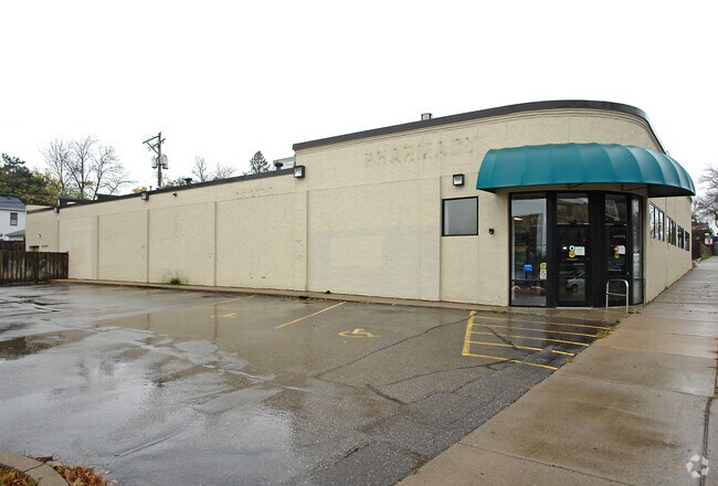
Property Record
522 Snelling Ave S, Saint Paul, MN 55116
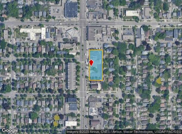
NEARBY LISTINGS FOR SALE OR LEASE
Property Detail
522 Snelling Ave S
Minneapolis-St. Paul-Bloomington, MN-WI
Koenigs Addition
10-28-23-32-0177
KOENIGS ADDITION LOTS 6 THRU LOT 12 BLK 2
Financialbuilding
Ramsey
X
Minnesota
27053C0400F
6,12
2024
0.79 AC
2025
St Paul
036500
Minneapolis/St Paul
5,222 SF
DEMOGRAPHICS near 522 Snelling Ave S
1 Mile
3 Mile
5 Mile
2024 Total Population
20,780
140,824
352,659
2029 Population
20,246
137,723
346,351
Pop Growth 2024-2029
(2.57%)
(2.20%)
(1.79%)
Average Age
41
40
38
2024 Total Households
8,607
61,614
147,543
HH Growth 2024-2029
(2.82%)
(2.40%)
(1.88%)
Median Household Inc
$101,476
$75,789
$70,558
Avg Household Size
2.30
2.10
2.20
2024 Avg HH Vehicles
2.00
2.00
2.00
Median Home Value
$392,602
$347,528
$315,108
Median Year Built
1947
1948
1950
Nearby Places
- Restaurants
- Banks
- Shops
- Fitness
- Groceries
PUBLIC TRANSPORTATION
COMMUTER RAIL
St. Paul-Minneapolis (Empire Builder - Amtrak)
DRIVE
WALK
Distance
St. Paul-Minneapolis (Empire Builder - Amtrak)
10 min
4.9 mi
Target Field Station (Northstar Corridor - Northstar Commuter Rail)
DRIVE
WALK
Distance
Target Field Station (Northstar Corridor - Northstar Commuter Rail)
17 min
8.4 mi
AIRPORT
Minneapolis-St Paul International/Wold-Chamberlain
DRIVE
WALK
Distance
Minneapolis-St Paul International/Wold-Chamberlain
12 min
5.7 mi
Freight Ports
Port Milwaukee
DRIVE
WALK
Distance
Port Milwaukee
370 min
333.5 mi
Nearby Properties
Address
Land Use
TOTAL SIZE
Lot Size
Zoning
Address
Land Use
TOTAL SIZE
Lot Size
Zoning
141,277 SF
44.78 AC
Address
Land Use
TOTAL SIZE
Lot Size
Zoning
84,316 SF
40.83 AC
Address
Land Use
TOTAL SIZE
Lot Size
Zoning
504,049 SF
75.43 AC
Address
Land Use
TOTAL SIZE
Lot Size
Zoning
124,932 SF
9.68 AC
Address
Land Use
TOTAL SIZE
Lot Size
Zoning
63.12 AC
Address
Land Use
TOTAL SIZE
Lot Size
Zoning
176,108 SF
27.45 AC
Address
Land Use
TOTAL SIZE
Lot Size
Zoning
2.65 AC
Address
Land Use
TOTAL SIZE
Lot Size
Zoning
267,530 SF
28.60 AC
Address
Land Use
TOTAL SIZE
Lot Size
Zoning
395,419 SF
2.73 AC
Address
Land Use
TOTAL SIZE
Lot Size
Zoning
3,200 SF
0.14 AC
Address
Land Use
TOTAL SIZE
Lot Size
Zoning
68,748 SF
21.59 AC
Address
Land Use
TOTAL SIZE
Lot Size
Zoning
18,630 SF
22.02 AC
Address
Land Use
TOTAL SIZE
Lot Size
Zoning
173.22 AC
Address
Land Use
TOTAL SIZE
Lot Size
Zoning
445,437 SF
7.80 AC
Address
Land Use
TOTAL SIZE
Lot Size
Zoning
265,736 SF
6.67 AC
Address
Land Use
TOTAL SIZE
Lot Size
Zoning
455,628 SF
2.81 AC
Address
Land Use
TOTAL SIZE
Lot Size
Zoning
Address
Land Use
TOTAL SIZE
Lot Size
Zoning
387,902 SF
14.81 AC
Address
Land Use
TOTAL SIZE
Lot Size
Zoning
318,765 SF
3.58 AC
Address
Land Use
TOTAL SIZE
Lot Size
Zoning
261,098 SF
24.12 AC
Address
Land Use
TOTAL SIZE
Lot Size
Zoning
217,620 SF
16.11 AC
Address
Land Use
TOTAL SIZE
Lot Size
Zoning
429,720 SF
6.02 AC
Address
Land Use
TOTAL SIZE
Lot Size
Zoning
279,247 SF
1.65 AC
Address
Land Use
TOTAL SIZE
Lot Size
Zoning
377,319 SF
6.94 AC
Address
Land Use
TOTAL SIZE
Lot Size
Zoning
310,391 SF
1.77 AC
Address
Land Use
TOTAL SIZE
Lot Size
Zoning
233,578 SF
9.56 AC
Address
Land Use
TOTAL SIZE
Lot Size
Zoning
237,685 SF
2.22 AC
Address
Land Use
TOTAL SIZE
Lot Size
Zoning
Address
Land Use
TOTAL SIZE
Lot Size
Zoning
378,880 SF
3.42 AC
Address
Land Use
TOTAL SIZE
Lot Size
Zoning
437,524 SF
6.11 AC
The World's #1 Commercial Real Estate Marketplace
Connect with us
© 2025 CoStar Group
The information above has been obtained from sources believed reliable. While we do not doubt its accuracy we have not verified it and make no guarantee, warranty or representation about it. It is your responsibility to independently confirm its accuracy and completeness. Any projections, opinions, assumptions, or estimates used are for example only and do not represent the current or future performance of the property. The value of this transaction to you depends on tax and other factors which should be evaluated by your tax, financial, and legal advisors. You and your advisors should conduct a careful, independent investigation of the property to determine to your satisfaction the suitability of the property for your needs.