Property Record
5220 E Main Ave, Bismarck, ND 58501
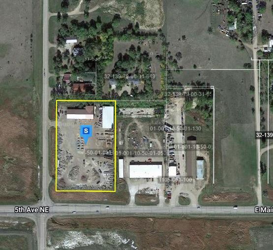

Property Detail
5220 E Main Ave
1105-001-001
KRUEGER'S SUBDIVISION LOT 1
Officebuilding
Burleigh
MA
North Dakota
AE The base floodplain where base flood elevations are provided. AE Zones are now used on new format FIRMs instead of A1-A30 Zones.
1
2025
3.66 AC
2025
East Bismarck
011300
Other Market Areas
7,180 SF
Bismarck, ND
NEARBY LISTINGS FOR SALE OR LEASE
DEMOGRAPHICS near 5220 E Main Ave
1 mile
3 mile
5 mile
2025 Total Population
874
24,008
75,041
2030 Population
925
24,843
77,353
Pop Growth 2025-2030
+ 5.84%
+ 3.48%
+ 3.08%
Average Age
38
40
40
2025 Total Households
276
9,475
31,991
HH Growth 2025-2030
+ 6.52%
+ 3.66%
+ 3.43%
Median Household Inc
$134,558
$83,753
$78,987
Avg Household Size
2.70
2.30
2.20
2025 Avg HH Vehicles
2.00
2.00
2.00
Median Home Value
$446,534
$286,307
$280,541
Median Year Built
2001
1985
1983
Nearby Places
Map Layers
Map Styles
 Street
 Aerial
Layers
 Traffic
 Biking
Places
Listings with unknown addresses are not visible on the map
- Restaurants
- Banks
- Shops
- Fitness
- Groceries
PUBLIC TRANSPORTATION
AIRPORT
Bismarck Municipal
Drive
Walk
Distance
Bismarck Municipal
15 min
4.5 mi
Nearby Properties
Address
Land Use
TOTAL SIZE
Lot Size
Zoning
Address
Land Use
TOTAL SIZE
Lot Size
Zoning
26.42 AC
MA
Address
Land Use
TOTAL SIZE
Lot Size
Zoning
30.33 AC
MA
Address
Land Use
TOTAL SIZE
Lot Size
Zoning
35.42 AC
MA
Address
Land Use
TOTAL SIZE
Lot Size
Zoning
18.70 AC
RM15
Address
Land Use
TOTAL SIZE
Lot Size
Zoning
20.41 AC
MA
Address
Land Use
TOTAL SIZE
Lot Size
Zoning
14.70 AC
MA
Address
Land Use
TOTAL SIZE
Lot Size
Zoning
52,718 SF
2.67 AC
RM15
Address
Land Use
TOTAL SIZE
Lot Size
Zoning
52,710 SF
7.13 AC
RM30
Address
Land Use
TOTAL SIZE
Lot Size
Zoning
14.22 AC
MA
Address
Land Use
TOTAL SIZE
Lot Size
Zoning
84,342 SF
11.63 AC
MA
Address
Land Use
TOTAL SIZE
Lot Size
Zoning
42,908 SF
12.44 AC
MA
Address
Land Use
TOTAL SIZE
Lot Size
Zoning
42,908 SF
12.14 AC
MA
Address
Land Use
TOTAL SIZE
Lot Size
Zoning
7,288 SF
7.50 AC
CG
Address
Land Use
TOTAL SIZE
Lot Size
Zoning
98,908 SF
2.33 AC
MA
Address
Land Use
TOTAL SIZE
Lot Size
Zoning
64,008 SF
12.61 AC
MA
Address
Land Use
TOTAL SIZE
Lot Size
Zoning
79,200 SF
6.01 AC
MA
Address
Land Use
TOTAL SIZE
Lot Size
Zoning
8.16 AC
MA
Address
Land Use
TOTAL SIZE
Lot Size
Zoning
7.65 AC
MA
Address
Land Use
TOTAL SIZE
Lot Size
Zoning
63,247 SF
6.80 AC
MA
Address
Land Use
TOTAL SIZE
Lot Size
Zoning
52,206 SF
3.73 AC
CG
Address
Land Use
TOTAL SIZE
Lot Size
Zoning
44,694 SF
5.76 AC
RM30
Address
Land Use
TOTAL SIZE
Lot Size
Zoning
11,915 SF
9.08 AC
MA
Address
Land Use
TOTAL SIZE
Lot Size
Zoning
25,336 SF
3.22 AC
RM15
Address
Land Use
TOTAL SIZE
Lot Size
Zoning
16,005 SF
5.46 AC
MA
Address
Land Use
TOTAL SIZE
Lot Size
Zoning
36,400 SF
5.10 AC
CG
Address
Land Use
TOTAL SIZE
Lot Size
Zoning
56,846 SF
8.26 AC
MA
Address
Land Use
TOTAL SIZE
Lot Size
Zoning
53,393 SF
6.60 AC
CG
Address
Land Use
TOTAL SIZE
Lot Size
Zoning
92,929 SF
5.41 AC
MA
Address
Land Use
TOTAL SIZE
Lot Size
Zoning
40.68 AC
RMH
Address
Land Use
TOTAL SIZE
Lot Size
Zoning
42,743 SF
5.24 AC
MA
The World's #1 Commercial Real Estate Marketplace
Connect with us
© 2026 CoStar Group
The information above has been obtained from sources believed reliable. While we do not doubt its accuracy we have not verified it and make no guarantee, warranty or representation about it. It is your responsibility to independently confirm its accuracy and completeness. Any projections, opinions, assumptions, or estimates used are for example only and do not represent the current or future performance of the property. The value of this transaction to you depends on tax and other factors which should be evaluated by your tax, financial, and legal advisors. You and your advisors should conduct a careful, independent investigation of the property to determine to your satisfaction the suitability of the property for your needs.