Property Record
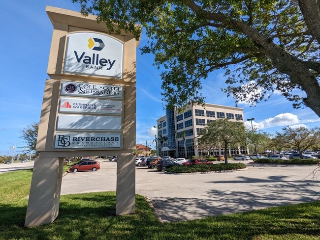
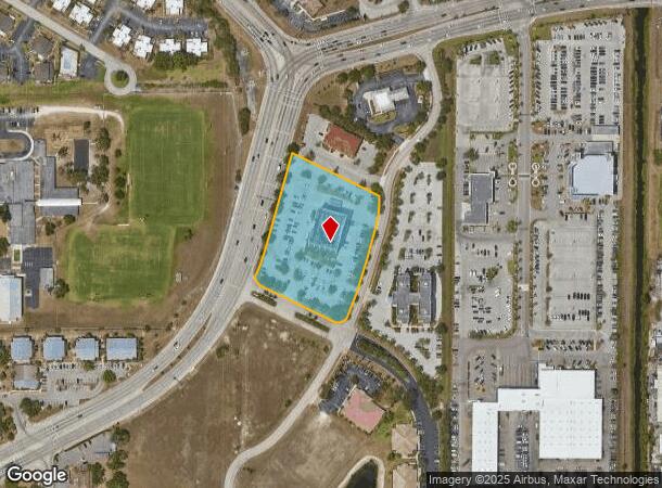
5220 Summerlin Commons Blvd, Fort Myers, FL 33907

Current Lease Availabilities
NEARBY LISTINGS FOR SALE OR LEASE
Property Detail
5220 Summerlin Commons Blvd
Cape Coral-Fort Myers, FL
Summerlin Rd Corridor
11-45-24-P2-03600.0030
SUMMERLIN COMMONS PB 70 PGS 81-84 LOTS 3 + 4
Officebuilding
Lee
X
Florida
12071C0409G
3,4
2024
3.19 AC
2025
S Ft Myers/San Carlos
001401
Southwest Florida
57,635 SF
DEMOGRAPHICS near 5220 Summerlin Commons Blvd
1 Mile
3 Mile
5 Mile
2024 Total Population
13,836
65,922
167,741
2029 Population
16,202
77,653
199,032
Pop Growth 2024-2029
+ 17.10%
+ 17.80%
+ 18.65%
Average Age
37
43
46
2024 Total Households
5,585
28,932
76,519
HH Growth 2024-2029
+ 16.71%
+ 17.33%
+ 18.34%
Median Household Inc
$41,709
$53,820
$59,061
Avg Household Size
2.30
2.10
2.10
2024 Avg HH Vehicles
1.00
1.00
2.00
Median Home Value
$250,339
$258,141
$282,146
Median Year Built
1981
1984
1988
Nearby Places
- Restaurants
- Banks
- Shops
- Fitness
- Groceries
PUBLIC TRANSPORTATION
AIRPORT
Southwest Florida International
DRIVE
WALK
Distance
Southwest Florida International
21 min
11.2 mi
Punta Gorda
DRIVE
WALK
Distance
Punta Gorda
42 min
32.7 mi
Freight Ports
Port Manatee
DRIVE
WALK
Distance
Port Manatee
122 min
104.4 mi
Nearby Properties
Address
Land Use
TOTAL SIZE
Lot Size
Zoning
Address
Land Use
TOTAL SIZE
Lot Size
Zoning
1,001,577 SF
140.54 AC
AG-2
Address
Land Use
TOTAL SIZE
Lot Size
Zoning
990,859 SF
38 AC
CI
Address
Land Use
TOTAL SIZE
Lot Size
Zoning
541,926 SF
54.06 AC
RM2
Address
Land Use
TOTAL SIZE
Lot Size
Zoning
689,351 SF
42.34 AC
RM-16/
Address
Land Use
TOTAL SIZE
Lot Size
Zoning
425,522 SF
380.73 AC
IL
Address
Land Use
TOTAL SIZE
Lot Size
Zoning
539,207 SF
61.09 AC
AG-2
Address
Land Use
TOTAL SIZE
Lot Size
Zoning
331,738 SF
39.51 AC
RM-10
Address
Land Use
TOTAL SIZE
Lot Size
Zoning
445,073 SF
44.82 AC
C-1
Address
Land Use
TOTAL SIZE
Lot Size
Zoning
427,764 SF
12.73 AC
C1
Address
Land Use
TOTAL SIZE
Lot Size
Zoning
441,655 SF
33.09 AC
RM-2
Address
Land Use
TOTAL SIZE
Lot Size
Zoning
749,922 SF
41.78 AC
C1
Address
Land Use
TOTAL SIZE
Lot Size
Zoning
364,206 SF
106.76 AC
PUD
Address
Land Use
TOTAL SIZE
Lot Size
Zoning
347,746 SF
29.74 AC
RM-10
Address
Land Use
TOTAL SIZE
Lot Size
Zoning
284,371 SF
12.61 AC
CG
Address
Land Use
TOTAL SIZE
Lot Size
Zoning
349,074 SF
39.54 AC
MPD
Address
Land Use
TOTAL SIZE
Lot Size
Zoning
381,135 SF
15.07 AC
MPD
Address
Land Use
TOTAL SIZE
Lot Size
Zoning
313,327 SF
29.72 AC
C-1
Address
Land Use
TOTAL SIZE
Lot Size
Zoning
281,781 SF
12.60 AC
C1
Address
Land Use
TOTAL SIZE
Lot Size
Zoning
13.71 AC
Address
Land Use
TOTAL SIZE
Lot Size
Zoning
357,679 SF
26.43 AC
PUD
Address
Land Use
TOTAL SIZE
Lot Size
Zoning
211,446 SF
7.81 AC
C1
Address
Land Use
TOTAL SIZE
Lot Size
Zoning
1,446 SF
9.81 AC
RS-6
Address
Land Use
TOTAL SIZE
Lot Size
Zoning
11.64 AC
C-1
Address
Land Use
TOTAL SIZE
Lot Size
Zoning
250,169 SF
10.67 AC
CI
Address
Land Use
TOTAL SIZE
Lot Size
Zoning
333,282 SF
25.70 AC
C1
Address
Land Use
TOTAL SIZE
Lot Size
Zoning
261,136 SF
11.68 AC
AG-2
Address
Land Use
TOTAL SIZE
Lot Size
Zoning
173,069 SF
34.58 AC
RS-6
Address
Land Use
TOTAL SIZE
Lot Size
Zoning
206,290 SF
31.37 AC
CFPD
Address
Land Use
TOTAL SIZE
Lot Size
Zoning
17,361 SF
19.88 AC
REC
Address
Land Use
TOTAL SIZE
Lot Size
Zoning
216,160 SF
10.73 AC
PO
The World's #1 Commercial Real Estate Marketplace
Connect with us
© 2025 CoStar Group
The information above has been obtained from sources believed reliable. While we do not doubt its accuracy we have not verified it and make no guarantee, warranty or representation about it. It is your responsibility to independently confirm its accuracy and completeness. Any projections, opinions, assumptions, or estimates used are for example only and do not represent the current or future performance of the property. The value of this transaction to you depends on tax and other factors which should be evaluated by your tax, financial, and legal advisors. You and your advisors should conduct a careful, independent investigation of the property to determine to your satisfaction the suitability of the property for your needs.