Property Record
5221 Intercoastal Dr, Monrovia, MD 21770

Property Detail
5221 Intercoastal Dr
09-592463
LOT 5A 4.77 ACRES INTERCOASTAL INDUSTRIAL
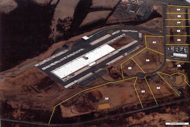
Warehouse
Frederick
GI
Maryland
B and X Area of moderate flood hazard, usually the area between the limits of the 100-year and 500-year floods.
5a
2024
4.77 AC
2025
Frederick
751903
Washington, DC
58,380 SF
Washington-Arlington-Alexandria, DC-VA-MD-WV
NEARBY LISTINGS FOR SALE OR LEASE
DEMOGRAPHICS near 5221 Intercoastal Dr
1 mile
3 mile
5 mile
2025 Total Population
3,209
21,985
59,735
2030 Population
3,449
23,966
64,716
Pop Growth 2025-2030
+ 7.48%
+ 9.01%
+ 8.34%
Average Age
36
38
39
2025 Total Households
1,036
7,321
19,664
HH Growth 2025-2030
+ 7.53%
+ 9.00%
+ 8.41%
Median Household Inc
$134,833
$165,010
$166,530
Avg Household Size
3.00
3.00
3.00
2025 Avg HH Vehicles
2.00
2.00
2.00
Median Home Value
$546,569
$590,356
$595,979
Median Year Built
1996
1996
1997
Nearby Places
Map Layers
Map Styles
 Street
 Aerial
Layers
 Traffic
 Biking
Places
Listings with unknown addresses are not visible on the map
- Restaurants
- Banks
- Shops
- Fitness
- Groceries
SALE & LEASE HISTORY
LISTING DATE
SALE/LEASE

Sep 24, 2016
For Sale
Nearby Properties
Address
Land Use
TOTAL SIZE
Lot Size
Zoning
Address
Land Use
TOTAL SIZE
Lot Size
Zoning
1,027,347 SF
123.95 AC
GI
Address
Land Use
TOTAL SIZE
Lot Size
Zoning
348,171 SF
12.76 AC
PUD
Address
Land Use
TOTAL SIZE
Lot Size
Zoning
254,000 SF
48.13 AC
PUD
Address
Land Use
TOTAL SIZE
Lot Size
Zoning
209,465 SF
32.49 AC
A
Address
Land Use
TOTAL SIZE
Lot Size
Zoning
72,065 SF
22 AC
PUD
Address
Land Use
TOTAL SIZE
Lot Size
Zoning
134,678 SF
19.92 AC
R1
Address
Land Use
TOTAL SIZE
Lot Size
Zoning
26,912 SF
17.65 AC
LI
Address
Land Use
TOTAL SIZE
Lot Size
Zoning
108,455 SF
16.59 AC
GC
Address
Land Use
TOTAL SIZE
Lot Size
Zoning
2,496 SF
125.75 AC
LI
Address
Land Use
TOTAL SIZE
Lot Size
Zoning
21,280 SF
2.02 AC
PUD
Address
Land Use
TOTAL SIZE
Lot Size
Zoning
41,076 SF
3.56 AC
LI
Address
Land Use
TOTAL SIZE
Lot Size
Zoning
51,998 SF
29.89 AC
R1
Address
Land Use
TOTAL SIZE
Lot Size
Zoning
31,697 SF
4.42 AC
GC
Address
Land Use
TOTAL SIZE
Lot Size
Zoning
37,878 SF
5.21 AC
GC
Address
Land Use
TOTAL SIZE
Lot Size
Zoning
50,624 SF
2 AC
I
Address
Land Use
TOTAL SIZE
Lot Size
Zoning
29,157 SF
12.15 AC
A
Address
Land Use
TOTAL SIZE
Lot Size
Zoning
36,914 SF
4.74 AC
GC
Address
Land Use
TOTAL SIZE
Lot Size
Zoning
9,703 SF
42.48 AC
A
Address
Land Use
TOTAL SIZE
Lot Size
Zoning
47,170 SF
5.22 AC
GC
Address
Land Use
TOTAL SIZE
Lot Size
Zoning
47,880 SF
12.68 AC
LI
Address
Land Use
TOTAL SIZE
Lot Size
Zoning
12,150 SF
1.50 AC
PUD
Address
Land Use
TOTAL SIZE
Lot Size
Zoning
18,638 SF
206.49 AC
A
Address
Land Use
TOTAL SIZE
Lot Size
Zoning
10,908 SF
2.45 AC
PUD
Address
Land Use
TOTAL SIZE
Lot Size
Zoning
28,022 SF
3.99 AC
LI
Address
Land Use
TOTAL SIZE
Lot Size
Zoning
12.22 AC
GC
Address
Land Use
TOTAL SIZE
Lot Size
Zoning
16,977 SF
3.79 AC
R1
Address
Land Use
TOTAL SIZE
Lot Size
Zoning
30,804 SF
2.31 AC
Address
Land Use
TOTAL SIZE
Lot Size
Zoning
29,515 SF
163.09 AC
A
Address
Land Use
TOTAL SIZE
Lot Size
Zoning
9 SF
22.53 AC
LI
The World's #1 Commercial Real Estate Marketplace
Connect with us
© 2026 CoStar Group
The information above has been obtained from sources believed reliable. While we do not doubt its accuracy we have not verified it and make no guarantee, warranty or representation about it. It is your responsibility to independently confirm its accuracy and completeness. Any projections, opinions, assumptions, or estimates used are for example only and do not represent the current or future performance of the property. The value of this transaction to you depends on tax and other factors which should be evaluated by your tax, financial, and legal advisors. You and your advisors should conduct a careful, independent investigation of the property to determine to your satisfaction the suitability of the property for your needs.