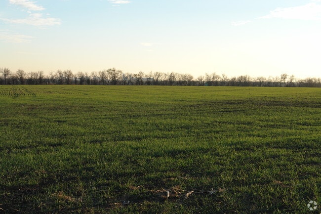
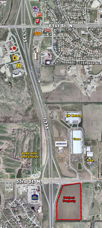
Property Record
5221 N Deere Rd, Park City, KS 67219
NEARBY LISTINGS FOR SALE OR LEASE
Property Detail
5221 N Deere Rd
095-21-0-12-01-001.00
P Clark Add
Servicestation
RESERVE A P CLARK ADD
X
Sedgwick
20173C0214G
Kansas
0
15.60 AC
2025
Northeast
0081002121
Wichita
62,459 SF
Wichita, KS
DEMOGRAPHICS near 5221 N Deere Rd
1 Mile
3 Mile
5 Mile
2024 Total Population
2,050
21,620
88,061
2029 Population
2,075
21,870
89,619
Pop Growth 2024-2029
+ 1.22%
+ 1.16%
+ 1.77%
Average Age
35
38
37
2024 Total Households
758
8,039
33,431
HH Growth 2024-2029
+ 1.19%
+ 1.09%
+ 1.69%
Median Household Inc
$79,067
$75,490
$60,054
Avg Household Size
2.70
2.70
2.50
2024 Avg HH Vehicles
2.00
2.00
2.00
Median Home Value
$176,600
$175,207
$160,694
Median Year Built
2002
1982
1976
Nearby Places
Map Layers
Map Styles
 Street
 Aerial
- Restaurants
- Banks
- Shops
- Fitness
- Groceries
PUBLIC TRANSPORTATION
AIRPORT
Wichita Dwight D Eisenhower Ntl
DRIVE
WALK
Distance
Wichita Dwight D Eisenhower Ntl
21 min
13.5 mi
Freight Ports
Tulsa Port Of Catoosa
DRIVE
WALK
Distance
Tulsa Port Of Catoosa
214 min
199.4 mi
Nearby Properties
Address
Land Use
TOTAL SIZE
Lot Size
Zoning
Address
Land Use
TOTAL SIZE
Lot Size
Zoning
924,000 SF
58.58 AC
SF-20
Address
Land Use
TOTAL SIZE
Lot Size
Zoning
304,863 SF
74.13 AC
SF5
Address
Land Use
TOTAL SIZE
Lot Size
Zoning
305,447 SF
46.77 AC
GI
Address
Land Use
TOTAL SIZE
Lot Size
Zoning
1,079,902 SF
68.86 AC
Address
Land Use
TOTAL SIZE
Lot Size
Zoning
147,784 SF
39.28 AC
SF-5
Address
Land Use
TOTAL SIZE
Lot Size
Zoning
64,133 SF
5.93 AC
SF-5
Address
Land Use
TOTAL SIZE
Lot Size
Zoning
92,735 SF
7.28 AC
R4
Address
Land Use
TOTAL SIZE
Lot Size
Zoning
292,500 SF
12.15 AC
LI
Address
Land Use
TOTAL SIZE
Lot Size
Zoning
72,001 SF
21.99 AC
LI
Address
Land Use
TOTAL SIZE
Lot Size
Zoning
60,945 SF
14.20 AC
SF-5
Address
Land Use
TOTAL SIZE
Lot Size
Zoning
87,018 SF
8.38 AC
LC
Address
Land Use
TOTAL SIZE
Lot Size
Zoning
1,179,118 SF
171.49 AC
LI
Address
Land Use
TOTAL SIZE
Lot Size
Zoning
94,251 SF
6.46 AC
C2
Address
Land Use
TOTAL SIZE
Lot Size
Zoning
76,039 SF
9.43 AC
R2
Address
Land Use
TOTAL SIZE
Lot Size
Zoning
25,748 SF
14.90 AC
MF-18
Address
Land Use
TOTAL SIZE
Lot Size
Zoning
52,947 SF
42.43 AC
B
Address
Land Use
TOTAL SIZE
Lot Size
Zoning
36,825 SF
10.47 AC
LC,SF-5
Address
Land Use
TOTAL SIZE
Lot Size
Zoning
33,361 SF
3.63 AC
Address
Land Use
TOTAL SIZE
Lot Size
Zoning
451,477 SF
58.44 AC
I1
Address
Land Use
TOTAL SIZE
Lot Size
Zoning
1,139,104 SF
89.68 AC
GI,LI
Address
Land Use
TOTAL SIZE
Lot Size
Zoning
50,838 SF
10.03 AC
GI
Address
Land Use
TOTAL SIZE
Lot Size
Zoning
35,000 SF
16.26 AC
Address
Land Use
TOTAL SIZE
Lot Size
Zoning
349,549 SF
19.11 AC
I1
Address
Land Use
TOTAL SIZE
Lot Size
Zoning
198,498 SF
15.50 AC
LC
Address
Land Use
TOTAL SIZE
Lot Size
Zoning
207,808 SF
1.15 AC
I1
Address
Land Use
TOTAL SIZE
Lot Size
Zoning
27,207 SF
9.78 AC
Address
Land Use
TOTAL SIZE
Lot Size
Zoning
35,040 SF
6.52 AC
LI
Address
Land Use
TOTAL SIZE
Lot Size
Zoning
26,000 SF
6.07 AC
SF-20
Address
Land Use
TOTAL SIZE
Lot Size
Zoning
272,864 SF
5.40 AC
I1
Address
Land Use
TOTAL SIZE
Lot Size
Zoning
15,360 SF
0.57 AC
CVCP*
The World's #1 Commercial Real Estate Marketplace
Connect with us
© 2025 CoStar Group
The information above has been obtained from sources believed reliable. While we do not doubt its accuracy we have not verified it and make no guarantee, warranty or representation about it. It is your responsibility to independently confirm its accuracy and completeness. Any projections, opinions, assumptions, or estimates used are for example only and do not represent the current or future performance of the property. The value of this transaction to you depends on tax and other factors which should be evaluated by your tax, financial, and legal advisors. You and your advisors should conduct a careful, independent investigation of the property to determine to your satisfaction the suitability of the property for your needs.