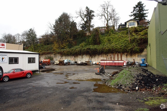
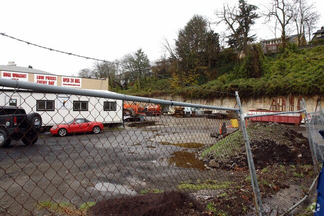
Property Record
5221 Ne Sandy Blvd, Portland, OR 97213

Property Detail
5221 Ne Sandy Blvd
R319212
SECTION 30 1N 2E, TL 1100 0.77 ACRES
Commercialacreage
MULTNOMAH
R2.5
Oregon
B and X Area of moderate flood hazard, usually the area between the limits of the 100-year and 500-year floods.
0.77 AC
2025
Gateway
2025
Portland
002802
Portland-Vancouver-Hillsboro, OR-WA
272 SF
NEARBY LISTINGS FOR SALE OR LEASE
DEMOGRAPHICS near 5221 Ne Sandy Blvd
1 mile
3 mile
5 mile
2024 Total Population
22,449
196,515
447,470
2029 Population
21,921
193,702
443,316
Pop Growth 2024-2029
(2.35%)
(1.43%)
(0.93%)
Average Age
43
41
41
2024 Total Households
9,729
87,766
201,803
HH Growth 2024-2029
(2.58%)
(1.56%)
(0.99%)
Median Household Inc
$108,338
$93,236
$86,792
Avg Household Size
2.20
2.10
2.10
2024 Avg HH Vehicles
2.00
1.00
1.00
Median Home Value
$729,120
$678,298
$621,692
Median Year Built
1946
1949
1960
Nearby Places
Map Layers
Map Styles
 Street
 Aerial
Transit
 Traffic
 Biking
Places
Listings with unknown addresses are not visible on the map
- Restaurants
- Banks
- Shops
- Fitness
- Groceries
PUBLIC TRANSPORTATION
TRANSIT/SUBWAY
Hollywood/NE 42nd Transit Center (MAX Blue Line - Tri-County Metropolitan Transportation District of Oregon Rail (TriMet Rail), MAX Green Line - Tri-County Metropolitan Transportation District of Oregon Rail (TriMet Rail), MAX Red Line - Tri-County Metropolitan Transportation District of Oregon Rail (TriMet Rail))
Drive
Walk
Distance
Hollywood/NE 42nd Transit Center (MAX Blue Line - Tri-County Metropolitan Transportation District of Oregon Rail (TriMet Rail), MAX Green Line - Tri-County Metropolitan Transportation District of Oregon Rail (TriMet Rail), MAX Red Line - Tri-County Metropolitan Transportation District of Oregon Rail (TriMet Rail))
7 min
18 min
0.9 mi
COMMUTER RAIL
Drive
Walk
Distance
10 min
4.6 mi
AIRPORT
Portland International
Drive
Walk
Distance
Portland International
13 min
5.2 mi
Freight Ports
Port of Portland
Drive
Walk
Distance
Port of Portland
13 min
6.7 mi
Nearby Properties
Address
Land Use
TOTAL SIZE
Lot Size
Zoning
Address
Land Use
TOTAL SIZE
Lot Size
Zoning
395,815 SF
2.66 AC
IRD
Address
Land Use
TOTAL SIZE
Lot Size
Zoning
627,500 SF
16.60 AC
CX
Address
Land Use
TOTAL SIZE
Lot Size
Zoning
417,324 SF
0.68 AC
CX
Address
Land Use
TOTAL SIZE
Lot Size
Zoning
178,785 SF
10.20 AC
R5
Address
Land Use
TOTAL SIZE
Lot Size
Zoning
197,027 SF
28.54 AC
R7H
Address
Land Use
TOTAL SIZE
Lot Size
Zoning
817,845 SF
22.54 AC
IG2
Address
Land Use
TOTAL SIZE
Lot Size
Zoning
296,039 SF
11.70 AC
R5
Address
Land Use
TOTAL SIZE
Lot Size
Zoning
7.78 AC
EX
Address
Land Use
TOTAL SIZE
Lot Size
Zoning
183,664 SF
8.96 AC
R5
Address
Land Use
TOTAL SIZE
Lot Size
Zoning
280,069 SF
18.31 AC
IR
Address
Land Use
TOTAL SIZE
Lot Size
Zoning
247,520 SF
7.74 AC
CX
Address
Land Use
TOTAL SIZE
Lot Size
Zoning
193,898 SF
2.50 AC
IRD
Address
Land Use
TOTAL SIZE
Lot Size
Zoning
134,398 SF
3.17 AC
CG
Address
Land Use
TOTAL SIZE
Lot Size
Zoning
23.95 AC
IG2
Address
Land Use
TOTAL SIZE
Lot Size
Zoning
2,218,439 SF
21.88 AC
CX
Address
Land Use
TOTAL SIZE
Lot Size
Zoning
105.72 AC
IG2
Address
Land Use
TOTAL SIZE
Lot Size
Zoning
360,053 SF
0.71 AC
EXD
Address
Land Use
TOTAL SIZE
Lot Size
Zoning
54,676 SF
190.32 AC
OS
Address
Land Use
TOTAL SIZE
Lot Size
Zoning
42,839,055 SF
19.25 AC
CI1
Address
Land Use
TOTAL SIZE
Lot Size
Zoning
40,595 SF
1.99 AC
IRD
Address
Land Use
TOTAL SIZE
Lot Size
Zoning
96,554 SF
2.02 AC
CM3
Address
Land Use
TOTAL SIZE
Lot Size
Zoning
320,732 SF
1.14 AC
CX
Address
Land Use
TOTAL SIZE
Lot Size
Zoning
152,575 SF
5.32 AC
EG1
Address
Land Use
TOTAL SIZE
Lot Size
Zoning
317,656 SF
21.94 AC
CX
Address
Land Use
TOTAL SIZE
Lot Size
Zoning
440,000 SF
1.80 AC
CX
Address
Land Use
TOTAL SIZE
Lot Size
Zoning
11,375 SF
1.46 AC
CI2
Address
Land Use
TOTAL SIZE
Lot Size
Zoning
785,000 SF
4 AC
NULL
Address
Land Use
TOTAL SIZE
Lot Size
Zoning
64,673 SF
NULL
Address
Land Use
TOTAL SIZE
Lot Size
Zoning
88,789 SF
1.48 AC
EX
Address
Land Use
TOTAL SIZE
Lot Size
Zoning
47.70 AC
IG2
The World's #1 Commercial Real Estate Marketplace
Connect with us
© 2026 CoStar Group
The information above has been obtained from sources believed reliable. While we do not doubt its accuracy we have not verified it and make no guarantee, warranty or representation about it. It is your responsibility to independently confirm its accuracy and completeness. Any projections, opinions, assumptions, or estimates used are for example only and do not represent the current or future performance of the property. The value of this transaction to you depends on tax and other factors which should be evaluated by your tax, financial, and legal advisors. You and your advisors should conduct a careful, independent investigation of the property to determine to your satisfaction the suitability of the property for your needs.