Property Record
5222 Whigham Cir, Tuscaloosa, AL 35405


NEARBY LISTINGS FOR SALE OR LEASE
Property Detail
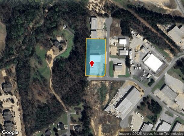
5222 Whigham Cir
Tuscaloosa, AL
Metro Ind Pk 6 Res
36-01-02-3-002-002.033
LOT 14M METRO INDUSTRIAL PARK PH 6 RESURVEY
Autorepair
Tuscaloosa
X
Alabama
01125C0516G
14m
2025
1.94 AC
2024
Tuscaloosa
012403
Birmingham
17,920 SF
DEMOGRAPHICS near 5222 Whigham Cir
1 Mile
3 Mile
5 Mile
2024 Total Population
4,239
50,475
120,189
2029 Population
4,718
57,508
135,386
Pop Growth 2024-2029
+ 11.30%
+ 13.93%
+ 12.64%
Average Age
34
35
34
2024 Total Households
1,993
22,015
46,044
HH Growth 2024-2029
+ 10.54%
+ 13.52%
+ 14.34%
Median Household Inc
$54,475
$37,271
$40,913
Avg Household Size
2.10
2.20
2.10
2024 Avg HH Vehicles
2.00
2.00
2.00
Median Home Value
$169,999
$173,364
$190,284
Median Year Built
1999
1989
1990
Nearby Places
Map Layers
Map Styles
 Street
 Aerial
- Restaurants
- Banks
- Shops
- Fitness
- Groceries
PUBLIC TRANSPORTATION
COMMUTER RAIL
Tuscaloosa Amtrak Station (Crescent - Amtrak)
DRIVE
WALK
Distance
Tuscaloosa Amtrak Station (Crescent - Amtrak)
7 min
3.5 mi
Freight Ports
Port of Mobile
DRIVE
WALK
Distance
Port of Mobile
237 min
192.3 mi
Nearby Properties
Address
Land Use
TOTAL SIZE
Lot Size
Zoning
Address
Land Use
TOTAL SIZE
Lot Size
Zoning
11,278 SF
145 AC
R3
Address
Land Use
TOTAL SIZE
Lot Size
Zoning
9,258 SF
19 AC
R4
Address
Land Use
TOTAL SIZE
Lot Size
Zoning
252,793 SF
2.73 AC
BN
Address
Land Use
TOTAL SIZE
Lot Size
Zoning
24,165 SF
28 AC
BN
Address
Land Use
TOTAL SIZE
Lot Size
Zoning
8,760 SF
23 AC
R4
Address
Land Use
TOTAL SIZE
Lot Size
Zoning
25,920 SF
16 AC
RMF1
Address
Land Use
TOTAL SIZE
Lot Size
Zoning
6,579 SF
15.07 AC
RMF1
Address
Land Use
TOTAL SIZE
Lot Size
Zoning
11,804 SF
76 AC
Address
Land Use
TOTAL SIZE
Lot Size
Zoning
13,804 SF
17.76 AC
Address
Land Use
TOTAL SIZE
Lot Size
Zoning
110,337 SF
0.91 AC
RMF2
Address
Land Use
TOTAL SIZE
Lot Size
Zoning
5,377 SF
22 AC
RMF1
Address
Land Use
TOTAL SIZE
Lot Size
Zoning
9,328 SF
19 AC
RMF1
Address
Land Use
TOTAL SIZE
Lot Size
Zoning
12 AC
R1
Address
Land Use
TOTAL SIZE
Lot Size
Zoning
34 AC
R-3
Address
Land Use
TOTAL SIZE
Lot Size
Zoning
25,155 SF
6 AC
R4
Address
Land Use
TOTAL SIZE
Lot Size
Zoning
16,000 SF
12 AC
RMF1
Address
Land Use
TOTAL SIZE
Lot Size
Zoning
25,422 SF
8.90 AC
RMF1
Address
Land Use
TOTAL SIZE
Lot Size
Zoning
193,154 SF
20 AC
BN
Address
Land Use
TOTAL SIZE
Lot Size
Zoning
68,796 SF
11.30 AC
MG
Address
Land Use
TOTAL SIZE
Lot Size
Zoning
8,960 SF
19 AC
R4
Address
Land Use
TOTAL SIZE
Lot Size
Zoning
7,536 SF
11 AC
R4
Address
Land Use
TOTAL SIZE
Lot Size
Zoning
18,828 SF
5 AC
R2
Address
Land Use
TOTAL SIZE
Lot Size
Zoning
20,535 SF
5.50 AC
R4
Address
Land Use
TOTAL SIZE
Lot Size
Zoning
65,868 SF
1.47 AC
RMF2
Address
Land Use
TOTAL SIZE
Lot Size
Zoning
314,500 SF
9.97 AC
MG
Address
Land Use
TOTAL SIZE
Lot Size
Zoning
2,090 SF
9.49 AC
Address
Land Use
TOTAL SIZE
Lot Size
Zoning
25,920 SF
4 AC
RMF1
Address
Land Use
TOTAL SIZE
Lot Size
Zoning
4,620 SF
12.55 AC
R4
Address
Land Use
TOTAL SIZE
Lot Size
Zoning
5,508 SF
0.14 AC
RM2
Address
Land Use
TOTAL SIZE
Lot Size
Zoning
2.30 AC
I
The World's #1 Commercial Real Estate Marketplace
Connect with us
© 2025 CoStar Group
The information above has been obtained from sources believed reliable. While we do not doubt its accuracy we have not verified it and make no guarantee, warranty or representation about it. It is your responsibility to independently confirm its accuracy and completeness. Any projections, opinions, assumptions, or estimates used are for example only and do not represent the current or future performance of the property. The value of this transaction to you depends on tax and other factors which should be evaluated by your tax, financial, and legal advisors. You and your advisors should conduct a careful, independent investigation of the property to determine to your satisfaction the suitability of the property for your needs.