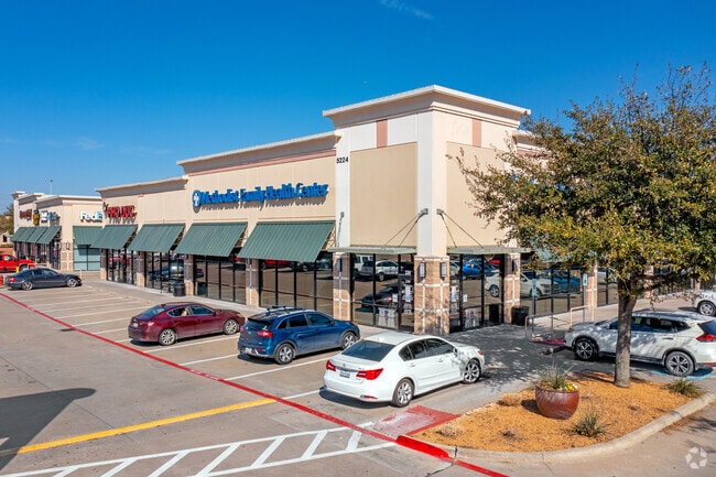
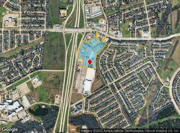
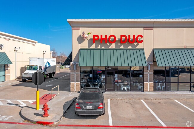
Property Record
5260 S State Highway 360, Grand Prairie, TX 75052
NEARBY LISTINGS FOR SALE OR LEASE
Property Detail
5260 S State Highway 360
Dallas-Fort Worth-Arlington, TX
Lake Prairie Towne Crossing Addition
41363515
LAKE PRAIRIE TOWNE CROSSING BLOCK A LOT 3R1 SCHOOL BOUNDARY SPLIT
Commercialnec
Tarrant
X
Texas
48439C0370L
3
2024
14.49 AC
2025
South Grand Prairie
111563
Dallas/Ft Worth
165,539 SF
DEMOGRAPHICS near 5260 S State Highway 360
1 Mile
3 Mile
5 Mile
2024 Total Population
12,185
94,333
272,973
2029 Population
12,825
98,298
283,702
Pop Growth 2024-2029
+ 5.25%
+ 4.20%
+ 3.93%
Average Age
36
36
36
2024 Total Households
3,631
29,758
87,831
HH Growth 2024-2029
+ 5.32%
+ 4.27%
+ 3.96%
Median Household Inc
$99,802
$84,772
$78,856
Avg Household Size
3.30
3.10
3.00
2024 Avg HH Vehicles
2.00
2.00
2.00
Median Home Value
$249,748
$245,265
$250,350
Median Year Built
1998
1998
1994
Nearby Places
Map Layers
Map Styles
 Street
 Aerial
- Restaurants
- Banks
- Shops
- Fitness
- Groceries
PUBLIC TRANSPORTATION
AIRPORT
Dallas-Fort Worth International
DRIVE
WALK
Distance
Dallas-Fort Worth International
28 min
19.7 mi
Dallas Love Field
DRIVE
WALK
Distance
Dallas Love Field
38 min
28.3 mi
Freight Ports
Port of Shreveport
DRIVE
WALK
Distance
Port of Shreveport
230 min
214.0 mi
SALE & LEASE HISTORY
LISTING DATE
SALE/LEASE

Sep 25, 2016
For Lease
Nearby Properties
Address
Land Use
TOTAL SIZE
Lot Size
Zoning
Address
Land Use
TOTAL SIZE
Lot Size
Zoning
399,570 SF
75.21 AC
Address
Land Use
TOTAL SIZE
Lot Size
Zoning
804,384 SF
48.38 AC
Address
Land Use
TOTAL SIZE
Lot Size
Zoning
456,473 SF
32.79 AC
Address
Land Use
TOTAL SIZE
Lot Size
Zoning
324,849 SF
13.52 AC
Address
Land Use
TOTAL SIZE
Lot Size
Zoning
1,114,563 SF
89.72 AC
Address
Land Use
TOTAL SIZE
Lot Size
Zoning
368,004 SF
13.89 AC
Address
Land Use
TOTAL SIZE
Lot Size
Zoning
453,257 SF
121.21 AC
Address
Land Use
TOTAL SIZE
Lot Size
Zoning
326,267 SF
13.11 AC
Address
Land Use
TOTAL SIZE
Lot Size
Zoning
352,649 SF
17.16 AC
Address
Land Use
TOTAL SIZE
Lot Size
Zoning
260,008 SF
139.37 AC
Address
Land Use
TOTAL SIZE
Lot Size
Zoning
419,875 SF
108.14 AC
Address
Land Use
TOTAL SIZE
Lot Size
Zoning
375,213 SF
17.77 AC
Address
Land Use
TOTAL SIZE
Lot Size
Zoning
298,234 SF
23.39 AC
Address
Land Use
TOTAL SIZE
Lot Size
Zoning
270,214 SF
17.85 AC
Address
Land Use
TOTAL SIZE
Lot Size
Zoning
821,502 SF
45.37 AC
Address
Land Use
TOTAL SIZE
Lot Size
Zoning
352,999 SF
60.81 AC
Address
Land Use
TOTAL SIZE
Lot Size
Zoning
315,359 SF
15 AC
Address
Land Use
TOTAL SIZE
Lot Size
Zoning
229,000 SF
8.01 AC
Address
Land Use
TOTAL SIZE
Lot Size
Zoning
302,022 SF
15.37 AC
Address
Land Use
TOTAL SIZE
Lot Size
Zoning
193,680 SF
8.25 AC
Address
Land Use
TOTAL SIZE
Lot Size
Zoning
258,908 SF
22.41 AC
Address
Land Use
TOTAL SIZE
Lot Size
Zoning
772,625 SF
43.80 AC
Address
Land Use
TOTAL SIZE
Lot Size
Zoning
723,840 SF
39.78 AC
Address
Land Use
TOTAL SIZE
Lot Size
Zoning
264,503 SF
17.48 AC
Address
Land Use
TOTAL SIZE
Lot Size
Zoning
460,400 SF
28.09 AC
Z236
Address
Land Use
TOTAL SIZE
Lot Size
Zoning
260,816 SF
11.52 AC
Address
Land Use
TOTAL SIZE
Lot Size
Zoning
77,038 SF
11.46 AC
Address
Land Use
TOTAL SIZE
Lot Size
Zoning
175,484 SF
18.99 AC
Address
Land Use
TOTAL SIZE
Lot Size
Zoning
557,478 SF
28.73 AC
The World's #1 Commercial Real Estate Marketplace
Connect with us
© 2026 CoStar Group
The information above has been obtained from sources believed reliable. While we do not doubt its accuracy we have not verified it and make no guarantee, warranty or representation about it. It is your responsibility to independently confirm its accuracy and completeness. Any projections, opinions, assumptions, or estimates used are for example only and do not represent the current or future performance of the property. The value of this transaction to you depends on tax and other factors which should be evaluated by your tax, financial, and legal advisors. You and your advisors should conduct a careful, independent investigation of the property to determine to your satisfaction the suitability of the property for your needs.