Property Record
5227 Alexis Rd, Sylvania, OH 43560
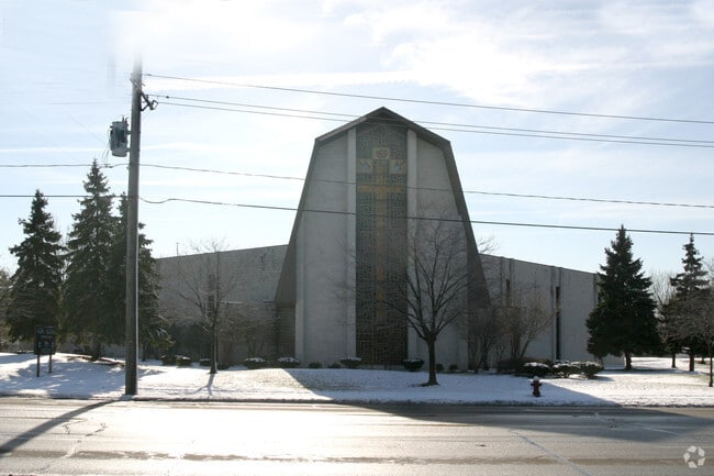


Property Detail
5227 Alexis Rd
82-05168
6 9 11 NE 1/4 S L FULLERS SUB LOT 6 5 AC W OF SLYFORDPLACE N OF BLAKSLEY
Religious
LUCAS
31-B2
Ohio
B and X Area of moderate flood hazard, usually the area between the limits of the 100-year and 500-year floods.
6
0
14.01 AC
2025
West/Sylvania
008206
Toledo
135,978 SF
Toledo, OH
NEARBY LISTINGS FOR SALE OR LEASE
DEMOGRAPHICS near 5227 Alexis Rd
1 mile
3 mile
5 mile
2025 Total Population
6,565
49,393
148,678
2030 Population
6,433
48,255
146,519
Pop Growth 2025-2030
(2.01%)
(2.30%)
(1.45%)
Average Age
42
43
41
2025 Total Households
2,726
21,236
63,290
HH Growth 2025-2030
(2.05%)
(2.30%)
(1.40%)
Median Household Inc
$79,453
$80,612
$75,684
Avg Household Size
2.40
2.30
2.30
2025 Avg HH Vehicles
2.00
2.00
2.00
Median Home Value
$210,915
$205,615
$196,913
Median Year Built
1969
1967
1966
Nearby Places
Map Layers
Map Styles
 Street
 Aerial
Layers
 Traffic
 Biking
Places
Listings with unknown addresses are not visible on the map
- Restaurants
- Banks
- Shops
- Fitness
- Groceries
PUBLIC TRANSPORTATION
COMMUTER RAIL
Drive
Walk
Distance
18 min
9.7 mi
AIRPORT
Eugene F Kranz Toledo Express
Drive
Walk
Distance
Eugene F Kranz Toledo Express
34 min
19.1 mi
Detroit Metro Wayne County
Drive
Walk
Distance
Detroit Metro Wayne County
66 min
48.8 mi
Nearby Properties
Address
Land Use
TOTAL SIZE
Lot Size
Zoning
Address
Land Use
TOTAL SIZE
Lot Size
Zoning
607,717 SF
7.39 AC
31-R3
Address
Land Use
TOTAL SIZE
Lot Size
Zoning
253,662 SF
16.59 AC
10-MX
Address
Land Use
TOTAL SIZE
Lot Size
Zoning
460,266 SF
85.36 AC
31-R1
Address
Land Use
TOTAL SIZE
Lot Size
Zoning
15.79 AC
31-B4
Address
Land Use
TOTAL SIZE
Lot Size
Zoning
312,089 SF
6.34 AC
31-B5
Address
Land Use
TOTAL SIZE
Lot Size
Zoning
7.71 AC
10-CRSO
Address
Land Use
TOTAL SIZE
Lot Size
Zoning
238,200 SF
32.90 AC
31-R1
Address
Land Use
TOTAL SIZE
Lot Size
Zoning
12.52 AC
10-CRSO
Address
Land Use
TOTAL SIZE
Lot Size
Zoning
293,770 SF
13.95 AC
10-RS6
Address
Land Use
TOTAL SIZE
Lot Size
Zoning
260,875 SF
9.91 AC
20-R5
Address
Land Use
TOTAL SIZE
Lot Size
Zoning
166,837 SF
23.82 AC
10-MX
Address
Land Use
TOTAL SIZE
Lot Size
Zoning
78,678 SF
10.20 AC
31-R1
Address
Land Use
TOTAL SIZE
Lot Size
Zoning
222,493 SF
29.88 AC
10-IC
Address
Land Use
TOTAL SIZE
Lot Size
Zoning
49,960 SF
8.33 AC
10-CO
Address
Land Use
TOTAL SIZE
Lot Size
Zoning
51,129 SF
460.05 AC
20-S1
Address
Land Use
TOTAL SIZE
Lot Size
Zoning
154,003 SF
14 AC
10-MX
Address
Land Use
TOTAL SIZE
Lot Size
Zoning
169,580 SF
8.98 AC
20-C2
Address
Land Use
TOTAL SIZE
Lot Size
Zoning
174,890 SF
19.86 AC
31-R3
Address
Land Use
TOTAL SIZE
Lot Size
Zoning
52,429 SF
3.79 AC
10-CO
Address
Land Use
TOTAL SIZE
Lot Size
Zoning
123,985 SF
9.74 AC
10-MX
Address
Land Use
TOTAL SIZE
Lot Size
Zoning
84,485 SF
8.41 AC
20-C2
Address
Land Use
TOTAL SIZE
Lot Size
Zoning
214,400 SF
13.07 AC
20-C2
Address
Land Use
TOTAL SIZE
Lot Size
Zoning
109,712 SF
10.64 AC
10-MX
Address
Land Use
TOTAL SIZE
Lot Size
Zoning
63,445 SF
5.72 AC
20-C4
Address
Land Use
TOTAL SIZE
Lot Size
Zoning
243,247 SF
11.66 AC
20-R5PUD
Address
Land Use
TOTAL SIZE
Lot Size
Zoning
78,266 SF
13.57 AC
20-S1
Address
Land Use
TOTAL SIZE
Lot Size
Zoning
44,028 SF
3.92 AC
10-MX
Address
Land Use
TOTAL SIZE
Lot Size
Zoning
81,608 SF
4 AC
12-A12
Address
Land Use
TOTAL SIZE
Lot Size
Zoning
54,085 SF
0.81 AC
20-S1
The World's #1 Commercial Real Estate Marketplace
Connect with us
© 2026 CoStar Group
The information above has been obtained from sources believed reliable. While we do not doubt its accuracy we have not verified it and make no guarantee, warranty or representation about it. It is your responsibility to independently confirm its accuracy and completeness. Any projections, opinions, assumptions, or estimates used are for example only and do not represent the current or future performance of the property. The value of this transaction to you depends on tax and other factors which should be evaluated by your tax, financial, and legal advisors. You and your advisors should conduct a careful, independent investigation of the property to determine to your satisfaction the suitability of the property for your needs.