Property Record
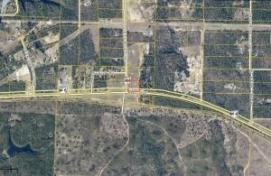
5227 Highway 393, Crestview, FL 32539

Property Detail
5227 Highway 393
15-3N-22-0000-0029-0000
300 FT SQ IN NE INTERSECTION OF DORCAS RD & US 90 IN N1/2 OF S1/2 OF SE1/4 OF SW1/4 OR 913-484
Storemultistory
Okaloosa
B and X Area of moderate flood hazard, usually the area between the limits of the 100-year and 500-year floods.
Florida
2025
2.08 AC
2025
Fort Walton Beach
020306
Other Market Areas
9,504 SF
Crestview-Fort Walton Beach-Destin, FL
NEARBY LISTINGS FOR SALE OR LEASE
DEMOGRAPHICS near 5227 Highway 393
1 mile
3 mile
5 mile
2025 Total Population
234
2,155
4,742
2030 Population
243
2,240
4,934
Pop Growth 2025-2030
+ 3.85%
+ 3.94%
+ 4.05%
Average Age
38
39
40
2025 Total Households
87
793
1,735
HH Growth 2025-2030
+ 3.45%
+ 3.78%
+ 3.86%
Median Household Inc
$86,029
$88,617
$89,169
Avg Household Size
2.60
2.60
2.60
2025 Avg HH Vehicles
2.00
2.00
2.00
Median Home Value
$305,882
$323,512
$316,793
Median Year Built
2005
2004
2002
Nearby Places
Map Layers
Map Styles
 Street
 Aerial
Transit
 Traffic
 Biking
Places
Listings with unknown addresses are not visible on the map
- Restaurants
- Banks
- Shops
- Fitness
- Groceries
PUBLIC TRANSPORTATION
AIRPORT
Eglin AFB/Destin-Ft Walton Beach
Drive
Walk
Distance
Eglin AFB/Destin-Ft Walton Beach
56 min
28.9 mi
Freight Ports
Port of Panama City
Drive
Walk
Distance
Port of Panama City
101 min
76.3 mi
SALE & LEASE HISTORY
LISTING DATE
SALE/LEASE

Sep 24, 2016
For Sale
Nearby Properties
Address
Land Use
TOTAL SIZE
Lot Size
Zoning
Address
Land Use
TOTAL SIZE
Lot Size
Zoning
358.97 AC
Address
Land Use
TOTAL SIZE
Lot Size
Zoning
10,448 SF
2.92 AC
Address
Land Use
TOTAL SIZE
Lot Size
Zoning
5,985 SF
36.51 AC
Address
Land Use
TOTAL SIZE
Lot Size
Zoning
6,622 SF
40 AC
RRS-3
Address
Land Use
TOTAL SIZE
Lot Size
Zoning
243.47 AC
Address
Land Use
TOTAL SIZE
Lot Size
Zoning
4,590 SF
13.80 AC
Address
Land Use
TOTAL SIZE
Lot Size
Zoning
4,201 SF
35.73 AC
Address
Land Use
TOTAL SIZE
Lot Size
Zoning
87.90 AC
RR
Address
Land Use
TOTAL SIZE
Lot Size
Zoning
7,706 SF
10.06 AC
Address
Land Use
TOTAL SIZE
Lot Size
Zoning
161.74 AC
Address
Land Use
TOTAL SIZE
Lot Size
Zoning
5,626 SF
71.73 AC
Address
Land Use
TOTAL SIZE
Lot Size
Zoning
392 SF
10.08 AC
Address
Land Use
TOTAL SIZE
Lot Size
Zoning
164.96 AC
Address
Land Use
TOTAL SIZE
Lot Size
Zoning
3,043 SF
40 AC
RRS-3
Address
Land Use
TOTAL SIZE
Lot Size
Zoning
5,167 SF
11.93 AC
Address
Land Use
TOTAL SIZE
Lot Size
Zoning
2,944 SF
659.53 AC
Address
Land Use
TOTAL SIZE
Lot Size
Zoning
5,648 SF
8.91 AC
Address
Land Use
TOTAL SIZE
Lot Size
Zoning
3,793 SF
60 AC
Address
Land Use
TOTAL SIZE
Lot Size
Zoning
864 SF
19.08 AC
Address
Land Use
TOTAL SIZE
Lot Size
Zoning
Address
Land Use
TOTAL SIZE
Lot Size
Zoning
4,384 SF
99.23 AC
Address
Land Use
TOTAL SIZE
Lot Size
Zoning
2,418 SF
62.54 AC
Address
Land Use
TOTAL SIZE
Lot Size
Zoning
2,685 SF
371.50 AC
Address
Land Use
TOTAL SIZE
Lot Size
Zoning
2,350 SF
26.92 AC
Address
Land Use
TOTAL SIZE
Lot Size
Zoning
Address
Land Use
TOTAL SIZE
Lot Size
Zoning
3,625 SF
10 AC
Address
Land Use
TOTAL SIZE
Lot Size
Zoning
3,666 SF
18 AC
Address
Land Use
TOTAL SIZE
Lot Size
Zoning
4,934 SF
2.60 AC
Address
Land Use
TOTAL SIZE
Lot Size
Zoning
2,584 SF
60 AC
The World's #1 Commercial Real Estate Marketplace
Connect with us
© 2026 CoStar Group
The information above has been obtained from sources believed reliable. While we do not doubt its accuracy we have not verified it and make no guarantee, warranty or representation about it. It is your responsibility to independently confirm its accuracy and completeness. Any projections, opinions, assumptions, or estimates used are for example only and do not represent the current or future performance of the property. The value of this transaction to you depends on tax and other factors which should be evaluated by your tax, financial, and legal advisors. You and your advisors should conduct a careful, independent investigation of the property to determine to your satisfaction the suitability of the property for your needs.