Property Record
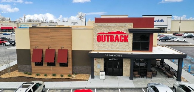
I-70 N Service Rd, St Peters, MO 63376


NEARBY LISTINGS FOR SALE OR LEASE
Property Detail
I-70 N Service Rd
St. Louis, MO-IL
Quiktrip Subdivision Pb 27 Page 138 And
T180400071
KAPLAN SUB #3 FINAL PLAT LOT OL D
Commercialnec
St. Charles
X
Missouri
29183C0261G
old
2024
1.29 AC
2025
St Charles Region
311311
St. Louis
6,585 SF
DEMOGRAPHICS near I-70 N Service Rd
1 Mile
3 Mile
5 Mile
2024 Total Population
5,224
51,751
148,635
2029 Population
5,548
54,652
156,748
Pop Growth 2024-2029
+ 6.20%
+ 5.61%
+ 5.46%
Average Age
44
42
41
2024 Total Households
2,351
20,386
58,698
HH Growth 2024-2029
+ 6.34%
+ 5.74%
+ 5.57%
Median Household Inc
$56,534
$86,106
$88,888
Avg Household Size
2.10
2.50
2.50
2024 Avg HH Vehicles
2.00
2.00
2.00
Median Home Value
$157,964
$236,831
$255,618
Median Year Built
1981
1986
1988
Nearby Places
Map Layers
Map Styles
 Street
 Aerial
- Restaurants
- Banks
- Shops
- Fitness
- Groceries
PUBLIC TRANSPORTATION
AIRPORT
St Louis Lambert International
DRIVE
WALK
Distance
St Louis Lambert International
26 min
17.9 mi
Freight Ports
Port Milwaukee
DRIVE
WALK
Distance
Port Milwaukee
445 min
391.0 mi
SALE & LEASE HISTORY
LISTING DATE
SALE/LEASE

Apr 11, 2019
For Sale
Nearby Properties
Address
Land Use
TOTAL SIZE
Lot Size
Zoning
Address
Land Use
TOTAL SIZE
Lot Size
Zoning
855,000 SF
39.97 AC
Address
Land Use
TOTAL SIZE
Lot Size
Zoning
500,420 SF
99.80 AC
Address
Land Use
TOTAL SIZE
Lot Size
Zoning
719,340 SF
48.06 AC
Address
Land Use
TOTAL SIZE
Lot Size
Zoning
810,640 SF
48.73 AC
Address
Land Use
TOTAL SIZE
Lot Size
Zoning
423,000 SF
18.07 AC
Address
Land Use
TOTAL SIZE
Lot Size
Zoning
136,142 SF
31.16 AC
Address
Land Use
TOTAL SIZE
Lot Size
Zoning
189,054 SF
24.92 AC
AA1
Address
Land Use
TOTAL SIZE
Lot Size
Zoning
253,800 SF
17.09 AC
Address
Land Use
TOTAL SIZE
Lot Size
Zoning
71,908 SF
8.72 AC
Address
Land Use
TOTAL SIZE
Lot Size
Zoning
279,526 SF
7.73 AC
Address
Land Use
TOTAL SIZE
Lot Size
Zoning
80,771 SF
41.99 AC
Address
Land Use
TOTAL SIZE
Lot Size
Zoning
143,897 SF
7.17 AC
Address
Land Use
TOTAL SIZE
Lot Size
Zoning
490,200 SF
36.53 AC
Address
Land Use
TOTAL SIZE
Lot Size
Zoning
433,744 SF
19.38 AC
Address
Land Use
TOTAL SIZE
Lot Size
Zoning
182,783 SF
19.83 AC
Address
Land Use
TOTAL SIZE
Lot Size
Zoning
449,111 SF
16.30 AC
AE2
Address
Land Use
TOTAL SIZE
Lot Size
Zoning
25,778 SF
5.62 AC
Address
Land Use
TOTAL SIZE
Lot Size
Zoning
337,411 SF
7.97 AC
Address
Land Use
TOTAL SIZE
Lot Size
Zoning
56,430 SF
14.72 AC
AE8
Address
Land Use
TOTAL SIZE
Lot Size
Zoning
28,215 SF
8.58 AC
AB6
Address
Land Use
TOTAL SIZE
Lot Size
Zoning
246,351 SF
9.69 AC
Address
Land Use
TOTAL SIZE
Lot Size
Zoning
342,840 SF
58.93 AC
AB6
Address
Land Use
TOTAL SIZE
Lot Size
Zoning
232,472 SF
11.88 AC
Address
Land Use
TOTAL SIZE
Lot Size
Zoning
46,980 SF
4.15 AC
AF0
Address
Land Use
TOTAL SIZE
Lot Size
Zoning
23,262 SF
7.05 AC
Address
Land Use
TOTAL SIZE
Lot Size
Zoning
366,600 SF
12.88 AC
Address
Land Use
TOTAL SIZE
Lot Size
Zoning
160,312 SF
6.82 AC
Address
Land Use
TOTAL SIZE
Lot Size
Zoning
513,174 SF
19.75 AC
AB6
Address
Land Use
TOTAL SIZE
Lot Size
Zoning
399,520 SF
16.98 AC
AB3
Address
Land Use
TOTAL SIZE
Lot Size
Zoning
93.68 AC
AF0
The World's #1 Commercial Real Estate Marketplace
Connect with us
© 2025 CoStar Group
The information above has been obtained from sources believed reliable. While we do not doubt its accuracy we have not verified it and make no guarantee, warranty or representation about it. It is your responsibility to independently confirm its accuracy and completeness. Any projections, opinions, assumptions, or estimates used are for example only and do not represent the current or future performance of the property. The value of this transaction to you depends on tax and other factors which should be evaluated by your tax, financial, and legal advisors. You and your advisors should conduct a careful, independent investigation of the property to determine to your satisfaction the suitability of the property for your needs.