Property Record
112 Reid Ln, Pineville, NC 28134


Current Lease Availabilities
NEARBY LISTINGS FOR SALE OR LEASE
Property Detail
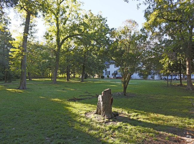
112 Reid Ln
Charlotte-Concord-Gastonia, NC-SC
Mecklenburg
221-021-22
North Carolina
Sfr
1.82 AC
AE
South/485
45057C0009E
Charlotte
5,527 SF
DEMOGRAPHICS near 112 Reid Ln
1 Mile
3 Mile
5 Mile
2024 Total Population
4,026
58,777
178,958
2029 Population
4,245
63,268
192,043
Pop Growth 2024-2029
+ 5.44%
+ 7.64%
+ 7.31%
Average Age
40
38
38
2024 Total Households
1,775
24,501
72,421
HH Growth 2024-2029
+ 5.52%
+ 7.41%
+ 7.18%
Median Household Inc
$62,316
$70,518
$86,025
Avg Household Size
2.20
2.40
2.40
2024 Avg HH Vehicles
2.00
2.00
2.00
Median Home Value
$306,750
$316,952
$374,318
Median Year Built
1996
1992
1995
Nearby Places
Map Layers
Map Styles
 Street
 Aerial
- Restaurants
- Banks
- Shops
- Fitness
- Groceries
PUBLIC TRANSPORTATION
AIRPORT
Charlotte/Douglas International
DRIVE
WALK
Distance
Charlotte/Douglas International
22 min
12.3 mi
Concord-Padgett Regional
DRIVE
WALK
Distance
Concord-Padgett Regional
42 min
28.6 mi
Freight Ports
North Charleston Terminal
DRIVE
WALK
Distance
North Charleston Terminal
216 min
190.1 mi
Nearby Properties
Address
Land Use
TOTAL SIZE
Lot Size
Zoning
Address
Land Use
TOTAL SIZE
Lot Size
Zoning
922,476 SF
49.91 AC
BP
Address
Land Use
TOTAL SIZE
Lot Size
Zoning
605,976 SF
46.31 AC
R17MF
Address
Land Use
TOTAL SIZE
Lot Size
Zoning
244,692 SF
264.29 AC
I2
Address
Land Use
TOTAL SIZE
Lot Size
Zoning
654,693 SF
51.50 AC
O1
Address
Land Use
TOTAL SIZE
Lot Size
Zoning
646,209 SF
72.24 AC
CC
Address
Land Use
TOTAL SIZE
Lot Size
Zoning
326,013 SF
25.59 AC
RMF
Address
Land Use
TOTAL SIZE
Lot Size
Zoning
381,729 SF
22.37 AC
R17MF
Address
Land Use
TOTAL SIZE
Lot Size
Zoning
1,007,888 SF
55.04 AC
G-I
Address
Land Use
TOTAL SIZE
Lot Size
Zoning
321,129 SF
23.59 AC
MX2
Address
Land Use
TOTAL SIZE
Lot Size
Zoning
452,964 SF
9.19 AC
OCCD
Address
Land Use
TOTAL SIZE
Lot Size
Zoning
324,998 SF
16.60 AC
OICD
Address
Land Use
TOTAL SIZE
Lot Size
Zoning
293,128 SF
22.70 AC
MX2
Address
Land Use
TOTAL SIZE
Lot Size
Zoning
429,918 SF
13.50 AC
O1
Address
Land Use
TOTAL SIZE
Lot Size
Zoning
236,862 SF
30.19 AC
CC
Address
Land Use
TOTAL SIZE
Lot Size
Zoning
212,904 SF
58.09 AC
INST
Address
Land Use
TOTAL SIZE
Lot Size
Zoning
226,768 SF
19.59 AC
RMF
Address
Land Use
TOTAL SIZE
Lot Size
Zoning
294,045 SF
24.31 AC
B4
Address
Land Use
TOTAL SIZE
Lot Size
Zoning
262,246 SF
51.99 AC
R3
Address
Land Use
TOTAL SIZE
Lot Size
Zoning
221,152 SF
15.87 AC
MX2
Address
Land Use
TOTAL SIZE
Lot Size
Zoning
190,262 SF
15.94 AC
RMF
Address
Land Use
TOTAL SIZE
Lot Size
Zoning
216,222 SF
21.81 AC
RMF
Address
Land Use
TOTAL SIZE
Lot Size
Zoning
227,264 SF
21.77 AC
RMF
Address
Land Use
TOTAL SIZE
Lot Size
Zoning
196,886 SF
18.60 AC
R17MF
Address
Land Use
TOTAL SIZE
Lot Size
Zoning
141,117 SF
21.75 AC
B1SCD
Address
Land Use
TOTAL SIZE
Lot Size
Zoning
170,443 SF
13.77 AC
MUDD-O
Address
Land Use
TOTAL SIZE
Lot Size
Zoning
241,548 SF
29.87 AC
R12MFCD
Address
Land Use
TOTAL SIZE
Lot Size
Zoning
524,365 SF
33.52 AC
G-I
Address
Land Use
TOTAL SIZE
Lot Size
Zoning
205,029 SF
25.80 AC
R12MFCD
Address
Land Use
TOTAL SIZE
Lot Size
Zoning
156,008 SF
16.03 AC
R17MF
Address
Land Use
TOTAL SIZE
Lot Size
Zoning
175,326 SF
14.66 AC
RMF
The World's #1 Commercial Real Estate Marketplace
Connect with us
© 2026 CoStar Group
The information above has been obtained from sources believed reliable. While we do not doubt its accuracy we have not verified it and make no guarantee, warranty or representation about it. It is your responsibility to independently confirm its accuracy and completeness. Any projections, opinions, assumptions, or estimates used are for example only and do not represent the current or future performance of the property. The value of this transaction to you depends on tax and other factors which should be evaluated by your tax, financial, and legal advisors. You and your advisors should conduct a careful, independent investigation of the property to determine to your satisfaction the suitability of the property for your needs.