Property Record
523 W River Rd, Hooksett, NH 03106
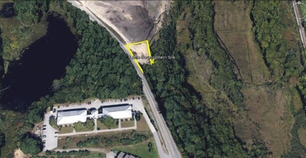

Property Detail
523 W River Rd
HOOK-000001-000002-000001
MERRIMACK
Minequarry
New Hampshire
IND
1
B and X Area of moderate flood hazard, usually the area between the limits of the 100-year and 500-year floods.
6.70 AC
2025
Concord/New Hampshire North Area
2025
Other Market Areas
003001
Concord, NH
NEARBY LISTINGS FOR SALE OR LEASE
DEMOGRAPHICS near 523 W River Rd
1 mile
3 mile
5 mile
2025 Total Population
1,918
15,296
31,943
2030 Population
1,956
15,725
32,822
Pop Growth 2025-2030
+ 1.98%
+ 2.80%
+ 2.75%
Average Age
41
42
42
2025 Total Households
747
6,373
12,917
HH Growth 2025-2030
+ 1.87%
+ 2.90%
+ 2.83%
Median Household Inc
$96,093
$93,937
$103,109
Avg Household Size
2.50
2.40
2.40
2025 Avg HH Vehicles
2.00
2.00
2.00
Median Home Value
$412,871
$373,857
$405,602
Median Year Built
1975
1977
1984
Nearby Places
Map Layers
Map Styles
 Street
 Aerial
Layers
 Traffic
 Biking
Places
Listings with unknown addresses are not visible on the map
- Restaurants
- Banks
- Shops
- Fitness
- Groceries
PUBLIC TRANSPORTATION
AIRPORT
Manchester Boston Regional
Drive
Walk
Distance
Manchester Boston Regional
29 min
16.1 mi
Freight Ports
Port of Boston
Drive
Walk
Distance
Port of Boston
94 min
64.7 mi
Nearby Properties
Address
Land Use
TOTAL SIZE
Lot Size
Zoning
Address
Land Use
TOTAL SIZE
Lot Size
Zoning
266,056 SF
22.11 AC
I2
Address
Land Use
TOTAL SIZE
Lot Size
Zoning
6,000 SF
66.58 AC
I2
Address
Land Use
TOTAL SIZE
Lot Size
Zoning
23,236 SF
26.66 AC
MUD2
Address
Land Use
TOTAL SIZE
Lot Size
Zoning
147,477 SF
41.81 AC
R-1A
Address
Land Use
TOTAL SIZE
Lot Size
Zoning
114,272 SF
12.86 AC
CLI -
Address
Land Use
TOTAL SIZE
Lot Size
Zoning
183.12 AC
OSF -
Address
Land Use
TOTAL SIZE
Lot Size
Zoning
93,077 SF
35.96 AC
PZ
Address
Land Use
TOTAL SIZE
Lot Size
Zoning
9,662 SF
76.91 AC
COM
Address
Land Use
TOTAL SIZE
Lot Size
Zoning
28,124 SF
17.08 AC
I2
Address
Land Use
TOTAL SIZE
Lot Size
Zoning
80,844 SF
24.43 AC
MUD2
Address
Land Use
TOTAL SIZE
Lot Size
Zoning
21,548 SF
3.74 AC
Address
Land Use
TOTAL SIZE
Lot Size
Zoning
16,461 SF
3.49 AC
Address
Land Use
TOTAL SIZE
Lot Size
Zoning
57,804 SF
2.75 AC
HDR
Address
Land Use
TOTAL SIZE
Lot Size
Zoning
10,200 SF
26.88 AC
I2
Address
Land Use
TOTAL SIZE
Lot Size
Zoning
Address
Land Use
TOTAL SIZE
Lot Size
Zoning
70,416 SF
8.50 AC
I2
Address
Land Use
TOTAL SIZE
Lot Size
Zoning
37,509 SF
19.80 AC
MDR
Address
Land Use
TOTAL SIZE
Lot Size
Zoning
23,466 SF
5.25 AC
Address
Land Use
TOTAL SIZE
Lot Size
Zoning
60.15 AC
COM
Address
Land Use
TOTAL SIZE
Lot Size
Zoning
23,780 SF
5.51 AC
Address
Land Use
TOTAL SIZE
Lot Size
Zoning
211 AC
I2
Address
Land Use
TOTAL SIZE
Lot Size
Zoning
4,950 SF
46.31 AC
IND
Address
Land Use
TOTAL SIZE
Lot Size
Zoning
3,536 SF
0.14 AC
B-2A
Address
Land Use
TOTAL SIZE
Lot Size
Zoning
10,506 SF
12.20 AC
IND -
Address
Land Use
TOTAL SIZE
Lot Size
Zoning
Address
Land Use
TOTAL SIZE
Lot Size
Zoning
740 SF
135.12 AC
PZ
Address
Land Use
TOTAL SIZE
Lot Size
Zoning
5,436 SF
7.85 AC
SB
Address
Land Use
TOTAL SIZE
Lot Size
Zoning
9,720 SF
66.30 AC
IND
Address
Land Use
TOTAL SIZE
Lot Size
Zoning
16,250 SF
1.05 AC
IND -
Address
Land Use
TOTAL SIZE
Lot Size
Zoning
63,533 SF
9.86 AC
COM
The World's #1 Commercial Real Estate Marketplace
Connect with us
© 2026 CoStar Group
The information above has been obtained from sources believed reliable. While we do not doubt its accuracy we have not verified it and make no guarantee, warranty or representation about it. It is your responsibility to independently confirm its accuracy and completeness. Any projections, opinions, assumptions, or estimates used are for example only and do not represent the current or future performance of the property. The value of this transaction to you depends on tax and other factors which should be evaluated by your tax, financial, and legal advisors. You and your advisors should conduct a careful, independent investigation of the property to determine to your satisfaction the suitability of the property for your needs.