Property Record
5236 Mary Ball Rd, Lancaster, VA 22503

Property Detail
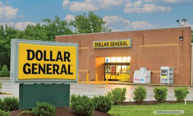
5236 Mary Ball Rd
Storebuilding
LIVELY 1.443 AC 14A (3) 1 LR11/2408 P#0161&0162
C1
Lancaster
B and X Area of moderate flood hazard, usually the area between the limits of the 100-year and 500-year floods.
Virginia
2025
1.44 AC
2025
Virginia Regional
030100
Other Market Areas
9,100 SF
14-40D
NEARBY LISTINGS FOR SALE OR LEASE
-
-
View all Lancaster listings for sale on LoopNet.com
DEMOGRAPHICS near 5236 Mary Ball Rd
1 mile
3 mile
5 mile
2025 Total Population
224
978
2,527
2030 Population
223
979
2,545
Pop Growth 2025-2030
(0.45%)
+ 0.10%
+ 0.71%
Average Age
50
50
50
2025 Total Households
101
442
1,161
HH Growth 2025-2030
(0.99%)
+ 0.45%
+ 1.03%
Median Household Inc
$61,875
$67,500
$66,614
Avg Household Size
2.10
2.10
2.10
2025 Avg HH Vehicles
2.00
2.00
2.00
Median Home Value
$278,260
$253,977
$277,157
Median Year Built
1982
1978
1979
Nearby Places
Map Layers
Map Styles
 Street
 Aerial
Layers
 Traffic
 Biking
Places
Listings with unknown addresses are not visible on the map
- Restaurants
- Banks
- Shops
- Fitness
- Groceries
SALE & LEASE HISTORY
LISTING DATE
SALE/LEASE

May 30, 2024
For Sale
Nearby Properties
Address
Land Use
TOTAL SIZE
Lot Size
Zoning
Address
Land Use
TOTAL SIZE
Lot Size
Zoning
22,452 SF
24.28 AC
A2
Address
Land Use
TOTAL SIZE
Lot Size
Zoning
16,682 SF
1 AC
R1
Address
Land Use
TOTAL SIZE
Lot Size
Zoning
12,506 SF
2.02 AC
R1
Address
Land Use
TOTAL SIZE
Lot Size
Zoning
26,741 SF
11.08 AC
A2
Address
Land Use
TOTAL SIZE
Lot Size
Zoning
257.50 AC
A2
Address
Land Use
TOTAL SIZE
Lot Size
Zoning
6,766 SF
3.03 AC
C1
Address
Land Use
TOTAL SIZE
Lot Size
Zoning
9,100 SF
1.44 AC
C1
Address
Land Use
TOTAL SIZE
Lot Size
Zoning
8,044 SF
19 AC
A2
Address
Land Use
TOTAL SIZE
Lot Size
Zoning
19,320 SF
5 AC
C1
Address
Land Use
TOTAL SIZE
Lot Size
Zoning
13,350 SF
8.40 AC
M1
Address
Land Use
TOTAL SIZE
Lot Size
Zoning
5,266 SF
5.23 AC
R3
Address
Land Use
TOTAL SIZE
Lot Size
Zoning
17,548 SF
5.12 AC
M1
Address
Land Use
TOTAL SIZE
Lot Size
Zoning
7,768 SF
5.48 AC
R1
Address
Land Use
TOTAL SIZE
Lot Size
Zoning
6,358 SF
3.01 AC
R1
Address
Land Use
TOTAL SIZE
Lot Size
Zoning
5,068 SF
2 AC
A2
Address
Land Use
TOTAL SIZE
Lot Size
Zoning
2,052 SF
2.67 AC
C1
Address
Land Use
TOTAL SIZE
Lot Size
Zoning
3,314 SF
5.80 AC
R1
Address
Land Use
TOTAL SIZE
Lot Size
Zoning
13,016 SF
2.60 AC
M1
Address
Land Use
TOTAL SIZE
Lot Size
Zoning
4,795 SF
4.37 AC
R1
Address
Land Use
TOTAL SIZE
Lot Size
Zoning
19.58 AC
A1
Address
Land Use
TOTAL SIZE
Lot Size
Zoning
9,410 SF
0.39 AC
R1
Address
Land Use
TOTAL SIZE
Lot Size
Zoning
3,182 SF
0.83 AC
R1
Address
Land Use
TOTAL SIZE
Lot Size
Zoning
3,584 SF
15.35 AC
A2
Address
Land Use
TOTAL SIZE
Lot Size
Zoning
1,906 SF
0.62 AC
C1
Address
Land Use
TOTAL SIZE
Lot Size
Zoning
5,280 SF
0.04 AC
C1
Address
Land Use
TOTAL SIZE
Lot Size
Zoning
2,511 SF
1.02 AC
C1
Address
Land Use
TOTAL SIZE
Lot Size
Zoning
3.51 AC
R1
Address
Land Use
TOTAL SIZE
Lot Size
Zoning
93.22 AC
A2
Address
Land Use
TOTAL SIZE
Lot Size
Zoning
1,616 SF
0.57 AC
C1
The World's #1 Commercial Real Estate Marketplace
Connect with us
© 2026 CoStar Group
The information above has been obtained from sources believed reliable. While we do not doubt its accuracy we have not verified it and make no guarantee, warranty or representation about it. It is your responsibility to independently confirm its accuracy and completeness. Any projections, opinions, assumptions, or estimates used are for example only and do not represent the current or future performance of the property. The value of this transaction to you depends on tax and other factors which should be evaluated by your tax, financial, and legal advisors. You and your advisors should conduct a careful, independent investigation of the property to determine to your satisfaction the suitability of the property for your needs.