Property Record
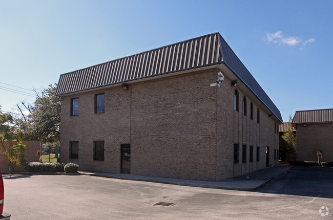
5240 Nolda St, Houston, TX 77007


Property Detail
5240 Nolda St
1174540040001
RES A BLK 1 FIESTA MAIN OFFICE PAR R/P
Commercialnec
HARRIS
B and X Area of moderate flood hazard, usually the area between the limits of the 100-year and 500-year floods.
Texas
2024
2.02 AC
2025
Midtown
510601
Houston
37,242 SF
Houston-Pasadena-The Woodlands, TX
NEARBY LISTINGS FOR SALE OR LEASE
DEMOGRAPHICS near 5240 Nolda St
1 mile
3 mile
5 mile
2025 Total Population
28,760
189,778
517,822
2030 Population
31,233
206,681
560,949
Pop Growth 2025-2030
+ 8.60%
+ 8.91%
+ 8.33%
Average Age
37
39
39
2025 Total Households
14,662
98,416
244,151
HH Growth 2025-2030
+ 8.87%
+ 9.11%
+ 8.79%
Median Household Inc
$169,103
$124,320
$100,083
Avg Household Size
1.90
1.90
2.00
2025 Avg HH Vehicles
2.00
2.00
2.00
Median Home Value
$543,910
$645,105
$573,543
Median Year Built
2010
2003
1996
Nearby Places
Map Layers
Map Styles
 Street
 Aerial
Layers
 Traffic
 Biking
Places
Listings with unknown addresses are not visible on the map
- Restaurants
- Banks
- Shops
- Fitness
- Groceries
PUBLIC TRANSPORTATION
COMMUTER RAIL
Houston (Sunset Limited - Amtrak)
Drive
Walk
Distance
Houston (Sunset Limited - Amtrak)
7 min
4.4 mi
AIRPORT
William P Hobby
Drive
Walk
Distance
William P Hobby
28 min
16.8 mi
George Bush Intcntl/Houston
Drive
Walk
Distance
George Bush Intcntl/Houston
28 min
22.1 mi
Freight Ports
Port of Houston
Drive
Walk
Distance
Port of Houston
22 min
13.5 mi
Nearby Properties
Address
Land Use
TOTAL SIZE
Lot Size
Zoning
Address
Land Use
TOTAL SIZE
Lot Size
Zoning
4,169,721 SF
31.23 AC
Address
Land Use
TOTAL SIZE
Lot Size
Zoning
2,005,097 SF
1.44 AC
Address
Land Use
TOTAL SIZE
Lot Size
Zoning
1,150,681 SF
1.17 AC
Address
Land Use
TOTAL SIZE
Lot Size
Zoning
1,282,908 SF
2.74 AC
Address
Land Use
TOTAL SIZE
Lot Size
Zoning
555,351 SF
1.40 AC
Address
Land Use
TOTAL SIZE
Lot Size
Zoning
1,044,305 SF
3.16 AC
Address
Land Use
TOTAL SIZE
Lot Size
Zoning
565,276 SF
1.35 AC
Address
Land Use
TOTAL SIZE
Lot Size
Zoning
644,352 SF
8.05 AC
Address
Land Use
TOTAL SIZE
Lot Size
Zoning
567,282 SF
2.40 AC
Address
Land Use
TOTAL SIZE
Lot Size
Zoning
1,075,210 SF
2.26 AC
Address
Land Use
TOTAL SIZE
Lot Size
Zoning
265,878 SF
2.23 AC
Address
Land Use
TOTAL SIZE
Lot Size
Zoning
743,548 SF
3.40 AC
Address
Land Use
TOTAL SIZE
Lot Size
Zoning
408,475 SF
1.05 AC
Address
Land Use
TOTAL SIZE
Lot Size
Zoning
406,032 SF
2.74 AC
Address
Land Use
TOTAL SIZE
Lot Size
Zoning
453,456 SF
3.11 AC
Address
Land Use
TOTAL SIZE
Lot Size
Zoning
1,227,182 SF
4.43 AC
Address
Land Use
TOTAL SIZE
Lot Size
Zoning
432,689 SF
2.84 AC
Address
Land Use
TOTAL SIZE
Lot Size
Zoning
957,961 SF
4.56 AC
Address
Land Use
TOTAL SIZE
Lot Size
Zoning
332,908 SF
0.91 AC
Address
Land Use
TOTAL SIZE
Lot Size
Zoning
709,825 SF
4.92 AC
Address
Land Use
TOTAL SIZE
Lot Size
Zoning
607,893 SF
3.69 AC
Address
Land Use
TOTAL SIZE
Lot Size
Zoning
649,000 SF
7.35 AC
Address
Land Use
TOTAL SIZE
Lot Size
Zoning
402,886 SF
17.95 AC
Address
Land Use
TOTAL SIZE
Lot Size
Zoning
261,388 SF
1.56 AC
Address
Land Use
TOTAL SIZE
Lot Size
Zoning
519,374 SF
6.18 AC
Address
Land Use
TOTAL SIZE
Lot Size
Zoning
788,433 SF
5.09 AC
Address
Land Use
TOTAL SIZE
Lot Size
Zoning
714,875 SF
5.79 AC
Address
Land Use
TOTAL SIZE
Lot Size
Zoning
404,603 SF
2.94 AC
Address
Land Use
TOTAL SIZE
Lot Size
Zoning
416,975 SF
2.52 AC
Address
Land Use
TOTAL SIZE
Lot Size
Zoning
616,707 SF
5.74 AC
The World's #1 Commercial Real Estate Marketplace
Connect with us
© 2026 CoStar Group
The information above has been obtained from sources believed reliable. While we do not doubt its accuracy we have not verified it and make no guarantee, warranty or representation about it. It is your responsibility to independently confirm its accuracy and completeness. Any projections, opinions, assumptions, or estimates used are for example only and do not represent the current or future performance of the property. The value of this transaction to you depends on tax and other factors which should be evaluated by your tax, financial, and legal advisors. You and your advisors should conduct a careful, independent investigation of the property to determine to your satisfaction the suitability of the property for your needs.