Property Record
5249 Shiloh Rd E, Alpharetta, GA 30005


NEARBY LISTINGS FOR SALE OR LEASE
Property Detail
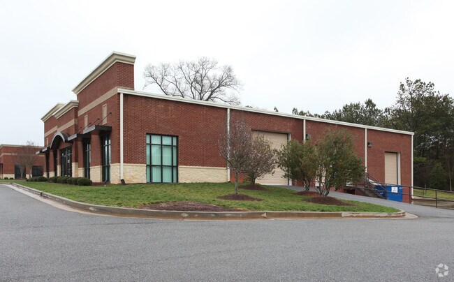
5249 Shiloh Rd E
Atlanta-Sandy Springs-Roswell, GA
Park
063-194
2-1 695-696 TR 2 SHILOH WEST BUS PARK
Industrialgeneral
Forsyth
X
Georgia
13117C0139F
672
2024
1.05 AC
2025
N Fulton/Forsyth Cnty
011653
Atlanta
7,220 SF
DEMOGRAPHICS near 5249 Shiloh Rd E
1 Mile
3 Mile
5 Mile
2024 Total Population
4,272
50,008
158,452
2029 Population
4,960
57,806
176,878
Pop Growth 2024-2029
+ 16.10%
+ 15.59%
+ 11.63%
Average Age
35
37
38
2024 Total Households
1,442
17,054
52,855
HH Growth 2024-2029
+ 16.23%
+ 15.73%
+ 11.50%
Median Household Inc
$124,841
$131,912
$136,273
Avg Household Size
2.90
2.90
3.00
2024 Avg HH Vehicles
2.00
2.00
2.00
Median Home Value
$427,258
$467,669
$478,796
Median Year Built
2010
2007
2002
Nearby Places
Map Layers
Map Styles
 Street
 Aerial
- Restaurants
- Banks
- Shops
- Fitness
- Groceries
Nearby Properties
Address
Land Use
TOTAL SIZE
Lot Size
Zoning
Address
Land Use
TOTAL SIZE
Lot Size
Zoning
383,859 SF
9.55 AC
CBD
Address
Land Use
TOTAL SIZE
Lot Size
Zoning
406,800 SF
11.61 AC
MP
Address
Land Use
TOTAL SIZE
Lot Size
Zoning
477,112 SF
20.58 AC
MP
Address
Land Use
TOTAL SIZE
Lot Size
Zoning
475,011 SF
39.64 AC
CBD
Address
Land Use
TOTAL SIZE
Lot Size
Zoning
997,824 SF
32.63 AC
CUP
Address
Land Use
TOTAL SIZE
Lot Size
Zoning
328,265 SF
4 AC
MP
Address
Land Use
TOTAL SIZE
Lot Size
Zoning
281,780 SF
19.08 AC
PUD
Address
Land Use
TOTAL SIZE
Lot Size
Zoning
9.04 AC
CBD
Address
Land Use
TOTAL SIZE
Lot Size
Zoning
56,313 SF
13.37 AC
MP
Address
Land Use
TOTAL SIZE
Lot Size
Zoning
10,908 SF
107.57 AC
RES3
Address
Land Use
TOTAL SIZE
Lot Size
Zoning
309,293 SF
16 AC
CBD
Address
Land Use
TOTAL SIZE
Lot Size
Zoning
2.12 AC
MP
Address
Land Use
TOTAL SIZE
Lot Size
Zoning
90,671 SF
11.03 AC
MP
Address
Land Use
TOTAL SIZE
Lot Size
Zoning
504,893 SF
17.14 AC
CUP
Address
Land Use
TOTAL SIZE
Lot Size
Zoning
119,926 SF
23.23 AC
M1
Address
Land Use
TOTAL SIZE
Lot Size
Zoning
249,386 SF
33.24 AC
RES6
Address
Land Use
TOTAL SIZE
Lot Size
Zoning
4,616 SF
12.30 AC
R3
Address
Land Use
TOTAL SIZE
Lot Size
Zoning
170,400 SF
24.98 AC
M1
Address
Land Use
TOTAL SIZE
Lot Size
Zoning
83,161 SF
277.43 AC
A1
Address
Land Use
TOTAL SIZE
Lot Size
Zoning
222,893 SF
103.13 AC
M1
Address
Land Use
TOTAL SIZE
Lot Size
Zoning
141,728 SF
32.45 AC
M1
Address
Land Use
TOTAL SIZE
Lot Size
Zoning
182,039 SF
19.40 AC
CUP
Address
Land Use
TOTAL SIZE
Lot Size
Zoning
232,832 SF
17.74 AC
M1
Address
Land Use
TOTAL SIZE
Lot Size
Zoning
167,705 SF
14.46 AC
CUP
Address
Land Use
TOTAL SIZE
Lot Size
Zoning
122,964 SF
7.82 AC
RES6
Address
Land Use
TOTAL SIZE
Lot Size
Zoning
184,680 SF
18.22 AC
M1
Address
Land Use
TOTAL SIZE
Lot Size
Zoning
60,235 SF
11.94 AC
CBD
Address
Land Use
TOTAL SIZE
Lot Size
Zoning
192,316 SF
51.53 AC
A1
Address
Land Use
TOTAL SIZE
Lot Size
Zoning
16.56 AC
MP
Address
Land Use
TOTAL SIZE
Lot Size
Zoning
91,296 SF
12.76 AC
CBD
The World's #1 Commercial Real Estate Marketplace
Connect with us
© 2026 CoStar Group
The information above has been obtained from sources believed reliable. While we do not doubt its accuracy we have not verified it and make no guarantee, warranty or representation about it. It is your responsibility to independently confirm its accuracy and completeness. Any projections, opinions, assumptions, or estimates used are for example only and do not represent the current or future performance of the property. The value of this transaction to you depends on tax and other factors which should be evaluated by your tax, financial, and legal advisors. You and your advisors should conduct a careful, independent investigation of the property to determine to your satisfaction the suitability of the property for your needs.