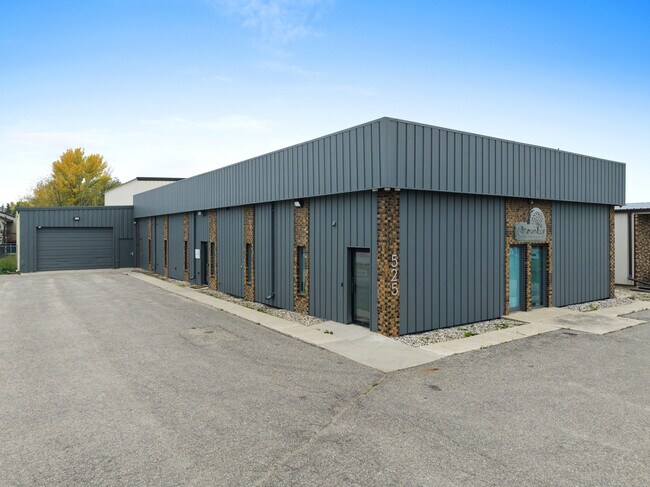
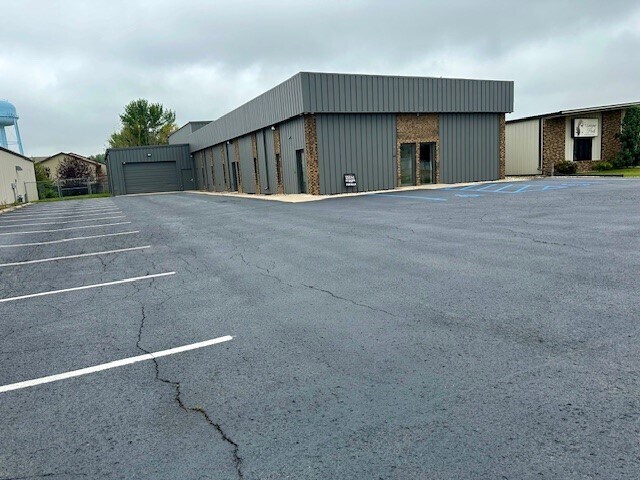
Property Record
525 31St Ave Sw, Minot, ND 58701
NEARBY LISTINGS FOR SALE OR LEASE
Property Detail
525 31St Ave Sw
Other Market Areas
Prairie Green
Minot, ND
SUB: MI35301 PRAIRIE GREEN ADDITION LOT 36
MI-35301-000-036-0
Ward
Realpropertynec
North Dakota
2024
36
2024
0.46 AC
010601
Souris Valley
6,810 SF
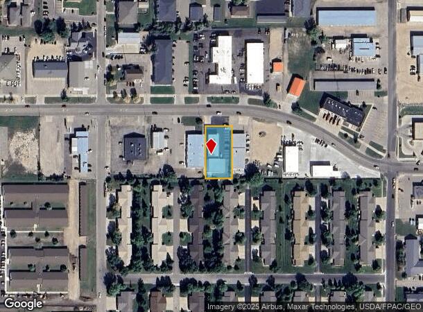
DEMOGRAPHICS near 525 31St Ave Sw
1 Mile
3 Mile
5 Mile
2024 Total Population
6,810
32,229
50,619
2029 Population
6,715
31,782
49,866
Pop Growth 2024-2029
(1.40%)
(1.39%)
(1.49%)
Average Age
44
39
38
2024 Total Households
3,215
13,876
21,630
HH Growth 2024-2029
(1.28%)
(1.43%)
(1.54%)
Median Household Inc
$62,716
$67,523
$69,473
Avg Household Size
2.00
2.20
2.20
2024 Avg HH Vehicles
2.00
2.00
2.00
Median Home Value
$231,719
$231,850
$237,104
Median Year Built
1996
1980
1983
Nearby Places
Map Layers
Map Styles
 Street
 Aerial
- Restaurants
- Banks
- Shops
- Fitness
- Groceries
PUBLIC TRANSPORTATION
COMMUTER RAIL
Minot Amtrak Station (Empire Builder - Amtrak)
DRIVE
WALK
Distance
Minot Amtrak Station (Empire Builder - Amtrak)
6 min
2.9 mi
AIRPORT
Minot International
DRIVE
WALK
Distance
Minot International
11 min
5.0 mi
Freight Ports
Port Milwaukee
DRIVE
WALK
Distance
Port Milwaukee
941 min
869.5 mi
SALE & LEASE HISTORY
LISTING DATE
SALE/LEASE

Mar 01, 2024
For Sale
Nearby Properties
Address
Land Use
TOTAL SIZE
Lot Size
Zoning
Address
Land Use
TOTAL SIZE
Lot Size
Zoning
142,655 SF
9.54 AC
Address
Land Use
TOTAL SIZE
Lot Size
Zoning
55,908 SF
5.89 AC
Address
Land Use
TOTAL SIZE
Lot Size
Zoning
29,172 SF
9.19 AC
Address
Land Use
TOTAL SIZE
Lot Size
Zoning
41,710 SF
2.45 AC
Address
Land Use
TOTAL SIZE
Lot Size
Zoning
14,400 SF
4.46 AC
Address
Land Use
TOTAL SIZE
Lot Size
Zoning
39,667 SF
0.02 AC
Address
Land Use
TOTAL SIZE
Lot Size
Zoning
13.96 AC
Address
Land Use
TOTAL SIZE
Lot Size
Zoning
45,052 SF
3.78 AC
Address
Land Use
TOTAL SIZE
Lot Size
Zoning
24,471 SF
1.54 AC
Address
Land Use
TOTAL SIZE
Lot Size
Zoning
9.49 AC
Address
Land Use
TOTAL SIZE
Lot Size
Zoning
55,520 SF
2.50 AC
Address
Land Use
TOTAL SIZE
Lot Size
Zoning
8,060 SF
1.02 AC
Address
Land Use
TOTAL SIZE
Lot Size
Zoning
6,868 SF
1.52 AC
Address
Land Use
TOTAL SIZE
Lot Size
Zoning
7,222 SF
3.07 AC
Address
Land Use
TOTAL SIZE
Lot Size
Zoning
161.15 AC
Address
Land Use
TOTAL SIZE
Lot Size
Zoning
14,112 SF
1.71 AC
Address
Land Use
TOTAL SIZE
Lot Size
Zoning
36,633 SF
2.07 AC
Address
Land Use
TOTAL SIZE
Lot Size
Zoning
4,460 SF
44.39 AC
Address
Land Use
TOTAL SIZE
Lot Size
Zoning
24,110 SF
5.83 AC
Address
Land Use
TOTAL SIZE
Lot Size
Zoning
38,721 SF
1.60 AC
Address
Land Use
TOTAL SIZE
Lot Size
Zoning
36,158 SF
Address
Land Use
TOTAL SIZE
Lot Size
Zoning
7,200 SF
1.10 AC
Address
Land Use
TOTAL SIZE
Lot Size
Zoning
6,120 SF
0.53 AC
Address
Land Use
TOTAL SIZE
Lot Size
Zoning
9,715 SF
0.86 AC
Address
Land Use
TOTAL SIZE
Lot Size
Zoning
2.63 AC
Address
Land Use
TOTAL SIZE
Lot Size
Zoning
19,520 SF
1.03 AC
Address
Land Use
TOTAL SIZE
Lot Size
Zoning
6,930 SF
0.51 AC
Address
Land Use
TOTAL SIZE
Lot Size
Zoning
12,000 SF
2 AC
Address
Land Use
TOTAL SIZE
Lot Size
Zoning
9,844 SF
1.27 AC
The World's #1 Commercial Real Estate Marketplace
Connect with us
© 2025 CoStar Group
The information above has been obtained from sources believed reliable. While we do not doubt its accuracy we have not verified it and make no guarantee, warranty or representation about it. It is your responsibility to independently confirm its accuracy and completeness. Any projections, opinions, assumptions, or estimates used are for example only and do not represent the current or future performance of the property. The value of this transaction to you depends on tax and other factors which should be evaluated by your tax, financial, and legal advisors. You and your advisors should conduct a careful, independent investigation of the property to determine to your satisfaction the suitability of the property for your needs.