Property Record
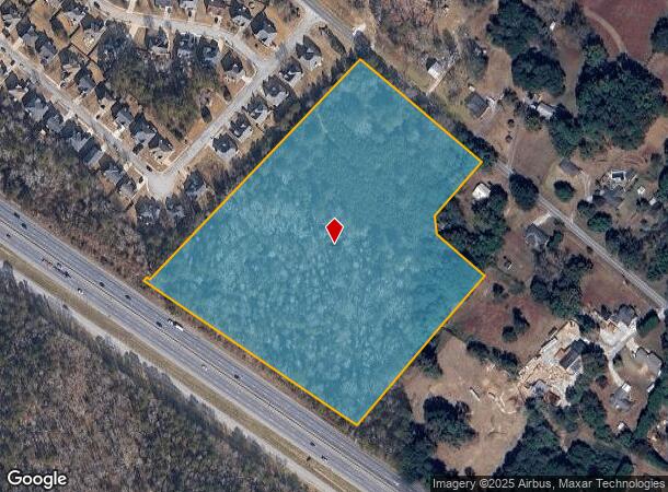
525 Almon Rd, Covington, GA 30014


NEARBY LISTINGS FOR SALE OR LEASE
Property Detail
525 Almon Rd
Atlanta-Sandy Springs-Roswell, GA
R4 Misc Land - Area 3
0024000000055A00
13.25AC ALMON RD
Agriculturalland
Newton
X
Georgia
13217C0106D
13.25 AC
2025
Newton County
2025
Atlanta
100102
DEMOGRAPHICS near 525 Almon Rd
1 mile
3 mile
5 mile
2024 Total Population
2,793
32,006
87,903
2029 Population
3,090
34,809
95,064
Pop Growth 2024-2029
+ 10.63%
+ 8.76%
+ 8.15%
Average Age
39
37
38
2024 Total Households
972
11,282
30,907
HH Growth 2024-2029
+ 10.80%
+ 8.99%
+ 8.34%
Median Household Inc
$93,564
$70,400
$69,346
Avg Household Size
2.90
2.80
2.80
2024 Avg HH Vehicles
3.00
2.00
2.00
Median Home Value
$220,635
$193,733
$193,035
Median Year Built
1998
1999
1995
Nearby Places
Map Layers
Map Styles
 Street
 Aerial
Transit
 Traffic
 Biking
Places
Listings with unknown addresses are not visible on the map
- Restaurants
- Banks
- Shops
- Fitness
- Groceries
PUBLIC TRANSPORTATION
AIRPORT
Hartsfield - Jackson Atlanta International
Drive
Walk
Distance
Hartsfield - Jackson Atlanta International
43 min
33.5 mi
Freight Ports
Georgia Ports - Savannah
Drive
Walk
Distance
Georgia Ports - Savannah
276 min
239.2 mi
SALE & LEASE HISTORY
LISTING DATE
SALE/LEASE

Feb 15, 2024
For Sale
Nearby Properties
Address
Land Use
TOTAL SIZE
Lot Size
Zoning
Address
Land Use
TOTAL SIZE
Lot Size
Zoning
4,734 SF
35.19 AC
RMF
Address
Land Use
TOTAL SIZE
Lot Size
Zoning
4,162 SF
37.52 AC
R3
Address
Land Use
TOTAL SIZE
Lot Size
Zoning
306,886 SF
118.50 AC
R2
Address
Land Use
TOTAL SIZE
Lot Size
Zoning
1,648 SF
25.08 AC
C1
Address
Land Use
TOTAL SIZE
Lot Size
Zoning
882,960 SF
0.01 AC
Address
Land Use
TOTAL SIZE
Lot Size
Zoning
324,975 SF
35.98 AC
M1
Address
Land Use
TOTAL SIZE
Lot Size
Zoning
135,000 SF
24.77 AC
M1
Address
Land Use
TOTAL SIZE
Lot Size
Zoning
33,216 SF
8.26 AC
MXD/CID/MU
Address
Land Use
TOTAL SIZE
Lot Size
Zoning
17,056 SF
16.78 AC
C1
Address
Land Use
TOTAL SIZE
Lot Size
Zoning
5,902 SF
903.52 AC
RES AG
Address
Land Use
TOTAL SIZE
Lot Size
Zoning
372,762 SF
32.27 AC
A1
Address
Land Use
TOTAL SIZE
Lot Size
Zoning
163,807 SF
10.60 AC
M1
Address
Land Use
TOTAL SIZE
Lot Size
Zoning
5,160 SF
45.17 AC
C1
Address
Land Use
TOTAL SIZE
Lot Size
Zoning
882,960 SF
114.02 AC
M1
Address
Land Use
TOTAL SIZE
Lot Size
Zoning
154,980 SF
17.37 AC
M1
Address
Land Use
TOTAL SIZE
Lot Size
Zoning
8,156 SF
14.49 AC
C1
Address
Land Use
TOTAL SIZE
Lot Size
Zoning
8,832 SF
8.26 AC
C1
Address
Land Use
TOTAL SIZE
Lot Size
Zoning
8,632 SF
8.11 AC
C1
Address
Land Use
TOTAL SIZE
Lot Size
Zoning
42,540 SF
2.40 AC
MXD
Address
Land Use
TOTAL SIZE
Lot Size
Zoning
77,016 SF
15.28 AC
C2
Address
Land Use
TOTAL SIZE
Lot Size
Zoning
125,971 SF
23.84 AC
C1
Address
Land Use
TOTAL SIZE
Lot Size
Zoning
3,888 SF
7.17 AC
C1
Address
Land Use
TOTAL SIZE
Lot Size
Zoning
65,520 SF
35 AC
E6
Address
Land Use
TOTAL SIZE
Lot Size
Zoning
65,008 SF
23.81 AC
R2
Address
Land Use
TOTAL SIZE
Lot Size
Zoning
19,197 SF
9.72 AC
R3
Address
Land Use
TOTAL SIZE
Lot Size
Zoning
4,768 SF
263.26 AC
C1
Address
Land Use
TOTAL SIZE
Lot Size
Zoning
154,336 SF
19.77 AC
M1
Address
Land Use
TOTAL SIZE
Lot Size
Zoning
6,936 SF
8.88 AC
C1
Address
Land Use
TOTAL SIZE
Lot Size
Zoning
46,536 SF
3.49 AC
MXD/CID/MU
Address
Land Use
TOTAL SIZE
Lot Size
Zoning
367,374 SF
39.48 AC
M1
The World's #1 Commercial Real Estate Marketplace
Connect with us
© 2026 CoStar Group
The information above has been obtained from sources believed reliable. While we do not doubt its accuracy we have not verified it and make no guarantee, warranty or representation about it. It is your responsibility to independently confirm its accuracy and completeness. Any projections, opinions, assumptions, or estimates used are for example only and do not represent the current or future performance of the property. The value of this transaction to you depends on tax and other factors which should be evaluated by your tax, financial, and legal advisors. You and your advisors should conduct a careful, independent investigation of the property to determine to your satisfaction the suitability of the property for your needs.