Property Record
525 Bates St, Saint Louis, MO 63111


Save to a Folder
{{folder.Name}}
{{folder.ListingIds.length}} Properties
{{folder.ListingIds.length}} Property
Create a New Folder
Property Detail
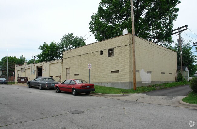
525 Bates St
2852-00-0050-0
C.B. 2852 BATES 50 FT X 137 FT J S THOMAS ADDN LOT 1
Industrialgeneral
Saint Louis City
B
Missouri
B and X Area of moderate flood hazard, usually the area between the limits of the 100-year and 500-year floods.
1
2025
0.16 AC
2026
St Louis City South
101400
St. Louis
5,792 SF
St. Louis, MO-IL
NEARBY LISTINGS FOR SALE OR LEASE
DEMOGRAPHICS near 525 Bates St
1 mile
3 mile
5 mile
2025 Total Population
16,592
105,076
231,993
2030 Population
15,696
99,311
221,800
Pop Growth 2025-2030
(5.40%)
(5.49%)
(4.39%)
Average Age
40
40
40
2025 Total Households
7,193
47,901
107,103
HH Growth 2025-2030
(5.84%)
(6.11%)
(4.92%)
Median Household Inc
$51,423
$60,576
$66,915
Avg Household Size
2.20
2.10
2.10
2025 Avg HH Vehicles
1.00
1.00
1.00
Median Home Value
$152,570
$178,151
$198,999
Median Year Built
1946
1946
1948
Nearby Places
Map Layers
Map Styles
 Street
 Aerial
Layers
 Traffic
 Biking
Places
Listings with unknown addresses are not visible on the map
- Restaurants
- Banks
- Shops
- Fitness
- Groceries
PUBLIC TRANSPORTATION
COMMUTER RAIL
Union Station (Lambert Airport Shiloh-Scott - St. Louis MetroLink (MetroLink), Shrewsbury-Lansdowne I-44 Emerson Park - St. Louis MetroLink (MetroLink))
Drive
Walk
Distance
Union Station (Lambert Airport Shiloh-Scott - St. Louis MetroLink (MetroLink), Shrewsbury-Lansdowne I-44 Emerson Park - St. Louis MetroLink (MetroLink))
9 min
5.4 mi
Shrewsbury-Lansdowne (Shrewsbury-Lansdowne I-44 Emerson Park - St. Louis MetroLink (MetroLink))
Drive
Walk
Distance
Shrewsbury-Lansdowne (Shrewsbury-Lansdowne I-44 Emerson Park - St. Louis MetroLink (MetroLink))
11 min
5.5 mi
AIRPORT
St Louis Lambert International
Drive
Walk
Distance
St Louis Lambert International
30 min
20.4 mi
Scott AFB/Midamerica St Louis
Drive
Walk
Distance
Scott AFB/Midamerica St Louis
46 min
30.6 mi
Nearby Properties
Address
Land Use
TOTAL SIZE
Lot Size
Zoning
Address
Land Use
TOTAL SIZE
Lot Size
Zoning
0.92 AC
A
Address
Land Use
TOTAL SIZE
Lot Size
Zoning
5.61 AC
A
Address
Land Use
TOTAL SIZE
Lot Size
Zoning
327,966 SF
56.80 AC
FPC8
Address
Land Use
TOTAL SIZE
Lot Size
Zoning
275,354 SF
72.71 AC
FPM2
Address
Land Use
TOTAL SIZE
Lot Size
Zoning
177.77 AC
A
Address
Land Use
TOTAL SIZE
Lot Size
Zoning
124,890 SF
11.91 AC
J
Address
Land Use
TOTAL SIZE
Lot Size
Zoning
22.44 AC
A
Address
Land Use
TOTAL SIZE
Lot Size
Zoning
17.93 AC
R5
Address
Land Use
TOTAL SIZE
Lot Size
Zoning
124,541 SF
13.07 AC
G
Address
Land Use
TOTAL SIZE
Lot Size
Zoning
54,790 SF
0.87 AC
B
Address
Land Use
TOTAL SIZE
Lot Size
Zoning
89,094 SF
9.91 AC
G
Address
Land Use
TOTAL SIZE
Lot Size
Zoning
219,361 SF
9.36 AC
M1
Address
Land Use
TOTAL SIZE
Lot Size
Zoning
3.22 AC
B
Address
Land Use
TOTAL SIZE
Lot Size
Zoning
6.99 AC
D
Address
Land Use
TOTAL SIZE
Lot Size
Zoning
9.33 AC
R5
Address
Land Use
TOTAL SIZE
Lot Size
Zoning
50,060 SF
20.10 AC
K
Address
Land Use
TOTAL SIZE
Lot Size
Zoning
12.61 AC
B
Address
Land Use
TOTAL SIZE
Lot Size
Zoning
15.97 AC
A
Address
Land Use
TOTAL SIZE
Lot Size
Zoning
39.88 AC
A
Address
Land Use
TOTAL SIZE
Lot Size
Zoning
264,575 SF
1.50 AC
K
Address
Land Use
TOTAL SIZE
Lot Size
Zoning
88,456 SF
10.48 AC
H
Address
Land Use
TOTAL SIZE
Lot Size
Zoning
14.47 AC
C
Address
Land Use
TOTAL SIZE
Lot Size
Zoning
13.81 AC
A
Address
Land Use
TOTAL SIZE
Lot Size
Zoning
72,100 SF
6.34 AC
FB
Address
Land Use
TOTAL SIZE
Lot Size
Zoning
183,124 SF
16.75 AC
F
Address
Land Use
TOTAL SIZE
Lot Size
Zoning
145,540 SF
13.66 AC
H
Address
Land Use
TOTAL SIZE
Lot Size
Zoning
231,876 SF
4.08 AC
J
Address
Land Use
TOTAL SIZE
Lot Size
Zoning
92,296 SF
3.49 AC
K
Address
Land Use
TOTAL SIZE
Lot Size
Zoning
297,280 SF
5.04 AC
K
Address
Land Use
TOTAL SIZE
Lot Size
Zoning
13.37 AC
C
The World's #1 Commercial Real Estate Marketplace
Connect with us
© 2026 CoStar Group
The information above has been obtained from sources believed reliable. While we do not doubt its accuracy we have not verified it and make no guarantee, warranty or representation about it. It is your responsibility to independently confirm its accuracy and completeness. Any projections, opinions, assumptions, or estimates used are for example only and do not represent the current or future performance of the property. The value of this transaction to you depends on tax and other factors which should be evaluated by your tax, financial, and legal advisors. You and your advisors should conduct a careful, independent investigation of the property to determine to your satisfaction the suitability of the property for your needs.